Cougar Mountain Regional Wildland Park facts for kids
Quick facts for kids Cougar Mountain Regional Wildland Park |
|
|---|---|
|
IUCN Category IV (Habitat/Species Management Area)
|
|
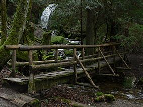
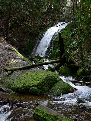
Coal Creek Falls foot bridge with falls in background
|
|
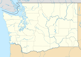
| Location | Washington, USA |
| Nearest city | Seattle |
| Area | 3,115 acres (12.61 km2) |
| Established | January 1985 |
| Governing body | King County Parks and Recreation Division |
Cougar Mountain Regional Wildland Park is a large nature park in King County, Washington. It's located near the cities of Bellevue and Issaquah. This park was created in 1983 to protect the main part of Cougar Mountain. It covers about 3,115 acres (12.61 km2) of land. You can explore the park on 38 miles (61 km) of hiking trails. There are also 12 miles (19 km) of trails for horseback riding.
Contents
Exploring Cougar Mountain: Trailheads and Rules
Cougar Mountain Park has several main entrances called trailheads. You can find maps at these spots. Signs also help you find your way at important trail crossings.
Where to Start Your Adventure?
- Jim Whittaker Wilderness Peak Trailhead: This parking area is on SR 900. It leads to trails on the east side of the park. The trailhead was renamed in 2013. It honors Jim Whittaker, the first American to climb Mount Everest.
- Harvey Manning Trailhead: This spot is near the top of Cougar Mountain. It offers great views to the north. On clear days, you might even see Mount Baker. Many park trails start from here.
- Sky Country Trailhead: You can find this trailhead near an old Nike missile site.
- Red Town Trailhead: This entrance gives you quick access to historical mining exhibits. It also connects to the nearby Coal Creek Trail.
Important Trail Rules
- You can ride horses from all trailheads except the Jim Whittaker one.
- Bicycles are not allowed on any trails in the park.
- Always stay on marked trails for your safety. This is especially important because of old mining activities.
Cougar Mountain's Natural Features
Cougar Mountain is a beautiful area with diverse landscapes. It is part of the Mountains to Sound Greenway.
What's Around the Park?
The park is surrounded by different cities and natural areas.
- To the north is the Lakemont neighborhood of Bellevue.
- Issaquah is to the northeast.
- The Talus Open Space, a 260-acre area, borders the park to the east.
- State Route 900 forms the southeastern edge.
- Squak Mountain is to the southeast.
- The May Creek valley farms are to the south.
- Renton is to the southwest.
- Newcastle is to the west. It includes the China Creek Open Space and the Newcastle Golf Club.
- The deep valley of Coal Creek is to the northwest. It has its own park, the Coal Creek Natural Area. A trail here goes all the way to I-405.
High Points of the Park
Cougar Mountain has several peaks, each with its own unique features.
- AA Peak (1,480 feet (450 m)): This peak overlooks a former Cold War military site. You can get great views of Lake Sammamish and Mount Baker from here. It's the only peak you can reach by car.
- Claypit Peak (1,560 feet (480 m)): This peak is near a large, 150-acre (0.61 km2) open pit. This pit was once a source of clay for making bricks. This area is a protected habitat, so there is no public access.
- Long View Peak (1,445 feet (440 m)): This summit has a bench and offers views to the south.
- Marshall's Hill (1,120 feet (340 m)): This hill overlooks the Renton side of Cougar Mountain.
- Reichert's Hill (1,420 feet (430 m)): Also known as Radio Hill, this is where many radio and TV antennas are located.
- Wilderness Peak (1,595 feet (486 m)): This is the highest point in the park. There are no views from the top because of tall, old trees. You can find a special book here to sign your name.
Water Features: Creeks, Marshes, and Waterfalls
Cougar Mountain is home to many creeks, marshes, and even waterfalls.
Flowing Waters: Creeks
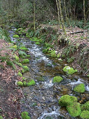
The hilltops of Cougar Mountain form a horseshoe shape around the start of Coal Creek. This creek flows northwest to Lake Washington. Other creeks like Long Marsh Creek and Wilderness Creek flow south to May Creek, also draining into Lake Washington. On the north and east sides, Lewis Creek and Claypit Creek flow into Lake Sammamish.
Wetlands: Marshes and Ponds
- Blackwater Pond: Located between Wilderness Peak and Claypit Peak.
- Jerry's Duck Pond: A quiet, man-made pond near Claypit Peak.
- Klondike Marsh: This was once a reservoir that provided water for coal-car steam hoists.
- Long Marsh: A large swamp between the Wildside Trail and Indian Trail.
- Shy Bear Marsh: The starting point of Cabbage Creek, found in a very remote part of the park.
- Tibbett's Marsh: The source of West Tibbett's Creek. You can cross it on a huge fallen cedar log.
- Trog Swamp: A wetland along the Far Country Trail.
Beautiful Waterfalls
There are five named waterfalls in or near the park.
- Coal Creek Falls: About 25 feet (7.6 m) tall, this waterfall flows mostly during rainy seasons. It's near the Quarry Trail.
- Doughty Falls: Found at Cabbage Creek on the Deceiver Trail.
- Far Country Falls: Located at Far Country Creek on the Indian Trail.
- Sandstone Falls: On the Primrose Trail in Coal Creek Park.
- North Fork Falls: About 20 feet (6.1 m) tall, this waterfall flows all year. It's on a trail in Bellevue's Coal Creek Natural Area.
Official Trails: Your Guide to Exploration
The official park map warns visitors to stay on marked trails. This is because of safety hazards from historical mining activities.
Trails on the North Side
- Coal Creek Trail (N1): This scenic trail is actually part of the Bellevue park system. It follows Coal Creek and passes old farm relics. You can also see strange mounds of debris from coal mining.
- Military Road Trail (N2): This trail follows an old U.S. Army route. It leads to the Clay Pit Road.
- Radio Peak Trail (N3): This trail climbs a narrow ridge with Douglas Fir trees. It ends at a cluster of radio transmitters.
- Coyote Creek Trail (N4): Also known as "Bill's Trail," this path winds along the edge of Klondike Swamp.
- Klondike Swamp Trail (N5): This old road is flat and straight. It offers a quick way into the heart of Cougar Mountain.
- Lost Beagle Trail (N6): This trail climbs through a cool forest to Anti-Aircraft Peak. Here, you can see interpretive signs and concrete foundations of an old military site. During World War II, anti-aircraft guns were here. Later, Nike missiles were installed nearby.
- Harvey Manning Trail (N7): This trail runs south from Anti-Aircraft Peak. It goes through a forest of mixed trees.
- Cougar Pass Trail (N8): This trail connects the Klondike Swamp Trail with the Tibbett's Marsh Trail.
- Tibbett's Marsh Trail (N9): This trail is the most direct route to the Claypit area. It crosses the marsh on a giant fallen cedar tree used as a bridge.
- Primrose Overlook Trail (N10): This trail descends to a loop above a tributary of Coal Creek.
- Little Creek Trail (N11): This trail crosses several small streams to meet the Military Road Trail.
Trails on the East Side
- Shangri-La Trail (E1): This wide, gently sloping trail was once a logging road. It descends from Radar Park to the Talus development.
- Surprise Creek Trail (E2): This trail offers a more scenic route down to the Issaquah Reservoir.
- Bear Ridge Trail (E3): This trail follows an old road through an alder forest. It passes a huge, fern-covered boulder called the Fantastic Erratic. This boulder was left by a glacier during the ice age.
- Whittaker Wilderness Peak Trail (E4): This trail climbs many switchbacks along a creek. It passes Cougar Mountain Cave and reaches Shy Bear Pass. From there, it continues to the highest point on Cougar Mountain. Plaques at the start of the trail honor Jim Whittaker and his climbing partner Nawang Gombu.
- Gombu Wilderness Cliffs Trail (E5): This trail climbs to cliff-top views of Squak Mountain and Mount Rainier. It then goes through a beautiful forest to the summit of Wilderness Peak.
- No Name Trail (E8): This short trail connects the Shangri-La Trail and Surprise Creek Trail.
- Protector Trail (E9): This trail links to the Shangri-La Trail. It runs along a ridge that was once outside the park.
- West Tibbetts Creek Trail (E10): This trail descends gently along a shallow ravine of the creek.
- Squak Mountain Connector Trail (E11): This trail goes east from the Gombu Wilderness Cliffs trail. It leads to a parking spot on SR-900.
- Red Cedars Trail (E12): This trail descends from Surprise Creek Trail to the top of Big Tree Ridge.
- Precipice Top Trail (E13): This trail connects Surprise Creek Trail to Military Ridge Trail.
- Military Ridge Trail (E14): Originally part of the Military Road, this trail descends from Big Tree Ridge Trail. It crosses two creeks and eventually leads to Harvey Manning Park.
- Big Tree Ridge Trail (E15): This trail follows an old road through an alder swamp. It then climbs Big Tree Ridge, offering winter views of Lake Sammamish.
Trails in the Central Basins
- Clay Pit Road (C1): This gravel road extends from the Sky Country Trailhead to the former Clay Pit. It provides access to a meadow at Nike Park. This park was once a site for Nike anti-aircraft missiles during the Cold War. The clay pit itself was graded and seeded in 2015.
- Red Town Creek Trail (C2): This trail connects the Cave Hole Trail to the Military Road Trail. It also provides access to the Red Town Creek Dam.
- Cave Hole Trail (C3): This trail is the main route from the Red Town area to the higher parts of Cougar Mountain. It passes large holes formed by collapsing coal seams.
- Coal Creek Falls Trail (C4): This trail leads to a 25-foot (7.6 m) waterfall on Coal Creek. This is one of the most popular spots in the park.
- Quarry Trail (C6): This trail climbs the ravine of Shy Bear Creek.
- Fred's Railroad Trail (C7): This trail follows an old railroad bed. It has no sharp turns or steep climbs. You can see many old logging structures along the way.
- East Fork Trail (C8): This trail climbs the east branch of Coal Creek to its source. It passes the peaceful Jerry's Duckpond.
- Bypass Trail (C9): This trail provides a way to move through the area without using the main road.
- Mine Shaft Trail (C10): This trail leads to a large, deep mine shaft covered with a metal grate. You can safely stand on the grate over the hole.
- Old Man's Trail (C11): This trail connects from near the Nike site to the Cave Hole Trail.
- Nike Horse Trail (C12): This trail connects from Cave Hole Trail to Fred's Railroad Trail.
- Sky Country Trail (C13): This trail connects the Sky Country Trailhead to the Military Road Trail.
Trails on the West Side
- Wildside Trail (W1): This trail runs along the western side of the Coal Creek valley. It passes Long Marsh and connects to the Deleo Wall Trail.
- Red Town Trail (W2): This trail runs along the eastern side of the Coal Creek valley.
- Rainbow Town Trail (W3): This trail passes the Ford Slope coal mining exhibit. It shows pictures of the Red Town area during its coal-mining past. You can see how nature has taken back the land.
- Steam Hoist Trail (W4): This trail loops back to the Rainbow Town Trail. It passes many old coal-mining artifacts. These include a concrete dam and a huge concrete foundation for an old steam hoist.
- China Creek Trail (W5): This trail runs to the edge of the park. It provides access to the Rainbow Town Trail.
- Marshall's Hill Trail (W6): This trail climbs to a view of the Coal Creek basin. It continues to the Deleo Wall Trail.
- Indian Trail (W7): This trail is believed to be part of an old route used by the Duwamish tribe. It connects Coal Creek and May Creek. It also leads to Far Country Falls.
- Deleo Wall Trail (W9): This trail climbs steadily to the top of Deleo Wall. This is a 600-foot (180 m) cliff with views over May Valley to Mount Rainier. From here, you can also see downtown Seattle.
- Bagley Seam Trail (W10): This trail descends a gully that collapsed into a former coal seam. It then links to the Red Town Trail.
Unofficial Trails and Wild Areas
Some trails are not officially maintained by the park. These often connect to nearby properties.
Wilderness Corridor: A Place for Wildlife
A large part of the eastern park has been set aside as a Habitat Conservation Area. This area is meant to be totally wild for animals like cougars, bears, and deer. It's located between the Bear Ridge trails, East Fork Trail, and Shy Bear/Whittaker Wilderness Peak/Gombu Wilderness Cliffs trails. The park map asks visitors to stay out of this section to help nature recover. Old trails in this area are no longer maintained.
Park History: From Mines to Missiles
Cougar Mountain has a rich history, including its past as a mining area and a military site.
Cold War Nike Missile Site
Near the Sky Country Trailhead, you'll find an open field that was once a Nike missile installation. During the Cold War, these missiles were here to protect the region from nuclear attack. Today, only a few concrete pads and an interpretive sign remain. The site now has restrooms, picnic tables, and a playfield. The radar site that supported these missiles was on Anti-Aircraft Peak, about a mile northeast. Another sign there tells more about its history.
|
 | Emma Amos |
 | Edward Mitchell Bannister |
 | Larry D. Alexander |
 | Ernie Barnes |


