Crowley, Colorado facts for kids
Quick facts for kids
Crowley, Colorado
|
|
|---|---|

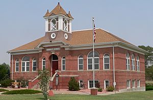
Crowley County Heritage Center, formerly the Crowley School, listed in National Register of Historic Places (2012)
|
|

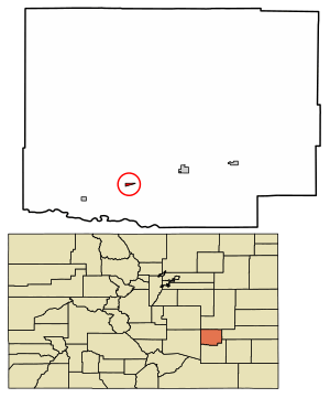
Location within Crowley County and Colorado
|
|
| Country | United States |
| State | Colorado |
| County | Crowley |
| Incorporated | October 10, 1921 |
| Area | |
| • Total | 0.225 sq mi (0.584 km2) |
| • Land | 0.225 sq mi (0.584 km2) |
| • Water | 0 sq mi (0.000 km2) |
| Elevation | 4,354 ft (1,327 m) |
| Population
(2020)
|
|
| • Total | 166 |
| • Density | 736.2/sq mi (284.2/km2) |
| Time zone | UTC−7 (MST) |
| • Summer (DST) | UTC−6 (MDT) |
| ZIP Codes |
81033-81034
|
| Area code | 719 |
| FIPS code | 08-18750 |
| GNIS ID | 195382 |
Crowley is a small town located in Crowley County, Colorado, in the United States. It is known as a statutory town, which means it follows general laws set by the state of Colorado for how towns are run. According to the 2020 United States Census, 166 people lived in Crowley.
Contents
Where is Crowley Located?
Crowley is in the southern part of Crowley County. You can find it at these coordinates: 38°11′37″N 103°51′28″W / 38.19361°N 103.85778°W.
If you travel east from Crowley on Colorado State Highway 96, you will reach Ordway, Colorado, which is the county seat, about 6 miles away. Going west on the same highway will take you to Pueblo, Colorado, about 43 miles away. Highway 207 goes south from Crowley for about 6 miles, connecting to Manzanola, Colorado and U.S. Route 50.
The town of Crowley covers a total area of about 0.584 square kilometers (or 0.225 square miles). All of this area is land, with no water.
How Many People Live in Crowley?
The number of people living in Crowley has changed over the years. Here is a look at the population from different U.S. Decennial Census reports:
| Historical population | |||
|---|---|---|---|
| Census | Pop. | %± | |
| 1920 | 224 | — | |
| 1930 | 323 | 44.2% | |
| 1940 | 318 | −1.5% | |
| 1950 | 379 | 19.2% | |
| 1960 | 265 | −30.1% | |
| 1970 | 216 | −18.5% | |
| 1980 | 192 | −11.1% | |
| 1990 | 225 | 17.2% | |
| 2000 | 187 | −16.9% | |
| 2010 | 176 | −5.9% | |
| 2020 | 166 | −5.7% | |
Famous People from Crowley
- Jonathan Almanzar - He is known for starting the company Chick'nCone.
See also
 In Spanish: Crowley (Colorado) para niños
 | Mary Eliza Mahoney |
 | Susie King Taylor |
 | Ida Gray |
 | Eliza Ann Grier |

