Crypt Lake Trail facts for kids
The Crypt Lake Trail is one of the most exciting hikes in Waterton Lakes National Park in Alberta, Canada. To start this adventure, you take a special ferry from the Waterton Park Townsite.
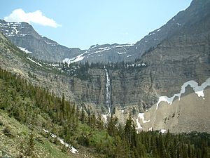
The first part of the trail lets you choose between two paths through the forest. One path is longer and takes you past the amazing Hellroaring Falls. After that, the trail opens up into a valley with small mountain streams. It leads you to see the beautiful Crypt Falls. These waterfalls are over 150 metres (490 ft) tall! They get their water from Crypt Lake, which sits in a high valley above the falls.
The last part of the trail, leading up to Crypt Lake, is more challenging. Some parts of the path are right next to steep drops, but don't worry, there are cables to help you stay safe. You'll even get to crawl through a short, narrow tunnel! Finally, after this exciting climb, you'll reach the peaceful shores of Crypt Lake.
Contents
Crypt Lake Trail: An Amazing Adventure
The Crypt Lake Hike was once called "Canada's Best Hike" in 1981. It starts with a gentle climb through shady forests. As you go deeper into the valley, the trees become fewer, and the hike gets more challenging. After passing Burnt Rock Falls, the trail climbs steadily up the open mountain side. From here, you get fantastic views of the Crypt Valley and the tall Crypt Falls.
After hiking along the mountain side, you'll reach the Crypt Lake Campground. This area used to be for campers staying overnight, but it is now closed. The trail then continues past an alpine creek towards a narrow ledge and a tunnel. The ledge is about 50 centimetres (20 in) wide. It leads to a steel ladder and the entrance to the tunnel.
You'll crawl through this natural mountain tunnel for almost 30 metres (100 ft)! After the tunnel, you'll find a steel cable to help you scramble along a steep cliff. This part is very exciting! After this scramble, the path goes through a shady forest before you finally arrive at Crypt Lake. The entire hike is about 17.2 kilometres (10.7 mi) round trip. You'll climb about 700-metre (2,300 ft) in elevation.
The very southern edge of Crypt Lake touches Canada's international border with the United States. The trail actually goes into the United States for less than 50 metres (160 ft)! This means hikers technically enter the U.S. for a short moment. However, there are no signs or warnings about the border, and there are no legal problems for hikers. This is because you can't go any further into the United States from this spot due to steep mountain cliffs.
Exploring Crypt Lake Itself
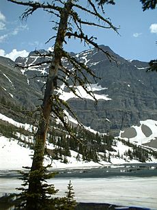
Crypt Lake is a beautiful, clear mountain lake. It sits in a bowl-shaped area called a cirque. You can often see ice on the lake even in August! Most of the land around the lake is covered in loose rocks called scree or snow. Walking all the way around the lake takes about 45 minutes.
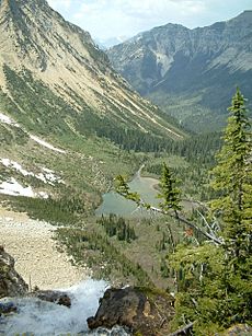
You might spot amazing wildlife in the tall mountains above the lake. Look for mountain goats and bighorn sheep. From Crypt Lake, it's just a short walk to the edge of Crypt Falls. From there, you get incredible views of the valley below.
Wildlife You Might See
The slopes along the Crypt Lake Trail are home to bears. Both grizzly bears and black bears can be seen here. It's very important to check with the visitor center or the ferry service about any recent bear sightings before you go.
Other large animals that live in the Crypt Valley include bighorn sheep, moose, mountain goat, mule deer, and white-tailed deer. You might also see smaller animals like striped or least chipmunks on the trail. Other rodents like hoary marmots, yellow-bellied marmots, red squirrels, and Richardson's ground squirrels also live here. Crypt Lake itself is filled with cutthroat trout, making it a popular spot for local fishermen.
Ferry Service for Hikers
A ferry service from the Waterton townsite takes hikers to the start of the trail. During peak season, the ferry makes two trips in the morning to drop off hikers. It then returns twice in the late afternoon to pick them up. During off-peak seasons (like May-June and September-October), the ferry only makes one round trip per day. The time given is usually enough to complete the whole trail, but it's always a good idea to keep an eye on the clock!
There is no drinking water available at the ferry landing or along the trail, so bring your own. There are outhouses at the start of the trail where the ferry docks. There's also one near the top of the trail at the old campground, before you reach the cave entrance. Hikers should remember to bring their own toilet paper.
 | Leon Lynch |
 | Milton P. Webster |
 | Ferdinand Smith |


