Cuajinicuilapa facts for kids
Quick facts for kids
Cuajinicuilapa
|
|||
|---|---|---|---|
|
Town
|
|||
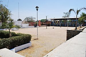
Main plaza of Cuajinicuilapa
|
|||
|
|||
| Country | |||
| State | Guerrero | ||
| Area | |||
| • Total | 715 km2 (276 sq mi) | ||
| Elevation
(of seat)
|
50 m (160 ft) | ||
| Population
(2020) Municipality
|
|||
| • Total | 26,627 | ||
| • Seat | 10,282 | ||
| Time zone | UTC-6 (Central (US Central)) | ||
| Postal code (of seat) |
41919
|
||
| Area code(s) | 741 | ||
| Demonym | Cuijileña | ||
| Website | [1] | ||
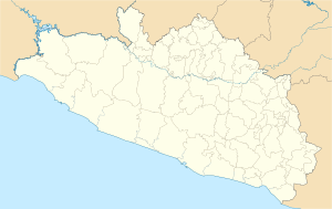
Cuajinicuilapa is a town in the Mexican state of Guerrero. It's located in the Costa Chica region, close to the Pacific Ocean and the state of Oaxaca. This area is special because it has the largest community of Afro-Mexican people in Guerrero. The town and its surrounding area, called the municipality, face some economic challenges. Their main ways of making a living are raising animals and fishing.
Contents
About Cuajinicuilapa Town
The town of Cuajinicuilapa is about 361 kilometers (224 miles) from Chilpancingo, the capital of Guerrero. It sits about 50 meters (164 feet) above sea level. Even though it's a small town, it's the main place for shopping and services in the area. You can find two small supermarkets, various stores, and a traditional market here.
Cuajinicuilapa is also a hub for communication and travel. Most mail and phone services are found here. The town even has a small airstrip. The local government works to promote the town's unique Afro-Mexican heritage. In 2011, it hosted the 13th Encuentro de Pueblos Negros. This event helps celebrate and share Afro-Mexican identity and culture in Mexico.
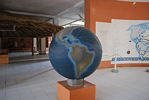
The Museo de las Culturas Afromestizas is in the town center, near the main plaza. It's the first museum in Mexico dedicated to the history of people descended from African slaves.
People and Culture
Cuajinicuilapa is home to the largest Afro-Mexican community in Guerrero's Costa Chica region. The local government calls it the "municipio negro" or "black municipality." This helps them get support for their community. Afro-Mexican culture is unique, shown through body language, words, and shared history. Many people in the "black" community also have indigenous heritage. Locals are called criollos, even if they are of African descent.
Since the 1980s, many people have moved away from this area. However, the population has grown because other groups have moved in. These include the Amuzgos and Mixtecs, especially in the 2000s. They now form the majority in some communities like El Cuije and La Petaca. In 2010, over 1,300 people here spoke an indigenous language. Most of them spoke Amuzgo and Mixtec.
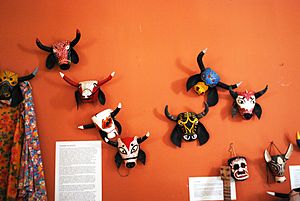
Los Diablos (The Devils) is a famous Afro-Mexican dance in the Costa Chica. Dancers wear devil masks and move with wild, energetic steps. They are joined by helpers carrying whips. From October 30 to November 1, the dancers leave the cemetery. They dance, eat food offerings, and spend three days in the streets. They enjoy music and playful acts before "returning" to the grave. The two main dancers are the devil chief, Tenango or Pancho, and his wife, La Minga. She is the mother of devils and appears in other local dances. This dance mixes African and Catholic traditions. In the past, only men could dance as devils. But now, women and children also join this yearly event.
Other dances in the municipality include El Torito (The Little Bull). In this dance, a bull-shaped frame moves through town, and people dance around it. Versions of La Conquista and Doce Pares de Francia also have unique characters. These can include Hernán Cortés, Cuauhtémoc, Moctezuma, Charlemagne, and Turkish horsemen.
Local food specialties include barbacoa (slow-cooked meat) and red and green mole sauces. You can also find pig's head with mole sauce and various types of tamales. Some tamales are even made with iguana meat. Seafood like shrimp and lobster is prepared in many ways. Traditional drinks include chilate, which is like pozol, and a drink called chicha.
Most people in the municipality are Catholic. About 2,500 people follow other faiths, such as Jehovah's Witness and Pentecostal. However, the number of non-Catholics is growing. The main celebrations are for the Apostle James in August and Nicolas of Tolentino in September. On the second Friday of Lent, there is a regional fair. It shows off local products like cattle. The fair also features cockfights, horse racing, and popular dances.
Geography and Climate
Cuajinicuilapa is in the Costa Chica region of Guerrero. It's in the southeast part of the state, along the Pacific Ocean. It also borders the state of Oaxaca. The area has mostly rolling hills and beaches along the coast. Near the Pacific Ocean, the land is flat. In the southeast, it has gentle hills. There are not many tall mountains. Some small hills include El Borjo (85 meters / 279 feet) and Las Tablas (70 meters / 230 feet).
The climate is warm and somewhat humid. Average temperatures range from 19°C (66°F) to 34°C (93°F) throughout the year. There is a clear rainy season from May to October.
The most important river is the Santa Catarina. It flows into the municipality from Ometepec. Here, it joins the Quetzala River and then empties into the Pacific Ocean at Barra de Tecoanapa. Many smaller streams also flow through the area. There are also some lagoons, such as Monte Alto and Albufera Salinitas.
Because this area is in a subduction zone, it can experience earthquakes. For example, a 7.4 magnitude earthquake hit the area in 2012.
Economy and Tourism
Cuajinicuilapa faces economic challenges and is one of the less wealthy areas in Guerrero. About 42% of homes have walls made of adobe (a type of mud brick). About 57% have cement walls. Most homes (82%) are owned by the people who live in them. About 61% of homes have running water, and 89% have electricity.
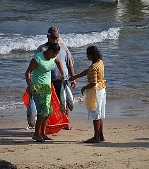
Much of the municipality has grasslands, which are good for farming and raising animals. The main crops sold for money are hibiscus and sesame seed. Other crops include palm trees and corn. Fishing is very important along the coast, especially in Punta Maldonado.
There are also some natural deposits of iron and aluminum oxide in the area.
The main place for tourists is Punta Maldonado, also known as El Faro (The Lighthouse). Another popular spot is the Santo Domingo Lagoon, which has many mangrove trees. Barra de Pío is also a nice place to visit.
History of Cuajinicuilapa
The name Cuajinicuilapa comes from the Nahuatl language. It means "in the river of the cuajiicuil plant," which is a type of edible plant.
Before the Spanish arrived, Cuajinicuilapa was part of the Ayacastla province. The capital of this province was the town of Igualapa. After Mexico became independent, the capital moved to Ometepec.
The Spanish, led by Pedro de Alvarado, conquered this area by 1522. They set up a Spanish town called Acatlán. In 1531, the Tlapaneca people rebelled, causing many to leave the area. During the 16th century, most of the indigenous population in the area was lost due to war, harsh treatment, and diseases.
Because there were not enough indigenous workers, the Spanish brought African slaves to Mexico for 300 years. Most slaves arrived in Veracruz. However, some who escaped made their way to the Costa Chica area. This region was used for raising livestock. Much of the land was owned by Mateo Anaus y Mauleon. The area was isolated, and there were few workers. So, Anaus made a deal with the escaped slaves: they would work cheaply in exchange for a safe place to live. Over time, the Cuajinicuilapa area became home to many communities of escaped slaves and their descendants. Many of them worked as cowboys or with leather. Over time, many of these people married indigenous people and white settlers.
During the Mexican War of Independence, the main rebels in this area were Afro-Mexicans Juan Bruno and Francisco Atilano Santa María. However, their impact was limited because they had little access to weapons.
In 1878, much of the land came under the control of the Casa Miller company. This company was a partnership between Pérez Reguera and Carlos A. Miller. They had a soap factory and land where they raised cattle and grew cotton. Their land covered about 125,000 hectares (308,883 acres) and was centered in Cuajinicuilapa. The town itself was home to white people. Black people lived in small huts with thatched roofs, built in an African style. Products from the company were shipped through Tecoanapa to places like Salina Cruz, Manzanillo, and Acapulco.
On March 20, 2012, a 7.4 magnitude earthquake hit the area. It caused two deaths and severe damage to over 500 homes. Another thousand homes were partly damaged.
See also
 In Spanish: Cuajinicuilapa para niños
 | Bayard Rustin |
 | Jeannette Carter |
 | Jeremiah A. Brown |


