Cul-de-sac facts for kids
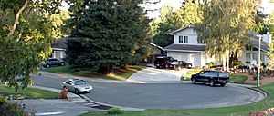
A cul-de-sac is a street that has only one way in and one way out. It's like a dead-end road, but it usually has a round area at the end where cars can easily turn around. City planners use culs-de-sac to keep neighborhoods quiet and safe by limiting cars just passing through. Some culs-de-sac are completely closed off, but others have paths for cyclists or pedestrians to walk or ride through.
Contents
Why Use Culs-de-sac?
Modern Neighborhood Design
Since the end of World War II, many new neighborhoods in America have started using culs-de-sac a lot. These neighborhoods, called subdivisions, often have one or two main roads. From these main roads, many culs-de-sac branch off, filling up all the space in the area. Only a few roads connect the whole neighborhood to bigger, main roads outside.
This is different from older city designs from the early 1900s. Back then, cities often used a grid pattern, like a checkerboard. This was partly because people used streetcars a lot, and there were many alleys.
Benefits for Residents
Using culs-de-sac helps reduce the amount of car traffic on the smaller streets inside a neighborhood. This means less noise and, some people believe, fewer accidents. It also means that most people who drive on a cul-de-sac either live there or are visiting someone who does. This can make the street feel more private and safer.
Images for kids
-
Aerial photographs of communities with cul-de-sac layouts in Loudoun County, Virginia
-
A short cul-de-sac in Welwyn Garden City, England
-
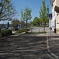
A dead end in Alicante, Spain
-
Workers' village at El Lahun pyramid site, Egypt (c. 1885 BC)
-
A cul-de-sac in Wrocław, Poland
-
A plan of Village Homes in Davis, California, showing the street and path network with connected culs-de-sac
-
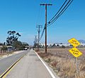
Dead end sign in English and Spanish in Otay Mesa, San Diego
See also
 In Spanish: Cul-de-sac para niños
 | Jewel Prestage |
 | Ella Baker |
 | Fannie Lou Hamer |


