Cumby, Texas facts for kids
Quick facts for kids
Cumby, Texas
|
|
|---|---|

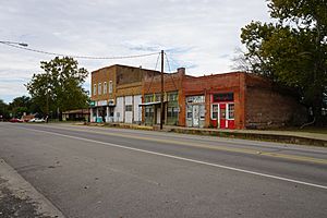
Main Street in Cumby
|
|

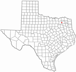
Location of Cumby, Texas
|
|
 |
|
| Country | United States |
| State | Texas |
| County | Hopkins |
| Area | |
| • Total | 0.96 sq mi (2.49 km2) |
| • Land | 0.96 sq mi (2.49 km2) |
| • Water | 0.00 sq mi (0.00 km2) |
| Elevation | 646 ft (197 m) |
| Population
(2020)
|
|
| • Total | 679 |
| • Density | 707/sq mi (272.7/km2) |
| Time zone | UTC-6 (Central (CST)) |
| • Summer (DST) | UTC-5 (CDT) |
| ZIP code |
75433
|
| Area code(s) | 903, 430 |
| FIPS code | 48-18128 |
| GNIS feature ID | 1333809 |
Cumby is a small city in Hopkins County, Texas, United States. It's a place where people live and work. In 2020, about 679 people called Cumby home. This number has changed a bit over the years. For example, in 2010, there were 777 residents.
Contents
History of Cumby
How Cumby Got Its Name
The city of Cumby has had a few different names over time. It was first known as Black Jack Grove. This name was used as early as 1848.
Later, between 1857 and 1858, the local post office changed its name to Theodocias. But it didn't stay that way for long. It went back to being called Black Jack Grove.
Finally, in 1896, the city got its current name, Cumby. It was named after Robert H. Cumby. He was a veteran who served in the Confederate army.
Geography of Cumby
Where is Cumby Located?
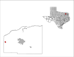
Cumby is found in the western part of Hopkins County. It's located at coordinates 33.135235 degrees North and 95.840141 degrees West.
A major road, Interstate 30, runs along the south side of the city. You can get into Cumby from Exit 110 on I-30. This highway connects Cumby to other important places.
Travel and Nearby Cities
If you drive east on Interstate 30, you will reach Sulphur Springs in about 14 miles. Sulphur Springs is the main city in Hopkins County.
If you head west on I-30, you can drive about 65 miles to reach downtown Dallas. This makes Cumby connected to bigger cities.
Land and Water Features
The city of Cumby covers a total area of about 2.6 square kilometers (or 0.96 square miles). Most of this area is land. Only a tiny part, about 0.50%, is water.
Cumby is special because it sits on a "watershed divide." This means that rain falling on the north side of the city flows towards the South Sulphur River. This river is part of the Red River system. Rain on the south side of the city flows towards Lake Fork Creek. This creek is part of the Sabine River system.
Climate in Cumby
Cumby has a humid subtropical climate. This means it usually has hot, humid summers and mild winters.
Population Information
How Many People Live in Cumby?
| Historical population | |||
|---|---|---|---|
| Census | Pop. | %± | |
| 1920 | 945 | — | |
| 1930 | 646 | −31.6% | |
| 1940 | 642 | −0.6% | |
| 1950 | 504 | −21.5% | |
| 1960 | 447 | −11.3% | |
| 1970 | 628 | 40.5% | |
| 1980 | 647 | 3.0% | |
| 1990 | 571 | −11.7% | |
| 2000 | 616 | 7.9% | |
| 2010 | 777 | 26.1% | |
| 2020 | 679 | −12.6% | |
| U.S. Decennial Census | |||
The population of Cumby changes over time. In 2020, there were 679 people living in the city. This was a decrease from 777 people in 2010.
Who Lives in Cumby?
According to the 2020 United States census, there were 321 households in Cumby. A household is a group of people living together in one home. Out of these, 222 were families.
Most people in Cumby are White. About 88.95% of the population identified as White (not Hispanic or Latino) in 2020. There are also smaller groups of people from other backgrounds, including Black or African American, Native American, Asian, and people of mixed races. About 4.71% of the population identified as Hispanic or Latino.
In 2000, the average household had about 2.35 people. The average family had about 2.87 people.
Education in Cumby
Schools in the City
The schools in Cumby are part of the Cumby Collegiate Independent School District. This district serves the students living in the city and the surrounding areas.
See also
 In Spanish: Cumby (Texas) para niños
 | John T. Biggers |
 | Thomas Blackshear |
 | Mark Bradford |
 | Beverly Buchanan |

