Curryville, Missouri facts for kids
Quick facts for kids
Curryville, Missouri
|
|
|---|---|

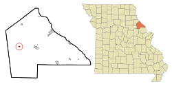
Location of Curryville, Missouri
|
|
| Country | United States |
| State | Missouri |
| County | Pike |
| Area | |
| • Total | 0.28 sq mi (0.71 km2) |
| • Land | 0.27 sq mi (0.71 km2) |
| • Water | 0.00 sq mi (0.00 km2) |
| Elevation | 827 ft (252 m) |
| Population
(2020)
|
|
| • Total | 197 |
| • Density | 718.98/sq mi (277.50/km2) |
| Time zone | UTC-6 (Central (CST)) |
| • Summer (DST) | UTC-5 (CDT) |
| ZIP code |
63339
|
| Area code(s) | 573 |
| FIPS code | 29-17902 |
| GNIS feature ID | 2393699 |
Curryville is a small city located in western Pike County, Missouri, United States. In 2020, about 197 people lived there.
Contents
History of Curryville
Curryville was officially planned and mapped out in 1866. It was named after Perry A. Curry, who owned the land where the city was built. A post office has been open in Curryville since 1869, helping people send and receive mail for over 150 years!
Where is Curryville Located?
Curryville is found in the western part of Pike County. It sits right on U.S. Route 54, a main highway. The city is about seven miles (11 km) west of Bowling Green. Another nearby town, Vandalia, is about 7.5 miles (12 km) southwest along the same highway.
According to the United States Census Bureau, Curryville covers a total area of about 0.27 square miles (0.71 square kilometers). All of this area is land.
People of Curryville
The number of people living in Curryville has changed over the years. Here's how the population has grown and shrunk since 1880:
| Historical population | |||
|---|---|---|---|
| Census | Pop. | %± | |
| 1880 | 273 | — | |
| 1890 | 302 | 10.6% | |
| 1900 | 271 | −10.3% | |
| 1910 | 238 | −12.2% | |
| 1920 | 285 | 19.7% | |
| 1930 | 236 | −17.2% | |
| 1940 | 266 | 12.7% | |
| 1950 | 258 | −3.0% | |
| 1960 | 287 | 11.2% | |
| 1970 | 337 | 17.4% | |
| 1980 | 323 | −4.2% | |
| 1990 | 261 | −19.2% | |
| 2000 | 251 | −3.8% | |
| 2010 | 225 | −10.4% | |
| 2020 | 197 | −12.4% | |
| U.S. Decennial Census | |||
Curryville in 2010
In 2010, there were 225 people living in Curryville. These people lived in 91 households, and 53 of these were families. The city had about 833 people per square mile (321 people per square kilometer).
Most people in Curryville were White (91.1%). There were also small numbers of African American (1.8%), Native American (1.8%), and Asian (0.4%) residents. About 4.9% of people were from two or more races. People of Hispanic or Latino background made up 1.8% of the population.
The average age of people in Curryville was 42.3 years old. About 24% of the residents were under 18 years old. About 12.9% were 65 years old or older. The population was almost evenly split between males (50.2%) and females (49.8%).
Getting Around Curryville
Curryville does not have its own public bus system. However, if you need to travel between cities, you can find bus service from Burlington Trailways in nearby Bowling Green.
See also
 In Spanish: Curryville (Misuri) para niños
 | Janet Taylor Pickett |
 | Synthia Saint James |
 | Howardena Pindell |
 | Faith Ringgold |

