Daglish, Western Australia facts for kids
Quick facts for kids DaglishPerth, Western Australia |
|||||||||||||||
|---|---|---|---|---|---|---|---|---|---|---|---|---|---|---|---|
Stubbs Terrace
|
|||||||||||||||
| Postcode(s) | 6008 | ||||||||||||||
| Location | 5 km (3 mi) W of Perth CBD | ||||||||||||||
| LGA(s) | City of Subiaco | ||||||||||||||
| State electorate(s) | Nedlands | ||||||||||||||
| Federal Division(s) | Curtin | ||||||||||||||
|
|||||||||||||||
Daglish is a small suburb located just west of Perth, the capital city of Western Australia. It's about 4 kilometres (2.5 miles) west of Perth's main city area. Daglish is part of the City of Subiaco local government area.
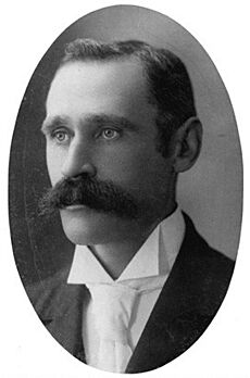
The suburb was named after Henry Daglish, an important person who was once the mayor of Subiaco and even the premier (leader) of Western Australia from 1904 to 1905. The Daglish railway station opened in 1924 because more people were moving to the nearby suburb of Subiaco. Soon after, the local council bought land near the station to build houses.
Daglish was designed using "garden suburb" ideas. This meant it had large blocks of land for homes, curved streets, and lots of green spaces. Today, many of the original homes are still standing, which gives the suburb a special historical feel. As of the 2021 Australian census, Daglish had a population of 1,551 people.
Contents
Where is Daglish Located?
Daglish is a suburb found about 4 kilometres (2.5 miles) west of Perth's city centre. It is also about 5 kilometres (3 miles) east of the Indian Ocean. Daglish is part of Perth's wealthy western suburbs.
The suburb has clear boundaries:
- To the south-east: Railway Road
- To the south: Lonnie Street
- To the west: Selby Street
- To the north: Dakin Street, Wilsmore Street, Roberta Street, Jersey Street, Troy Terrace, and Hay Street
Neighbouring suburbs include Subiaco to the east, Shenton Park to the south and west, and Jolimont to the north.
Daglish sits on sandy hills called Spearwood Dunes. These dunes formed about 40,000 years ago. The sand is brown over yellow soil, with Tamala Limestone underneath. These dunes are part of the larger Swan Coastal Plain. Some low-lying areas, like parts of Charles Stokes Park and Cliff Sadlier VC Memorial Park, used to be wetlands.
A Look at Daglish's Past
Early History and Railways
Before European settlers arrived, the land where Daglish now stands was home to the Mooro group of the Whadjuk Noongar people. Their leader was Yellagonga. They lived in the area north of the Swan River. Lakes and wetlands, including those in what are now Charles Stokes Park and Cliff Sadlier VC Memorial Park, were important for food and had spiritual meaning for them.
In 1871, people first suggested building a railway line between Fremantle and Guildford. This idea came after railways were successful in Sydney and Melbourne. The northern route for the railway was chosen in 1878. Construction began in 1879, and the Fremantle to Guildford railway line opened on March 1, 1881.
How Daglish Grew
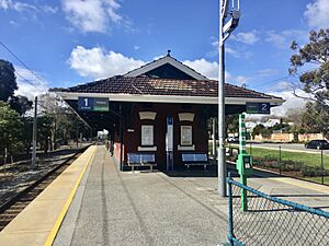
As more people moved to Subiaco, the Daglish railway station opened in 1924. It was named after Henry Daglish, who had been a mayor of Subiaco and a premier of Western Australia. He lived in Subiaco for 22 years before he passed away in 1920.
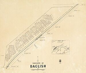
In 1925, the Subiaco Council worked with the government to buy land east of the station. They wanted to create a new suburb, also called Daglish. This land was divided into smaller blocks and sold, mostly to young couples. They liked that it was close to King Edward Memorial Hospital for Women and that railway workers could easily get to the Midland Railway Workshops. The land was more expensive than some nearby areas but still cheaper than most of Perth. The next year, water and electricity were connected to the new suburb.
At first, only a few houses were built by 1928. The area closest to the railway station was developed first. The suburb was surrounded by bushland to the west and north. Some roads were made of slag, but most were just sand tracks where cars often got stuck.
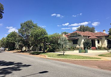
Daglish was planned using "garden suburb" ideas. This meant it had large public green spaces and curved streets. All the homes were made of brick, and most didn't have front fences. The houses were built in various styles popular at the time, like Californian Bungalow and Art Deco.
In 1928, Daglish was officially declared a "townsite." In 1933, the Workers' Home Board, which helped people get affordable housing, chose Daglish for its projects. This meant many homes in Daglish were built to a high standard. From 1935 to 1945, streets further from the station, like Troy Terrace and Cunningham Terrace, were developed.
Modern Daglish
In the 1950s, a plan for Perth suggested extending Cunningham Terrace and developing land between Troy Terrace and Cunningham Terrace. This new development had a mix of flats and houses, different from the earlier parts of Daglish. A large area of land, which used to be a water basin, was turned into Cliff Sadlier VC Memorial Park in 1969 and 1970. The last part of Daglish to be developed was north-west of this park in the early 1970s, with houses filling up the area by the late 1980s. In the early 1980s, all the dirt laneways in Daglish were paved.
Today, most of the original homes in Daglish are still standing. This is quite rare in older parts of Perth, where many old houses have been replaced. Daglish is the only remaining example in Western Australia of the garden suburb movement. To protect its history, the City of Subiaco created the Daglish Conservation Area in 2003. The National Trust of Western Australia also recognised Daglish as an important cultural heritage site in 2019. These recognitions help celebrate Daglish's unique past.
Who Lives in Daglish?
| Historical population | ||
|---|---|---|
| Year | Pop. | ±% p.a. |
| 2001 | 1,215 | — |
| 2006 | 1,242 | +0.44% |
| 2011 | 1,494 | +3.76% |
| 2016 | 1,419 | −1.02% |
| 2021 | 1,551 | +1.79% |
| Source: ABS | ||
At the 2021 Australian census, Daglish had 1,551 residents. The median age was 39 years old, which is slightly older than the average for Western Australia and Australia.
Most homes in Daglish are detached houses, but there are also semi-detached houses and apartments. The average household has 2.4 people. About one-third of homes are owned outright, one-third are owned with a mortgage, and one-third are rented.
The average weekly incomes in Daglish are higher than the state and national averages. Many residents work as professionals or managers. Common industries for residents include hospitals, engineering, and education. A high percentage of Daglish residents (over 50%) have a university degree, which is much higher than the state and national averages.
The most common backgrounds for Daglish residents are English, Australian, Irish, Scottish, and Chinese. Most people were born in Australia, followed by England, Malaysia, China, and New Zealand. Many residents have parents who were born overseas. When it comes to religion, most residents said they had no religious affiliation.
Parks and Fun Places
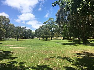
The biggest park in Daglish is the Cliff Sadlier VC Memorial Park. It was once a wetland and later a water basin. Locals used to call it "Daglish Park." In 1969, the City of Subiaco got permission to turn it into a park. By the end of 1970, it had grass and trees, and later paths, fitness equipment, and a playground were added. In 1980, it was renamed to honour Clifford Sadlier, a local hero who received the Victoria Cross award. The park still helps manage stormwater today.
Other parks in Daglish include Charles Stokes Reserve (named after a World War I soldier), Daglish Park, Hickey Avenue Park, and McCallum Park. Hickey Avenue Park is home to the Daglish Tennis Club, which started in 1930. It's one of the smallest tennis clubs in Perth, with only three courts.
Schools Near Daglish
Daglish itself doesn't have any schools, but there are several good ones very close by.
- Daglish is in the area for Jolimont Primary School, which is just north of the suburb. This is a public school for students from Kindergarten to Year 6.
- The suburb is also in the area for Shenton College, which is just west of Daglish. Shenton College is a public high school for students from Year 7 to Year 12.
How Daglish is Governed
Local Government
Daglish is part of the North Ward within the City of Subiaco local government area. This means local councillors represent the area and help make decisions for the community. The current mayor of Subiaco is David McMullen.
State and Federal Government
For state elections in Western Australia, Daglish is part of the electoral district of Nedlands. The current representative for Nedlands is Katrina Stratton from the Western Australian Labor Party.
For federal elections in Australia, Daglish is in the division of Curtin. The current representative for Curtin is Kate Chaney, who is an independent politician.
Getting Around Daglish
Many Daglish residents travel to work by car, but a good number also use public transport or walk. This is higher than the state average for public transport and walking.
Three main roads go through Daglish:
- Hay Street: Runs east-west. Going east leads to Thomas Street, the Mitchell Freeway, and the Perth city centre.
- Nash Street: Also runs east-west. It starts at Selby Street and goes east over the railway line, changing its name to Nicholson Road before reaching Thomas Street.
- Selby Street: Runs north-south. Going north leads to Wembley and further north to Innaloo and Stirling.
The Daglish railway station is on the southern edge of the suburb. It's on the Fremantle line and the Airport line, making it easy to travel by train.
Several bus routes also serve Daglish:
- Route 27: Travels between East Perth and Claremont railway station via Nash Street.
- Route 28: Travels between Perth Busport and Claremont station via Hay Street.
- Routes 998 and 999 (the CircleRoute): These buses travel in a big circle around Perth. Route 998 goes clockwise, and Route 999 goes anticlockwise. They both travel through Daglish along Selby Street.
 | Janet Taylor Pickett |
 | Synthia Saint James |
 | Howardena Pindell |
 | Faith Ringgold |


