Dairy Creek (Oregon) facts for kids
Quick facts for kids Dairy Creek |
|
|---|---|

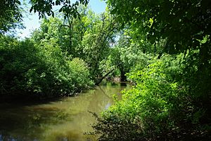
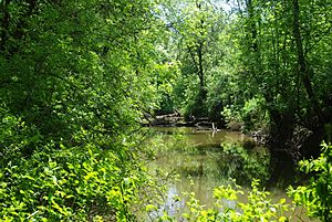
Dairy Creek just south of the Tualatin Valley Highway
|
|
|
Location of the mouth of Dairy Creek in Oregon
|
|
| Country | United States |
| State | Oregon |
| County | Washington |
| Physical characteristics | |
| Main source | Confluence of East Fork Dairy Creek and West Fork Dairy Creek near Schefflin, Washington County, Oregon 151 ft (46 m) 45°34′11″N 123°04′22″W / 45.56972°N 123.07278°W |
| River mouth | Tualatin River near Hillsboro, Washington County, Oregon 128 ft (39 m) 45°30′06″N 122°59′43″W / 45.50167°N 122.99528°W |
| Length | 10.55 mi (16.98 km) |
| Basin features | |
| Basin size | 226 sq mi (590 km2) |
Dairy Creek is a stream in Oregon, United States. It's about 10.55 miles (17 kilometers) long and flows into the Tualatin River. The creek gets its start where its two main branches, the East Fork and West Fork, meet near a place called Schefflin. From there, it gently winds its way southeast through the Tualatin Valley until it reaches the Tualatin River near Hillsboro, in Washington County.
The name "Dairy Creek" likely comes from a dairy farm. This farm was run by employees of the Hudson's Bay Company near the creek before the year 1840. In the past, before railroads became common, some steamboats even traveled on the lower part of Dairy Creek. There were even plans for them to go further upstream to a place called Centerville.
Contents
Where Does Dairy Creek Flow?
Dairy Creek is made up of a main stream and two important branches: the East Fork and the West Fork.
The Main Stream
The main part of Dairy Creek is about 10.6 miles (17 kilometers) long. It begins where the East Fork and West Fork join together. As it flows southeast, it picks up water from smaller streams like Council Creek and McKay Creek. The creek then passes under Oregon Route 8, which is also known as the Tualatin Valley Highway, west of Hillsboro. Finally, it flows into the Tualatin River.
The West Fork
The West Fork of Dairy Creek starts near a community called Tophill in northwestern Washington County. For its first 6 miles (10 kilometers), it flows south. Along its path, it goes under Oregon Route 47 two times and receives water from streams like Cummings Creek and Williams Creek. It also passes near Buxton.
Further downstream, the West Fork goes under U.S. Route 26 (the Sunset Highway) and then turns southeast. It flows alongside Route 26 for a bit, picking up more water from streams like Burgholzer Creek and Mendenhall Creek. It passes under Route 26 again and continues flowing parallel to the highway. It receives water from Whitcher Creek, Kuder Creek, and Garrigus Creek before passing under Route 26 one last time.
The West Fork also flows by Banks and receives Cedar Canyon Creek. It passes under Oregon Route 6 and then under Route 47 again. Near the end of its journey, it gets water from Lousignont Canal before meeting the East Fork to form the main Dairy Creek.
The East Fork
The East Fork of Dairy Creek begins in Columbia County and quickly enters Washington County. It flows south for about 21.3 miles (34.3 kilometers) before joining the West Fork. Along its way, it collects water from many smaller streams. These include Campbell Creek, Roundy Creek, Panther Creek, Rock Creek, Denny Creek, Plentywater Creek, Meadow Brook Creek, Murtaugh Creek, and Big Canyon.
About 12.3 miles (19.8 kilometers) from where it meets the West Fork, the East Fork passes a special measuring station run by the United States Geological Survey (USGS). This station helps scientists understand how much water is flowing in the creek. The East Fork also flows under U.S. Route 26 before it joins the West Fork to create the main Dairy Creek.
How Much Water Flows in Dairy Creek?
Scientists use special equipment to measure how much water flows in the East Fork of Dairy Creek. This is called "discharge." The United States Geological Survey (USGS) has a station near Meacham Corner that measures this flow. This station is about 12.3 miles (19.8 kilometers) upstream from where the East Fork meets the West Fork.
On average, about 76.9 cubic feet per second (2.18 cubic meters per second) of water flows past this station. This measurement comes from an area of about 33.8 square miles (87.5 square kilometers), which is about 15 percent of the entire area that drains into Dairy Creek. The most water ever recorded flowing past this station was 1,580 cubic feet per second (44.7 cubic meters per second) in January 2003. The least amount of water recorded was 6.9 cubic feet per second (0.20 cubic meters per second) in September 2007.
 | William M. Jackson |
 | Juan E. Gilbert |
 | Neil deGrasse Tyson |


