Dakota Ridge, Colorado facts for kids
Quick facts for kids
Dakota Ridge, Colorado
|
|
|---|---|

Dakota Ridge trail access
|
|

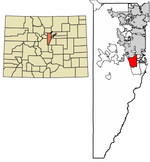
Location of the Dakota Ridge CDP in Jefferson County, Colorado.
|
|
| Country | |
| State | |
| County | Jefferson County |
| Government | |
| • Type | unincorporated community |
| Area | |
| • Total | 9.685 sq mi (25.085 km2) |
| • Land | 9.387 sq mi (24.311 km2) |
| • Water | 0.299 sq mi (0.774 km2) |
| Elevation | 5,771 ft (1,759 m) |
| Population
(2020)
|
|
| • Total | 33,892 |
| • Density | 3,499.30/sq mi (1,351.09/km2) |
| Time zone | UTC-7 (MST) |
| • Summer (DST) | UTC-6 (MDT) |
| ZIP Code |
80127, 80465
|
| Area codes | 303 & 720 |
| GNIS feature | Dakota Ridge CDP |
Dakota Ridge is a place in Colorado, United States. It is not an official city or town. Instead, it is called an "unincorporated community." This means it doesn't have its own local government like a city does. It is managed by Jefferson County.
Dakota Ridge is also known as a "census-designated place" (CDP). This is a special area created by the United States Census Bureau just for counting people. It helps them gather information about populations. Dakota Ridge is part of the larger Denver–Aurora–Lakewood, CO Metropolitan Statistical Area. This means it's connected to the big cities of Denver, Aurora, and Lakewood.
In 2020, about 33,892 people lived in Dakota Ridge. Back in 1988, people living there voted against becoming an official town. The community uses ZIP codes 80127 and 80465 for mail.
Where is Dakota Ridge?
Dakota Ridge is located in a busy part of Colorado. To its east, you'll find the big city of Denver. To the north is Lakewood, another large community. South of Dakota Ridge is Ken Caryl.
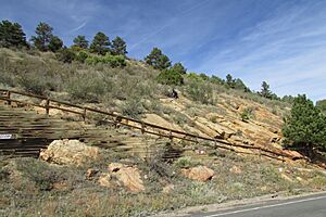
To the west, Dakota Ridge is next to a cool natural feature. It's called the Dakota Hogback. This is a sharp, narrow ridge of hills. Further north, near Morrison, this same ridge is famous as Dinosaur Ridge. Many dinosaur fossils have been found there!
A major highway, Colorado State Highway 470, runs through the western part of Dakota Ridge. This highway is like a beltway that goes around the Denver metropolitan area. It can take you north to Golden or southeast to Highlands Ranch. Downtown Denver is about 17 miles (27 km) northeast of Dakota Ridge.
The total area of Dakota Ridge is about 9.68 square miles (25.085 square kilometers). A small part of this area, about 0.3 square miles (0.774 square kilometers), is water.
How Many People Live Here?
The United States Census Bureau first officially counted Dakota Ridge as a CDP for the United States Census 2010. Here's how the population has changed:
| Dakota Ridge CDP, Colorado | ||
|---|---|---|
| Year | Pop. | ±% |
| 2010 | 32,005 | — |
| 2020 | 33,892 | +5.9% |
| Source: United States Census Bureau | ||
Learning and Schools
Students living in Dakota Ridge attend schools that are part of the Jefferson County Public Schools system. This school district serves many communities in Jefferson County.
See also
 In Spanish: Dakota Ridge para niños
 | Victor J. Glover |
 | Yvonne Cagle |
 | Jeanette Epps |
 | Bernard A. Harris Jr. |


