Dalmatia Creek facts for kids
Quick facts for kids Dalmatia Creek |
|
|---|---|

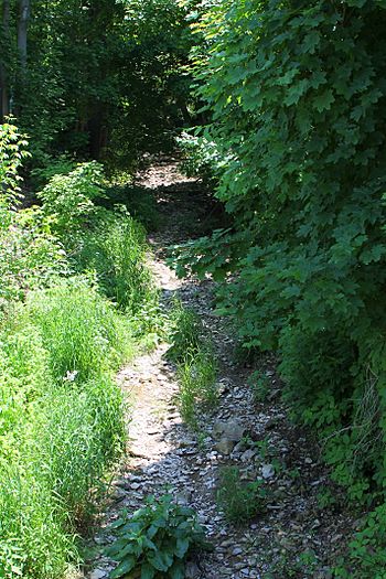
Dalmatia Creek looking upstream in Dalmatia
|
|
| Physical characteristics | |
| Main source | base of a mountain in Lower Mahanoy Township, Northumberland County, Pennsylvania 753 ft (230 m) |
| River mouth | Susquehanna River at Dalmatia in Lower Mahanoy Township, Northumberland County, Pennsylvania 400 ft (120 m) 40°39′25″N 76°54′01″W / 40.6569°N 76.9004°W |
| Length | 2.8 mi (4.5 km) |
| Basin features | |
| Progression | Susquehanna River → Chesapeake Bay |
| Basin size | 2.80 sq mi (7.3 km2) |
| Tributaries |
|
Dalmatia Creek is a small stream, also called a tributary, located in Northumberland County, Pennsylvania. It flows into the much larger Susquehanna River. The creek is about 2.8 miles (4.5 km) long. It runs through an area called Lower Mahanoy Township.
The land around Dalmatia Creek covers about 2.80 square miles (7.3 km2). Most of this land is used for farming. The creek and its smaller streams (tributaries) are considered "impaired." This means they aren't as healthy as they should be. The main problems are too much dirt and mud (sedimentation/siltation) from farming and not enough plants along the banks. Sometimes, the creek banks also wear away, which is called streambank erosion.
Contents
Where Dalmatia Creek Flows
Dalmatia Creek starts at the bottom of a mountain in Lower Mahanoy Township. It flows generally northwest and then west. As it travels, several smaller, unnamed streams join it. These smaller streams add water to Dalmatia Creek.
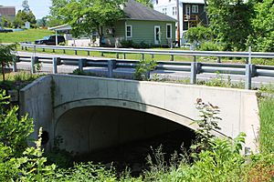
The creek eventually reaches the town of Dalmatia. Here, it flows under Pennsylvania Route 147. A short distance after that, Dalmatia Creek joins the Susquehanna River. This meeting point is about 108.25 miles (174.21 km) upstream from where the Susquehanna River flows into the ocean.
Smaller Streams Joining the Creek
Dalmatia Creek has several smaller streams that flow into it. These are called tributaries. None of these tributaries have official names. However, they are known by numbers like Unt 17500 and Unt 17501. Just like Dalmatia Creek, these smaller streams are also considered "impaired."
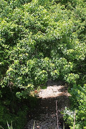
Some of these smaller streams don't have many plants or trees along their banks. These plants are important because they help hold the soil in place. In some areas, the land has even been plowed right up to the stream. However, some parts of the creek's upper sections do have plants along the banks. This helps reduce erosion and keeps the streambanks more stable.
Water Quality and Weather
Dalmatia Creek is listed as an "impaired waterbody." This means its water quality isn't as good as it should be. The main reasons for this are too much dirt and mud (sedimentation/siltation). This often comes from farm fields and places where plants have been removed.
When there are big storms, a lot of water flows through Dalmatia Creek. For example, there's a 10 percent chance that the water flow could reach 630 cubic feet per second (18 m3/s) in a year. During very big storms, like a "100-year flood," the water flow can be much higher. Some parts of the creek only have water flowing through them at certain times of the year, which means they are intermittent.
A lot of dirt and mud (sediment) washes into Dalmatia Creek each year. In 2013, over 8,324,400 pounds (3,775,900 kg) of sediment entered the creek. Most of this sediment, about 7,444,200 pounds (3,376,600 kg) per year, comes from farm fields. Other sources include hay fields, forests, and developed areas. The plants in forests are very good at holding soil, so they contribute the least amount of sediment.
The area around Dalmatia Creek gets about 39.30 inches (99.8 cm) of rain each year. About 3.15 inches (8.0 cm) of that rain runs off the land into the creek.
Land and Rocks Around the Creek
The land around Dalmatia Creek is part of the Ridge and Valley area. This means there are long, parallel ridges and valleys. The elevation of the creek's mouth (where it joins the Susquehanna River) is about 400 feet (120 m) above sea level. The creek's source (where it begins) is higher, at about 753 feet (230 m) above sea level. The highest points in the area around the creek are about 960 feet (290 m) high.
One book described Dalmatia Creek as "a minute stream" and "barely a trickle." This suggests it's quite small.
The land slopes in the creek's area are generally gentle. However, in farming areas, there aren't always enough plants to protect the soil. This can cause a lot of water to run off the land during rain. The creek banks in some places are not protected. This leads to the banks eroding and collapsing. There is also too much sediment (dirt and mud) built up in the creek.
The main type of rock under the ground in the creek's area is schist. This is a type of metamorphic rock. This rock doesn't have much effect on how much sediment ends up in the creek. In some parts, the creek's natural path has been changed or straightened by people.
The Creek's Drainage Area
The entire area that drains water into Dalmatia Creek is called its watershed. This watershed covers about 2.80 square miles (7.3 km2). The mouth of the creek is in the Dalmatia area. However, its source is in the Pillow area. The town of Hickory Corners is also located within this watershed.
Dalmatia Creek and all its smaller streams are entirely within Lower Mahanoy Township. There are about 5.0 miles (8.0 km) of streams in the entire watershed.
Most of the land in the Dalmatia Creek watershed is used for farming. This includes fields for crops and areas for hay or pastures. Farming takes up about 56.9 percent of the land. Forests cover about 34.0 percent of the area. There are also some developed areas and transitional land. Farmers sometimes plow the land right up to the creek banks, even in parts of the creek that only flow sometimes.
Dalmatia Creek experienced flooding in June 1972 during Tropical Storm Agnes. After this flood, people considered or carried out projects to restore the creek. They also replanted about 4.4 acres (1.8 ha) of stream banks. This was done to help reduce erosion and stop so much dirt from washing into the creek.
History of Dalmatia Creek
Dalmatia Creek was officially added to the Geographic Names Information System in 1979. This system keeps track of names for places like rivers and mountains.
A new concrete bridge was built in 2011 to carry Pennsylvania Route 147 over Dalmatia Creek in Dalmatia. This bridge is about 27.9 feet (8.5 m) long.
In 2012, a local authority received permission to build a platform for a pump station near Dalmatia Creek. Also in 2012, the Pennsylvania Department of Environmental Protection asked for public comments on a plan to improve the water quality of Dalmatia Creek.
Animals and Plants
The area around Dalmatia Creek is a good place for warmwater fish and fish that travel to lay eggs (migratory fish). The creek is meant to support aquatic life, meaning animals and plants that live in water. In 2016, rules were put in place for fishing in Dalmatia Creek. These rules affect the first 0.5 miles (0.80 km) upstream from its mouth. For example, between May 1 and June 17, you cannot try to catch bass. For the rest of the year, if you catch a bass, you must release it right away. However, Dalmatia Creek is not a place where people typically fish for trout.
In farming areas, there are often very few plants or trees along the banks of Dalmatia Creek. These plants, called riparian buffers, are important for the creek's health. Sometimes, farm equipment mows right up to the creek's edge. Also, farm animals can sometimes get into the creek. Waste from barns can even wash into the creek's starting points.


