Danielsville, Pennsylvania facts for kids
Quick facts for kids
Danielsville
|
|
|---|---|

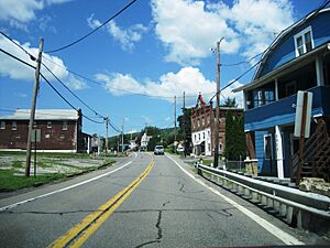
PA 946 westbound in Danielsville
|
|
| Country | |
| State | |
| County | Northampton County |
| Area | |
| • City | 39 km2 (15.1 sq mi) |
| • Land | 39 km2 (15.1 sq mi) |
| • Water | 0 km2 (0.00 sq mi) |
| Elevation | 208 m (682 ft) |
| Population
(2000)
|
|
| • City | 3,085 |
| • Density | 78.88/km2 (204.3/sq mi) |
| • Metro | 865,310 (US: 68th) |
| Time zone | UTC-5 (EST) |
| • Summer (DST) | UTC-4 (EDT) |
| ZIP Code |
18038
|
| Area codes | 610 and 484 |
Danielsville is a small community located in Northampton County, Pennsylvania. It's a village found northeast of the town of Northampton. You can find Danielsville along PA Route 946, especially where it crosses Blue Mountain Road.
In the year 2000, about 3,085 people lived in Danielsville. This village is part of a larger area called the Lehigh Valley metropolitan area. This bigger area is home to over 860,000 people. It is one of the largest metropolitan areas in the United States.
Danielsville got its name from Charles B. Daniels. He was a postmaster who also ran a local business called the Little Gap Slate Quarry. The special postal code, or ZIP Code, for Danielsville is 18038.
Learning in Danielsville
Students in Danielsville are part of the Northampton Area School District. This school district helps young people get a good education. If you live in Danielsville and are in grades nine through 12, you would attend Northampton Area High School. This high school is located in nearby Northampton.
 |
Lower Towamensing Township, Carbon County | Blue Mountain Resort | Lower Towamensing Township, Carbon County |  |
| Lehigh Gap | Rockville, Chapman | |||
| Walnutport | Cherryville | Youngsville, Bath |
 | Laphonza Butler |
 | Daisy Bates |
 | Elizabeth Piper Ensley |


