Dauphin, Pennsylvania facts for kids
Quick facts for kids
Dauphin, Pennsylvania
|
|
|---|---|
|
Borough
|
|
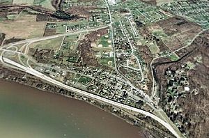
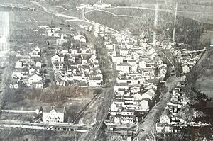
An aerial view of Dauphin
|
|
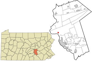
Location in Dauphin County and the U.S. state of Pennsylvania.
|
|
| Country | United States |
| State | Pennsylvania |
| County | Dauphin |
| Settled | 1765 |
| Incorporated | 1845 |
| Government | |
| • Type | Borough Council |
| Area | |
| • Total | 0.43 sq mi (1.12 km2) |
| • Land | 0.43 sq mi (1.11 km2) |
| • Water | 0.01 sq mi (0.01 km2) |
| Elevation | 427 ft (130 m) |
| Population
(2020)
|
|
| • Total | 795 |
| • Density | 1,857.48/sq mi (717.20/km2) |
| Time zone | UTC-5 (Eastern (EST)) |
| • Summer (DST) | UTC-4 (EDT) |
| ZIP Code |
17018
|
| Area code(s) | 717 |
| FIPS code | 42-18272 |
Dauphin is a small town, called a borough, located in Dauphin County, Pennsylvania, United States. It's a part of the larger Harrisburg area. In 2020, about 796 people lived here. The town's ZIP code is 17018.
Contents
Geography of Dauphin
Dauphin is found on the western side of Dauphin County. It sits right on the east bank of the Susquehanna River. The land near the river is a flat area called a floodplain, which means it can get wet when the river rises.
Mountains and Valleys Around Dauphin
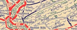
Dauphin is special because it's at the start of a narrow valley. This valley is nestled between two mountains and is where Stony Creek flows into the Susquehanna River. This area is like a natural entrance from the flat southeastern parts of Pennsylvania into the Appalachian Mountains.
The area around Dauphin, called Middle Paxton Township, has several mountains and valleys. These include Blue Mountain, Second Mountain, Third or Stony Mountain, and Peters Mountain. Many of the eastern parts of these valleys are protected as Pennsylvania State Game Lands, which are areas for wildlife and nature.
Roads and Waterways
Major roads, U.S. Route 22 and 322, run through Dauphin as a four-lane highway. These roads connect Dauphin to Harrisburg, which is about 8 miles (13 km) south, and Duncannon, about 7 miles (11 km) northwest. Another road, Pennsylvania Route 225, goes north over Peters Mountain to Halifax.
The U.S. Census Bureau says that Dauphin borough covers about 0.43 square miles (1.1 square kilometers). Only a tiny part of this area, about 0.01 square miles (0.01 square kilometers), is water.
Dauphin's Population Over Time
| Historical population | |||
|---|---|---|---|
| Census | Pop. | %± | |
| 1850 | 650 | — | |
| 1860 | 680 | 4.6% | |
| 1870 | 739 | 8.7% | |
| 1880 | 713 | −3.5% | |
| 1890 | 740 | 3.8% | |
| 1900 | 566 | −23.5% | |
| 1910 | 545 | −3.7% | |
| 1920 | 598 | 9.7% | |
| 1930 | 600 | 0.3% | |
| 1940 | 620 | 3.3% | |
| 1950 | 667 | 7.6% | |
| 1960 | 638 | −4.3% | |
| 1970 | 998 | 56.4% | |
| 1980 | 901 | −9.7% | |
| 1990 | 845 | −6.2% | |
| 2000 | 773 | −8.5% | |
| 2010 | 791 | 2.3% | |
| 2020 | 796 | 0.6% | |
| 2021 (est.) | 795 | 0.5% | |
| Sources: | |||
In 2010, there were 791 people living in Dauphin. Most residents were White (97.35%). A small number were African-American (0.76%), Asian (0.51%), or from other backgrounds. About 1.39% of the population identified as Hispanic or Latino.
The average household in Dauphin had about 2.53 people. About 29.8% of households had children under 18 living with them. The median age in the borough was 39 years old.
Education in Dauphin
Children living in Dauphin attend public schools that are part of the Central Dauphin School District. This includes Middle Paxton Elementary, Central Dauphin Middle School, and Central Dauphin High School. If families prefer a private school, St. Margaret Mary School in Harrisburg is nearby.
Many adults in Dauphin have completed high school. Some have also earned college degrees, including associate, bachelor's, and master's degrees.
History of Dauphin
Dauphin started as a small settlement in 1765. It was founded by Samuel Sturgeon at the spot where Stony Creek meets the Susquehanna River. Later, a soldier from the American Revolutionary War, Timothy Green, owned the land. The area became known as Green's Mill because of a grist mill he built there. People also knew the area for an old fort, sometimes called Fort Lyon or Fort McKee.
The larger area around Dauphin is called Middle Paxton Township. This township was formed in 1787. The landscape here is known for its old hills and narrow valleys.
Becoming a Borough and Early Growth
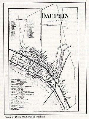
In 1826, Judge Innis Green, Timothy Green's son, officially planned the town and named it "Port Lyon." He named the streets after Pennsylvania rivers and creeks. There was hope that Dauphin would become an important port for transporting coal, especially with the creation of the Pennsylvania Canal.
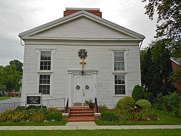
Dauphin officially became a borough in 1845. By 1850, about 650 people lived there. Many early residents worked as "day laborers." As time went on, jobs related to the canal decreased, and jobs related to the railroads grew. By 1875, Dauphin had four churches and several schools.
In the early 1900s, some people from Harrisburg built "summer" houses on Second Mountain, south of Stony Creek. These houses, called "Hillside," are now lived in all year round.
Transportation and Modern Changes
Dauphin has always been connected to transportation. Old Native American trails followed the rivers and creeks here. Later, canals and then railroads became important for moving goods. In the mid-1900s, U.S. Route 22 became a major highway through the town.
For the last 40 years or so, Dauphin has mostly been a "bedroom community" for Harrisburg. This means many people live in Dauphin but travel to Harrisburg for work. Over time, some of the town's businesses and industries closed. The railroad, which used to be very important, now only has two tracks with no stops in Dauphin.
Traffic on U.S. Route 22 used to be a big problem, sometimes cutting the town in half and making it hard for residents to get around. In the late 1990s, a new bypass road was built. This moved U.S. Route 22 closer to the river, away from the main part of Dauphin. This change helped reduce traffic in the town, making it a more desirable place to live again.
Today, Dauphin continues to work with Middle Paxton Township to provide services for its residents.
See also
 In Spanish: Dauphin (Pensilvania) para niños
 | Delilah Pierce |
 | Gordon Parks |
 | Augusta Savage |
 | Charles Ethan Porter |


