Del Valle, Texas facts for kids
Quick facts for kids
Del Valle
|
|
|---|---|
|
Edge city
|
|
| Country | United States |
| State | Texas |
| County | Travis |
| Settled | 1812 |
| Austin purchase | 1942 |
| Government | |
| • Type | Austin extraterritorial jurisdiction |
| Area
(Historical) |
|
| • Total | 44,000 acre (18,000 ha) |
| Elevation | 482 ft (147 m) |
| Population | |
| • Total | 300 |
| • Traffic | 200,000+ vehicles (AADT) |
| • Air traffic | 17,343,729 passengers |
| Time zone | UTC-6 (Central (CST)) |
| • Summer (DST) | UTC-5 (CDT) |
| ZIP codes |
78617
|
| Expressway | |
| U.S. Route | |
Del Valle (/ˌdɛl ˈvæli/ DEL-_-VAL-ee) is a community in Travis County, Texas, United States. It's considered an "edge city" of Austin, meaning it's a growing area outside the main city. Del Valle is known for being home to the Austin–Bergstrom International Airport and the Circuit of the Americas race track.
This area was first settled on land granted in the 1800s. Even though it's close to Austin, Del Valle doesn't have its own local government or official borders. However, parts of it have become part of Austin over time, including the airport area. Recently, big companies like Tesla have built factories here, bringing new jobs and development.
Contents
History of Del Valle
Del Valle was settled in 1812 by Santiago Del Valle. He received a large piece of land from the Spanish Government. The community was named after this land grant in the mid-1870s.
In 1878, Del Valle got its own post office. By the mid-1880s, about 50 people lived there. The community had three churches, two cotton gins, a general store, a mill, and a school. Farmers in the area mainly grew cotton and grain.
The population grew to 75 by 1900 and about 150 by 1927. However, during the Great Depression in the 1930s, the population dropped to just 25. Things changed in 1942 when the Del Valle Army Air Base opened. This base later became Bergstrom Air Force Base. The base helped the population grow again, reaching 125 people in the mid-1940s and 200 by the mid-1950s.
In 1963, the local school district was renamed Del Valle Independent School District. From the 1970s to the early 1990s, about 300 people lived in Del Valle. The military base closed in 1993, but it reopened as Austin–Bergstrom International Airport in 1999. This airport brought new growth and development to Del Valle and the surrounding area.
What to Do and See in Del Valle
Tesla Factory
Del Valle is home to a large factory for Tesla, a company famous for making electric cars. This factory is a major part of the area's recent growth.
Education
Del Valle has had schools for a long time. In 1907, there were two schools in the area. Today, students in Del Valle are part of the Del Valle Independent School District. This district includes Hornsby-Dunlap Elementary School, Del Valle Middle School, and Del Valle High School. There are also local libraries for the community.
Austin–Bergstrom International Airport
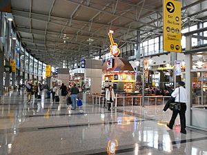
The Austin–Bergstrom International Airport (often called ABIA) is a big airport located in Del Valle. It's about 5 miles (8 km) southeast of downtown Austin. This airport helps people travel to and from the Austin area. It was built on the site of the former Bergstrom Air Force Base. The airport is named after Captain John August Earl Bergstrom, a military officer.
Circuit of the Americas
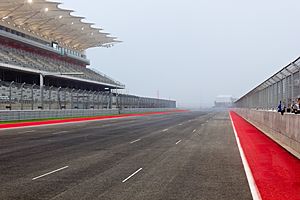
The Circuit of the Americas (COTA) is a famous race track located near Del Valle. It's a huge facility where many exciting motor racing events take place. COTA hosts the Formula One United States Grand Prix, which is a major international car race. It also hosts the Grand Prix of the Americas (MotoGP) for motorcycles and NASCAR races. Many other racing events have been held here too.
COTA is also a place for concerts. The rock band Kiss performed here in 2021.
Austin360 Amphitheater
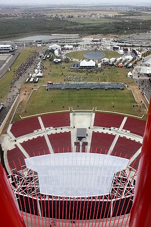
The Austin360 Amphitheater is an outdoor concert venue located within the Circuit of the Americas complex. It's a popular spot for live music and can hold up to 14,000 people. It even won an award for being the "Best New Major Concert Venue" in 2013.
Parks and Recreation
Del Valle has several parks where people can enjoy the outdoors:
- Southeast Metropolitan Park
- Barkley Meadows Park
- Richard Moya Park
- NLand Surf Park (a place to surf!)
Other Interesting Places
- The Zoho Corporation, a company that makes computer software, has an office in Del Valle.
- Wat Buddhananachat of Austin is a Buddhist temple located in the community.
- On April 8, 2024, the Live Oak Brewing Company hosted an event to view a Solar eclipse.
Media
Del Valle is home to transmitters for several radio stations, including KZNX, KIXL (a Catholic radio station), and KVLR.
Famous People from Del Valle
Some notable people have connections to Del Valle:
- Curtis Jerrells: A basketball player who attended Del Valle High School.
- Joel Kinnaman: A Swedish actor who was an exchange student in Del Valle.
- Priscilla Presley: The wife of Elvis Presley, who lived in Del Valle in 1956.
- Kevin Rollins: A businessman and philanthropist who had a home in the community.
 | William Lucy |
 | Charles Hayes |
 | Cleveland Robinson |


