Denison, Kansas facts for kids
Quick facts for kids
Denison, Kansas
|
|
|---|---|

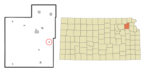
Location within Jackson County and Kansas
|
|

|
|
| Country | United States |
| State | Kansas |
| County | Jackson |
| Township | Garfield & Cedar |
| Founded | 1887 |
| Incorporated | 1904 |
| Area | |
| • Total | 0.11 sq mi (0.29 km2) |
| • Land | 0.11 sq mi (0.29 km2) |
| • Water | 0.00 sq mi (0.00 km2) |
| Elevation | 1,056 ft (322 m) |
| Population
(2020)
|
|
| • Total | 146 |
| • Density | 1,330/sq mi (503/km2) |
| Time zone | UTC-6 (CST) |
| • Summer (DST) | UTC-5 (CDT) |
| ZIP code |
66419
|
| Area code | 785 |
| FIPS code | 20-17625 |
| GNIS ID | 2394515 |
Denison is a small city located in Jackson County, Kansas, in the United States. In 2020, about 146 people lived there.
Contents
History of Denison
How Denison Started
Denison was founded in 1887. It started because a new railroad, the Kansas City, Wyandotte and Northwestern Railway, was being built. This railroad would connect the towns of Valley Falls and Holton.
The railroad was planned to go about a mile south of an older village called Tippinville. Two people who bought and sold land, A.D. Walker and Hollis Tucker, decided to create a new town there. They named it Denison, after Tucker's hometown in Ohio.
Many houses and even two churches from Tippinville were carefully moved to the new Denison townsite. At first, Denison was mostly in Garfield Township, with a small part in Cedar Township. By 1890, Tippinville was officially empty, and by 1894, Denison had grown to 150 people.
Important People and Places
Many soldiers who fought in the American Civil War are buried in the Denison Cemetery. One soldier from the Mexican–American War, G. W. White, is also buried there.
A famous person's sister, Eliza Cody Myers (Mrs. George Myers), is also buried in Denison. She was the sister of William F. "Buffalo Bill" Cody, a very well-known showman. It was a big deal for the school children when Buffalo Bill visited Denison to see his niece, Nellie Myers Copas, and her family.
The first post office in the area, called North Cedar, opened in 1867. The very first school, made of logs, was built in 1858. It was located south of where Denison is today, near the North Cedar Cemetery.
Churches and Community Life
The first church in the area was the Christian church, started in 1856. Other churches followed, including the Reformed Presbyterian Church in 1871, the United Presbyterian Church in 1880, and the Denison Methodist Episcopal Church in 1889.
In 1958, the Christian, United Presbyterian, and Methodist churches joined together to form the Denison Union Church. Later, it became the Denison Bible Church. The original Denison Christian Church building, built in 1878, is now the Denison Historical Museum. It's one of three buildings in Jackson County listed on the State Register of Historic Places because of its importance.
Denison in the 1900s
The Denison State Bank was started in 1901. After it was robbed for the second time in 1938, the bank moved to Holton, which is the main town of the county. It's still a successful bank there today.
Denison Rural High School was built in 1916. The first brick school building burned down in 1938, and a new one was finished in 1941. Due to changes in school districts, the last class graduated from Denison High School in 1969. However, the school continued to teach younger students until it closed in 1990. Today, students from the Denison area go to schools in Holton.
Where is Denison?
According to the United States Census Bureau, Denison covers a total area of about 0.11 square miles (0.29 square kilometers). All of this area is land.
Who Lives in Denison?
| Historical population | |||
|---|---|---|---|
| Census | Pop. | %± | |
| 1910 | 295 | — | |
| 1920 | 240 | −18.6% | |
| 1930 | 202 | −15.8% | |
| 1940 | 176 | −12.9% | |
| 1950 | 166 | −5.7% | |
| 1960 | 184 | 10.8% | |
| 1970 | 248 | 34.8% | |
| 1980 | 231 | −6.9% | |
| 1990 | 225 | −2.6% | |
| 2000 | 231 | 2.7% | |
| 2010 | 187 | −19.0% | |
| 2020 | 146 | −21.9% | |
| U.S. Decennial Census | |||
Denison is part of the larger Topeka area, which is called the Topeka Metropolitan Statistical Area.
Denison Today (2020 Census)
The 2020 United States census counted 146 people living in Denison. There were 63 households and 42 families. Most of the people (about 89.73%) were white. A small number were black (0.68%) or Native American (2.74%). About 6.85% of the population identified as being from two or more races.
- About 31.7% of households had children under 18 living with them.
- About 42.9% of households were married couples living together.
- The average household had about 1.9 people.
- The average family had about 2.8 people.
About 22.6% of the people in Denison were under 18 years old. About 13.7% were 65 years or older. The average age of people in Denison was 38.0 years.
Schools in Denison
The public schools that serve the Denison community are part of the Holton USD 336 school district.
See also
 In Spanish: Denison (Kansas) para niños

