Devils Head (summit) facts for kids
Quick facts for kids Devils Head |
|
|---|---|

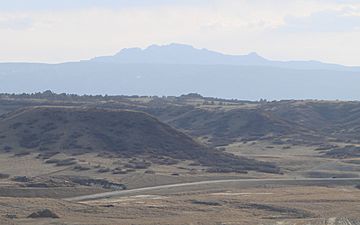
View of Devils Head from Castle Rock, Colorado
|
|
| Highest point | |
| Elevation | 9,749 ft (2,971 m) |
| Prominence | 1,248 ft (380 m) |
| Isolation | 7.99 mi (12.86 km) |
| Geography | |
| Location | Douglas County, Colorado, U.S. |
| Parent range | Front Range, Rampart Range |
| Topo map | USGS 7.5' topographic map Devils Head, Colorado |
| Climbing | |
| Easiest route | Devil's Head Trailhead #611(Devil's Head National Recreation Trail) |
Devils Head is a cool mountain peak located in the Rocky Mountains of Colorado, United States. It's part of the Rampart Range and stands tall at about 9,749 feet (2,971 meters) high! This mountain is found in Pike National Forest, not too far from a town called Sedalia.
About Devils Head Mountain
Devils Head is a mountain peak in Colorado. It's famous for having a special building at its very top. This building is called the Devil's Head Lookout. It's an active United States Forest Service fire lookout tower. This means people work there to spot forest fires from high up!
You can reach the top of Devils Head and the lookout tower by hiking the Devils Head National Recreation Trail. It's a popular trail for visitors.
How Devils Head Got Its Name
The name "Devils Head" came from gold prospectors back in the late 1800s. If you look at the mountain from its southwest side, it looks like a face lying down and looking up at the sky.
Even though some trees have grown and changed the view, you can still see the shape of a face. People say you can even see what looks like horns!
Past Names for Devils Head
- The Sleeping Indian
- Camels Back
- Devils Head – 1923 (This is when it officially got its current name)
- Platte Mountain
- Warrens Crag
 | Valerie Thomas |
 | Frederick McKinley Jones |
 | George Edward Alcorn Jr. |
 | Thomas Mensah |


