Devoke Water facts for kids
Quick facts for kids Devoke Water |
|
|---|---|
 |
|
| Location | Lake District, Cumbria |
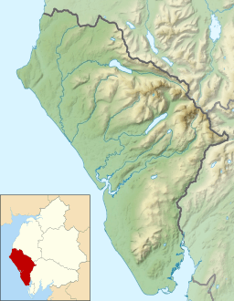
| Coordinates | 54°21′33″N 3°18′10″W / 54.35917°N 3.30278°W |
| Primary outflows | Black Beck |
| Basin countries | United Kingdom |
| Max. length | .75 mi (1.21 km) |
| Max. width | .27 mi (0.43 km) |
| Max. depth | 46 ft (14 m) |
| Surface elevation | 770 ft (230 m) |
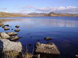
Devoke Water is a beautiful small lake located in the western part of the Lake District in England. It's found in the county of Cumbria. It is known as the biggest tarn in the Lake District. A tarn is a small mountain lake or pond, often formed in a hollow created by a glacier.
This lovely lake sits on Birker Fell, which is a type of open, hilly land. It's about 1 kilometer (0.6 miles) west of the road that connects the villages of Ulpha and Eskdale. Devoke Water is quite high up, at an altitude of 770 feet (223 meters) above sea level. The deepest part of the lake is about 46 feet (14 meters) deep.
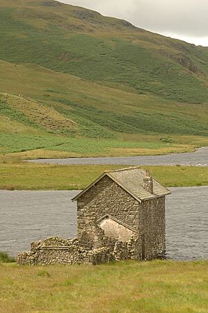
You can reach Devoke Water by following a special path called a bridle track. This path is suitable for walking, cycling, or even horse riding. Near the water, you'll find an old stone boathouse. It has two stories and also serves as a shelter. There are also the ruins of an old stable nearby.
Water flows out of Devoke Water from its north-west side. This outflow is called Linbeck Gill. Linbeck Gill then joins a larger river, the River Esk, at a small village called Linbeck.
If you enjoy fishing, the rights to fish in Devoke Water belong to a group called Millom Anglers. They make sure there are plenty of fish by stocking the lake with brown trout. You can also find perch living naturally in the water.
Exploring Around Devoke Water
One famous writer and walker, Alfred Wainwright, wrote about a circular walk around Devoke Water in his book The Outlying Fells of Lakeland. This walk goes around the lake in an anti-clockwise direction. It starts and finishes on the road to the east of the lake.
Wainwright described several hilltops, or summits, that you can reach on this walk:
- Rough Crag at 1049 feet (320 meters)
- Water Crag at 997 feet (304 meters)
- White Pike at 1370 feet (418 meters)
- Yoadcastle at 1610 feet (491 meters)
- Woodend Height at 1597 feet (487 meters)
- Seat How at 1020 feet (311 meters)
He highly recommended this walk because of the amazing views you can see from these summits. You can look north and see famous fells like Pillar. To the north-east, you might spot the Scafell group and the Bowfell group, which are some of the highest mountains in England. On a clear day, you might even see the Isle of Man far out in the sea! You can also see the Sellafield power station from some points.
Wainwright did give a warning for walkers: after it rains, the Linbeck Gill stream can be difficult to cross without getting your feet wet. So, it's good to be prepared!
All six of these summits are known as "Birketts." This means they are included in a list of hills in the Lake District compiled by Bill Birkett. Yoadcastle is also part of another list called "Fellranger" summits. These are hills described in a series of guidebooks by Mark Richards. Yoadcastle is one of the summits that was not included in Alfred Wainwright's main list of 214 fells, but it's still a great place to explore!
 | Ernest Everett Just |
 | Mary Jackson |
 | Emmett Chappelle |
 | Marie Maynard Daly |


