Dexter, Georgia facts for kids
Quick facts for kids
Dexter, Georgia
|
|
|---|---|

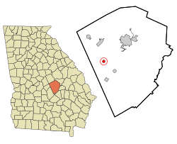
Location in Laurens County and the state of Georgia
|
|
| Country | United States |
| State | Georgia |
| County | Laurens |
| Area | |
| • Total | 0.79 sq mi (2.03 km2) |
| • Land | 0.77 sq mi (1.99 km2) |
| • Water | 0.02 sq mi (0.05 km2) |
| Elevation | 312 ft (95 m) |
| Population
(2020)
|
|
| • Total | 655 |
| • Density | 852.86/sq mi (329.50/km2) |
| Time zone | UTC-5 (Eastern (EST)) |
| • Summer (DST) | UTC-4 (EDT) |
| ZIP code |
31019
|
| Area code(s) | 478 |
| FIPS code | 13-22752 |
| GNIS feature ID | 0331543 |
Dexter is a small town located in Laurens County, Georgia, in the United States. In 2020, about 655 people lived there. It's a quiet place with a rich history.
History of Dexter
The first people to settle permanently in Dexter arrived in 1889. Soon after, in 1890, a post office opened, making it easier for people to send and receive mail.
Just one year later, in 1891, the Georgia General Assembly officially recognized Dexter as a town. This process is called "incorporation," and it means the town can now have its own local government and make its own rules.
Geography and Location
Dexter is found in the western part of Laurens County. You can find it at these coordinates: 32°26′4″N 83°3′32″W / 32.43444°N 83.05889°W.
The main road through town is Georgia State Route 257. This highway connects Dexter to other nearby places. If you drive northeast for about 12 miles (19 km), you'll reach Dublin. Dublin is the "county seat," which means it's where the main government offices for Laurens County are located. Driving southwest on the same road for about 6 miles (10 km) takes you to Chester.
Another important road, State Route 338, runs north and south from Dexter. It goes north about 9 miles (14 km) to Dudley and south about 7 miles (11 km) to Cadwell.
Dexter covers a total area of about 0.79 square miles (2.0 square kilometers). Most of this area is land, with a small part, about 0.02 square miles (0.05 square kilometers), being water. The town is built on a slightly raised area between two small streams, Boggy Branch and Stitchihatchie Creek. These streams eventually flow into Rocky Creek, which is part of the larger Oconee River system.
People of Dexter
The population of Dexter has changed over the years. Here's how many people have lived in the town during different census years:
| Historical population | |||
|---|---|---|---|
| Census | Pop. | %± | |
| 1900 | 199 | — | |
| 1910 | 550 | 176.4% | |
| 1920 | 481 | −12.5% | |
| 1930 | 336 | −30.1% | |
| 1940 | 324 | −3.6% | |
| 1950 | 264 | −18.5% | |
| 1960 | 359 | 36.0% | |
| 1970 | 438 | 22.0% | |
| 1980 | 527 | 20.3% | |
| 1990 | 475 | −9.9% | |
| 2000 | 509 | 7.2% | |
| 2010 | 575 | 13.0% | |
| 2020 | 655 | 13.9% | |
| U.S. Decennial Census | |||
The United States Census helps us understand who lives in a town. As of the 2020 census, there were 655 people living in Dexter. These people lived in 271 households, and 215 of those households were families.
The table below shows the different groups of people living in Dexter in 2020:
| Race | Num. | Perc. |
|---|---|---|
| White (non-Hispanic) | 403 | 61.53% |
| Black or African American (non-Hispanic) | 223 | 34.05% |
| Asian | 2 | 0.31% |
| Other/Mixed | 22 | 3.36% |
| Hispanic or Latino | 5 | 0.76% |
See also
 In Spanish: Dexter (Georgia) para niños
 | William L. Dawson |
 | W. E. B. Du Bois |
 | Harry Belafonte |

