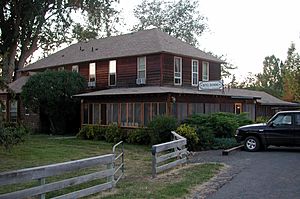
Diamond, Oregon facts for kids
Quick facts for kids
Diamond, Oregon
|
|
|---|---|

Hotel Diamond
|
|
| Country | United States |
| State | Oregon |
| County | Harney |
| Elevation | 4,219 ft (1,286 m) |
| Time zone | UTC-8 (PST) |
| • Summer (DST) | UTC-7 (PDT) |
| ZIP codes |
97722
|
| Area code(s) | 541 |
| Coordinates and elevation from United States Geological Survey | |
Diamond is a small, unincorporated community in Harney County, Oregon, United States. An unincorporated community means it's not an official city or town with its own government. Diamond is located west of Oregon Route 205 and south of Malheur Lake. It is about 52 miles (84 km) south-southeast of Burns by highway. The community has its own post office with ZIP code 97722.
Contents
History of Diamond
Diamond was first settled around 1874 or 1875. The community got its name from a special symbol. A local cattle rancher used a diamond-shaped branding iron to mark his cattle. This ranch was known as the Diamond Ranch. The name "Diamond" was then used for the Diamond Craters, the Diamond post office, and other places nearby. The ranch was started by an early settler named Mace McCoy. A post office was officially opened in Diamond in 1887.
Another early settler, Minerva J. (Dolly) Kiger, helped name the community in 1874. She also named Kiger Creek, which starts on Steens Mountain and flows into Swamp Creek near Diamond. She also named two other nearby streams, Cucamonga Creek and McCoy Creek.
Geography of Diamond
Diamond is located along Swamp Creek, at the start of Diamond Valley. This area is in southeastern Oregon, northwest of Steens Mountain. Swamp Creek flows into Diamond Swamp, which is a short distance down the valley. This swamp is part of the Malheur National Wildlife Refuge, a protected area for wildlife.
A road called Diamond Lane connects the community to Route 205. This road runs generally east to west. Route 205 links Diamond to Frenchglen to the south and Burns to the north.
Diamond Craters Natural Area
Next to the swamp, to the east, are the Diamond Craters. These are about 6 miles (10 km) northwest of Diamond. This area covers about 23-square-mile (60 km2) and has many different types of basalt rock formations. It is protected as an Outstanding Natural Area. The Bureau of Land Management looks after this special place.
Climate in Diamond
According to the Köppen Climate Classification system, Diamond has a semi-arid climate. This means it is a dry area, but not a desert. It gets some rain, but not a lot. On climate maps, this type of climate is shown as "BSk".
Education in Diamond
Students in Diamond attend local schools. The K-8 school for younger students is Diamond Elementary School.
For high school, students go to Crane Union High School. This school is part of the Harney County Union High School District 1J.
Harney County does not have its own community college district. However, it has an agreement with Treasure Valley Community College. This college operates the Burns Outreach Center in Burns, which is a nearby town.
 | Precious Adams |
 | Lauren Anderson |
 | Janet Collins |


