Malheur Lake facts for kids
Quick facts for kids Malheur Lake |
|
|---|---|

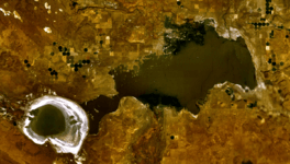
Satellite image of Malheur Lake (right) and Harney Lake (left) in 2004
|
|
| Location | Harney County, Oregon |
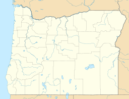
| Coordinates | 43°19′58″N 118°47′35″W / 43.33278°N 118.79306°W |
| Type | Natural, eutrophic in an endorheic basin |
| Primary inflows | Donner und Blitzen River, Silvies River, Sodhouse Spring, precipitation |
| Primary outflows | Mud Lake (frequent but intermittent flows) |
| Catchment area | 3,083 sq mi (7,980 km2) |
| Basin countries | United States |
| Surface area | 49,700 acres (20,100 ha) |
| Average depth | 2 ft (0.61 m) |
| Max. depth | 5 ft (1.5 m) |
| Water volume | .. 84,500 acre⋅ft (104,200,000 m3) |
| Residence time | 7.4 years |
| Shore length1 | 58 mi (93 km) |
| Surface elevation | 4,093 ft (1,248 m) |
| Islands | Cole, Pelican |
| Settlements | Burns, Crane, New Princeton |
| 1 Shore length is not a well-defined measure. | |
Malheur Lake is a special lake in Harney County, Oregon. It's part of the Malheur National Wildlife Refuge. You can find it about 18 miles (29 km) southeast of Burns.
This lake is actually a big marsh. It gets its water from the Donner und Blitzen River in the south and the Silvies River in the north. Sometimes, Malheur Lake gets so full that its water flows into Mud Lake. From Mud Lake, the water then goes into Harney Lake. Harney Lake is the lowest point in the Harney Basin, where water collects without flowing out to the ocean.
The western part of Malheur Lake has many small ponds. These ponds are separated by little islands and pieces of land sticking out. The middle and eastern parts of the lake are more open. The water in Malheur Lake is usually shallow. This makes it a perfect home for many kinds of birds and water plants.
Like other lakes in the Great Basin, Malheur Lake's size changes a lot. This happens because of the weather, climate, and seasons. The lake sits in a very flat area. A lot of its water comes from melting snow, especially from Steens Mountain to the south. For example, in the mid-1980s, there was a lot of snow. This made the lake grow from about 67 square miles (170 km2) to 160 square miles (410 km2) in just three years! It flooded dry areas and even damaged a train track. But then, in the early 1990s, a drought made the lake shrink to only 200 acres (0.31 sq mi). This left large muddy areas and dusty dry lakebeds.
History of Malheur Lake
Malheur Lake is what's left of a much bigger ancient lake. This huge lake existed during the Pleistocene Ice Age, when the climate was much wetter. Scientists think this ancient lake was about 900 square miles (2,300 km2) big. It was also up to 35 feet (11 m) deep.
Originally, this ancient lake's water flowed out to the east, into the Malheur River. The Malheur River then joins the Snake River. But over time, lava flows changed things. The lava blocked the original path near New Princeton. This made the water find a new way out near Crane. Today, much of the old lake bottom is now desert. Some parts have become meadows that get wet when the lake overflows. Mud Lake and Harney Lake are also parts of this original giant lake.
All these lakes, along with nearby marshes and dry lakebeds, are part of the Harney Basin. This basin is like a giant bowl. It's a "closed depression," meaning water flows into it but doesn't flow out to the ocean. The Harney Basin covers about 5,300 square miles (14,000 km2). That's even bigger than the state of Connecticut!
Wildlife and Plants
Malheur Lake is full of different water plants and grasses. It's a very important place for birds to nest and find food. Many kinds of waterfowl and migratory birds visit the lake. You can see many bird species here, including ducks, geese, swans, herons, egrets, gulls, terns, and grebes.
Malheur Lake Basin Redband Trout
The Great Basin redband trout is a special type of fish. Its scientific name is Oncorhynchus mykiss newberri. These trout used to have easy access to Malheur and Harney lakes. But now, it's harder for them to reach the lakes. This is because of things like irrigation, which takes water away. Also, channels have been built, and marshlands have been drained. High levels of saltiness in the water also make it tough for them.
There are also many non-native carp in Malheur Lake. These carp have caused a lot of damage to the trout's habitat. Harney Lake has been too salty for redband trout for many years. Today, you can find redband trout in the Malheur Lake basin in smaller and medium-sized streams.
The redband trout is a unique subspecies. It has adapted to live in the Malheur Lake basin ecosystem. In these closed, high-desert areas, redband trout have learned to survive. They can handle huge changes in water flow and temperature. They are one of only eight groups of native redband trout that live in desert basins. The Malheur Lake redband trout are found in 10 different groups within the Harney and Malheur lakes basin. In the past, all the streams were connected. This allowed these fish to move freely through all the lakes and streams.
The redband trout is not officially listed as a threatened or endangered species. However, it is recognized as a very important natural resource. The Steens Mountain Cooperative Management and Protection Act of 2000 is a law that helps protect these fish. It sets aside land in Oregon for their protection and for research.
 | Roy Wilkins |
 | John Lewis |
 | Linda Carol Brown |


