
Dimple Creek (Tohickon Creek tributary) facts for kids
Quick facts for kids Dimple Creek |
|
|---|---|

Light reflecting off Lake Towhee
|
|

Dimple Creek
|
|
| Other name(s) | Kimples Creek |
| Country | United States |
| State | Pennsylvania |
| County | Bucks |
| Township | Haycock |
| Physical characteristics | |
| Main source | 520 feet (160 m) 40°30′40″N 75°15′22″W / 40.51111°N 75.25611°W |
| River mouth | 456 feet (139 m) 40°27′19″N 75°16′36″W / 40.45528°N 75.27667°W |
| Length | 3.89 miles (6.26 km) |
| Basin features | |
| Progression | Dimple Creek → Tohickon Creek → Delaware River → Delaware Bay |
| River system | Delaware River |
| Basin size | 7.33 square miles (19.0 km2) |
| Landmarks | Haycock Mountain |
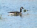
| Waterbodies | Lake Towhee |
| Bridges | Stoney Garden Road East Sawmill Road Deerwood Lane Roudenbush Road East Thatcher Road |
Dimple Creek (also known as Kimples Creek) is a small stream in Haycock Township, Bucks County, Pennsylvania. It flows into the Tohickon Creek. This creek is part of the larger Delaware River watershed, which means its water eventually flows into the Delaware River and then out to the ocean.
Contents
Facts About Dimple Creek
Dimple Creek is an important part of the local water system. It has a watershed area of about 7.33 square miles (18.99 square kilometers). A watershed is like a big bowl where all the rain and snowmelt drain into one main stream or river. Dimple Creek also flows through a popular spot called Lake Towhee.
Where Dimple Creek Flows
Dimple Creek starts high up at about 520 feet (158 meters) above sea level. It begins in the northern part of Haycock Township from a small pond. This pond is located west of a place called Little Haycock Mountain.
From its start, the creek flows south. It picks up water from a smaller stream that joins it from the left side. Then, Dimple Creek flows into Lake Towhee. This lake was created by building a dam across the creek.
After leaving Lake Towhee, the creek continues flowing southwest. It finally meets the Tohickon Creek at a place called the Levi Sheard Mill. At this point, the elevation is about 456 feet (139 meters). The entire stream is about 3.89 miles (6.26 kilometers) long. This means it drops about 16.45 feet for every mile it travels.
The Rocks Under Dimple Creek
Dimple Creek flows over some very old and interesting rocks. These rocks were formed when hot, melted rock called magma pushed its way into older rocks about 200 million years ago. This happened during the Jurassic and Triassic periods, which were a long, long time ago when dinosaurs roamed the Earth!
When this magma cooled down, it formed a very hard rock called diabase. This diabase rock is made of minerals like labradorite and augite. Because diabase is so strong, it doesn't wear away easily. This means the creek has carved its path through very tough ground.
Bridges Over Dimple Creek
Several roads cross over Dimple Creek. Here are some of the bridges you might find:
| Crossing | NBI Number | Length | Lanes | Spans | Material/Design | Built | Reconstructed | Latitude | Longitude |
|---|---|---|---|---|---|---|---|---|---|
| Stoney Garden Road | - | - | - | - | - | - | - | - | - |
| East Sawmill Road | 7464 | 7 metres (23 ft) | 1 | 1 | Steel stringer/multi-beam or girder | 1937 | - | 40°29'18.5"N | 75°15'21.2"W |
| Deerwood Lane | 7449 | 7 metres (23 ft) | 1 | 1 | Steel Stringer/Multi-beam or girder | 1971 | - | 40°29'7.4"N | 36.23"W |
| Roudenbush Road | 7579 | 9 metres (30 ft) | 1 | 1 | Steel stringer/nulti-beam or girder | 1930 | - | 40°28'15.1"N | 75°16'3.2"W |
| East Thatcher Road | 7414 | 17 metres (56 ft) | 2 | 1 | Prestressed concrete box beam or girders - single or spread | 1972 | - | 40°27'32.3"N | 75°16'33.2"W |
Images for kids
-
Goose paddling in Lake Towhee in the Autumn of 2016.

