Tohickon Creek facts for kids
Quick facts for kids Tohickon Creek |
|
|---|---|
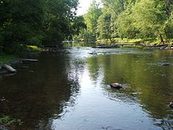
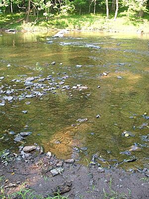
A typical view of the creek from Bedminster Township.
|
|
Tohickon Creek
|
|
|
Tohickon Creek
|
|
| Native name | Tachan Hoking, Achtuhhu Ing, Toh-hick-han, Toh-hick-hanne |
| Country | United States |
| State | Pennsylvania |
| County | Bucks |
| Township | Springfield Richland Haycock East Rockhill Nockamixon Tinicum Bedminster Plumstead |
| Borough | Quakertown |
| Physical characteristics | |
| Main source | The Lookout 640 feet (200 m) 40°30′35″N 75°21′37″W / 40.50972°N 75.36028°W |
| River mouth | 72 feet (22 m) 40°25′16″N 75°3′41″W / 40.42111°N 75.06139°W |
| Length | 29.5 miles (47.5 km) |
| Basin features | |
| Progression | Tohickon Creek → Delaware River → Delaware Bay |
| River system | Delaware River |
| Basin size | 112 square miles (290 km2) |
| Landmarks | Haycock Mountain |
| Tributaries | |
| Waterbodies | Lake Nockamixon |
| Bridges | Rocky Valley Road Povenski Road Hickon Road East Cherry Road California Road East Pumping Station Road Pennsylvania Route 212 (Richlandtown Pike) Erie Road West Thatcher Road Richlandtown Road Covered Bridge Road (Sheard's Mill Covered Bridge) Pennsylvania Route 563 (Mountain View Drive) South Park Road Creamery Road Farm School Road Pennsylvania Route 113 (Bedminster Road) Pennsylvania Route 611 (Easton Road) Randts Mill Road Dark Hollow Road Stover Park Road Pennsylvania Route 32 (River Road) |
| Slope | 19.25 feet per mile (3.646 m/km) |
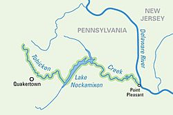
Tohickon Creek is a cool waterway, about 29.5 miles (47.5 km) long, located entirely in Bucks County, Pennsylvania. It's like a smaller river that flows into a bigger one, the Delaware River. The creek starts in Springfield Township and joins the Delaware River at Point Pleasant. A big dam on the creek creates a beautiful spot called Lake Nockamixon.
Contents
History of Tohickon Creek
Before Europeans settled here, the Lenape tribe lived in the area around Tohickon Creek. They had different names for the area, like Tachan Hoking, which meant "Piece of Wood Area Place." Another name, Achtuhhu Ing, meant "Deers Place."
Early Mills and Parks
Early settlers noticed how fast the creek flowed. By the late 1700s, many water-powered mills were built along the lower part of the Tohickon valley. One famous mill belonged to Ralph Stover in Plumstead Township.
Years later, during the Great Depression in the 1930s, Ralph Stover's family gave the mill area to Pennsylvania. The government's Works Progress Administration (WPA) turned it into a fun place for people to visit. This became Ralph Stover State Park, which opened in 1935.
From Industry to Recreation
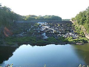
Creating Ralph Stover State Park was the start of the Tohickon Creek area changing from a place for factories to a place for fun. In 1958, the United States Army Corps of Engineers built a dam on the creek near Quakertown. This created Tohickon Lake, which was also a state park. It was later renamed Lake Nockamixon, another Lenape name meaning "place of soft soil."
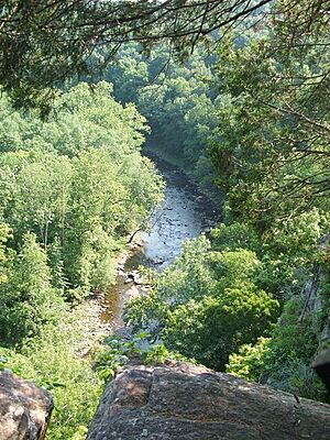
More and more land along the creek became parkland. James A. Michener, a famous author who lived nearby, gave the High Rocks area to the Commonwealth. This part of Ralph Stover State Park has tall rock cliffs above the creek.
Today, another park called Tohickon Valley County Park is next to High Rocks. Their walking trails connect, and together they protect the deep valley that Tohickon Creek carved through the hills.
The Boy Scouts of America also have a camp called Camp Ockanickon along the creek. There are also a few private campgrounds for visitors.
Tohickon Creek Facts
Tohickon Creek is the longest waterway completely within Bucks County. It is 29.5 miles (47.5 km) long. The creek is part of the Delaware River watershed, which means all the water from a 112 square mile (290 km2) area flows into it.
The Creek's Journey
Tohickon Creek is the longest waterway entirely in Bucks County. It starts in the northern part of the county and generally flows east to the Delaware River. We can think of its journey in three main parts: the western half, Lake Nockamixon, and the eastern half.
Western Course: The Beginning
Tohickon Creek starts as a small stream in Springfield Township, on the slopes of The Lookout. From there, it flows south into Richland Township and then Quakertown, which is the biggest town along the creek.
Then, it turns sharply east and forms the border between Haycock and East Rockhill Townships for a while. It makes one more turn south before flowing into Lake Nockamixon.
In this first part, the creek is small and the land is mostly flat. This makes the water flow slowly and look a bit muddy. About half of the creek's smaller streams (tributaries) join it before it reaches Lake Nockamixon.
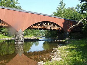
Fun places along this part of the creek include Camp Tohikanee and the scenic Sheards Mill and Sheard's Mill Covered Bridge.
Lake Nockamixon: The Wide Part
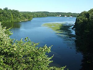
About halfway along its path, the creek widens to form Lake Nockamixon. In this section, the creek flows northeast for about 5 miles (8 km) until it reaches the dam. Here, it forms the border between Haycock and Bedminster Townships.
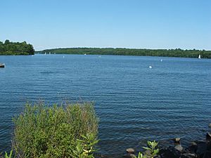
When the stream becomes Lake Nockamixon, the water moves very slowly. But it's not still! The deep water stays clean and blue. This part of the creek is home to many kinds of fish, like walleye, pickerel, carp, bass, and catfish.
This entire section is part of Nockamixon State Park. You can go boating and fishing in the lake. Visitors can also camp at park campgrounds or a nearby youth hostel.
Eastern Course: The Fast Flow
After leaving Lake Nockamixon, Tohickon Creek changes a lot. It becomes much faster and rockier. It flows southeast, creating the border between Bedminster and Tinicum townships. Then it twists and turns generally east for the rest of its journey.
Here, it forms the border between Tinicum and Plumstead townships and flows through Ralph Stover State Park. At its very end, it goes right through the village of Point Pleasant and under the Delaware Division of the Pennsylvania Canal. Finally, it joins the Delaware River.
The land along this part is very rocky, and the creek drops quickly, making the water clear and fast. The creek cuts a deep valley into the steep hills. At a place called High Rocks, there are vertical stone cliffs up to 200 feet (61 m) high above the creek. As the creek enters Point Pleasant, the ground flattens out, and the water becomes calmer before it meets the Delaware River.
When there's a lot of water, usually in early March and late November, the fast-moving water in this lower part of the creek creates exciting whitewater rapids. The village of Point Pleasant is a popular spot for visitors. You can see many old, scenic bridges that cross the creek before it flows into the Delaware.
Fun Activities at Tohickon Creek
Since the 1930s, Tohickon Creek has become a top spot for outdoor fun in southeastern Pennsylvania. It flows through three state parks: Nockamixon, Ralph Stover, and Delaware Canal. The eastern two-thirds of the creek are the most popular, offering many different activities.
Lake Nockamixon is the most visited place along the creek. Boating is very popular, and the main marina has many sailboats. You can also rent smaller boats. Fishing is another favorite activity, and there's a fishing pier on the lake shore. Visitors can also hike or bike, hunt in certain areas, and even camp overnight.
When water levels are high, usually in early March and late November, the dam at Lake Nockamixon releases bursts of water. This turns Tohickon Creek into a thrilling whitewater course! Experienced boaters can ride the rapids all the way from the lake to the Delaware River.
At the High Rocks part of Ralph Stover State Park, you can try rock climbing on 200-foot (61 m) cliffs or enjoy the amazing view from the top. A path called Ridge Trail goes along the top of the wide valley from High Rocks, heading south into Tohickon Valley County Park towards Point Pleasant.
At the very end of the creek, it passes under Delaware Canal State Park. Before floods in 2004–2005, visitors could walk along the canal north to Easton or south to Bristol. The picture shows debris from that flood, which damaged parts of the canal. The park is currently being rebuilt.
Bridges Over Tohickon Creek
Many bridges cross Tohickon Creek. Here are some of them:
- Rocky Valley Road
- Povenski Road
- Hickon Road
- East Cherry Road
- California Road
- East Pumping Station Road
- Pennsylvania Route 212 (Richlandtown Pike)
- Erie Road
- West Thatcher Road
- Richlandtown Road
- Covered Bridge Road (Sheard's Mill Covered Bridge)
- Pennsylvania Route 563 (Mountain View Drive)
- South Park Road
- Creamery Road
- Farm School Road
- Pennsylvania Route 113 (Bedminster Road)
- Pennsylvania Route 611 (Easton Road)
- Randts Mill Road
- Dark Hollow Road
- Stover Park Road
- Pennsylvania Route 32 (River Road)
Images for kids
 | Lonnie Johnson |
 | Granville Woods |
 | Lewis Howard Latimer |
 | James West |


