Douglas Navigation facts for kids
The Douglas Navigation was a river in Lancashire, England, that was made suitable for boats. It ran from the River Ribble all the way to Wigan. The idea to improve the river was approved in 1720. Some work started, but the people in charge lost most of their money due to a big financial problem called the "South Sea Bubble".
Eleven years later, a man named Alexander Leigh tried to restart the project. He managed to open parts of the navigation between 1738 and 1742. Leigh also started building a shortcut canal called Leigh's Cut. This was meant to make the journey from Newburgh to Gathurst easier. However, it was a slow process and wasn't finished by 1771.
The Douglas Navigation was only used for a short time. In 1772, the Leeds and Liverpool Canal Company bought it. They did this to stop another company from building a rival canal from Liverpool to Wigan. The canal company couldn't really afford it, but they needed to control the water supply.
The Leeds and Liverpool Canal Company finished Leigh's Cut. They also built locks so boats could avoid passing under their new aqueduct at Newburgh. They improved the river section into Wigan, and it officially opened in October 1774. Later, the last 3 miles (4.8 km) of the river section into Wigan was replaced by a new canal in 1780. The lower part of the river was replaced by the Rufford Branch, which opened in 1781.
The navigation didn't make much money. However, many investors owned coal mines. Improving the river helped them sell their coal to more places. Alexander Leigh kept investing in the navigation until it was bought out. This was probably because his coal business was doing well. The navigation was no longer used by 1801.
Because the canal company couldn't buy all the original shares, the new sections were called the Upper and Lower Douglas Navigations. They were managed separately until the last two shares were bought in 1893. So, on paper, the Douglas Navigation lasted for 173 years! A small part of it still exists. The river was moved to a new channel to build the Rufford Branch. The old river channel was then used for the canal. Sollom Lock can still be seen on this section, but it no longer has gates. About 4 miles (6.4 km) of the tidal river is still used today. This section has been used more since 2002, when the Ribble Link opened. This link connects the Lancaster Canal to the River Ribble.
Contents
History
Early Plans for the River
A special type of coal called Cannel coal was mined near Wigan. This coal burned with a bright yellow flame and made very little ash. People wanted to buy this coal around the Irish Sea. But it was hard to move the coal to the coast. The roads were very bad. The River Douglas, however, flowed from Wigan to the River Ribble. So, in the early 1700s, people became interested in making the river suitable for boats.
In 1712, Thomas Steers, an engineer, surveyed the Douglas. He suggested making it deeper for ships. This would help transport coal from Wigan to the Ribble and then to Preston. It's thought that Sir Roger Bradshaigh, who owned coal-rich land near Wigan, hired him. Sir Roger presented a plan to Parliament in 1713. Many people supported the idea. They believed it would improve trade and travel in Lancashire and The Fylde.
Steers planned to build seven locks to raise boats 75 feet (23 m) from Hesketh Bank to Wigan. A lock is like a water elevator that helps boats move between different water levels. The plan passed the House of Commons. But some local landowners didn't like it, and it was stopped in the House of Lords. People then wrote pamphlets to try and change local opinions. With support from Wigan, another plan was presented. It faced opposition again, but this time it passed.
On April 7, 1720, Parliament approved making the river suitable for boats. This section ran from the River Ribble to Miry Lane End in Wigan. Steers and William Squire were the two owners. They had 11 years to finish the work. They could charge tolls for goods carried, but not for manure. Commissioners were appointed to find new owners if Steers and Squire failed.
To pay for the project, Steers and Squire, with help from Richard Norris, divided the expected profits. They kept some for themselves and split the rest into 1,200 parts. They hoped to sell each part for £5, aiming to raise £6,000. It's not clear how many parts were sold, but at least 942 were, raising £4,170.
Steers started work. He replaced a shallow river crossing at Rufford with a bridge. He also began building the first lock using stone from nearby quarries. The river channel downstream was made straighter and wider for about 1.5 miles (2.4 km). Work also began on the lowest lock at Croston Finney. Steers even built a boat to trade on the river. He said he spent £700 on the work, but Squire only gave him £600.
In 1720, there was a big financial problem called the "South Sea Bubble." Squire had stayed in London to raise money. But he is believed to have lost most of the money he raised by investing badly in this financial problem. The problem got worse two months after the shares were sold. With no money left, the work stopped. Steers, Squire, and Norris ended up in court. The court case lasted from 1729 to 1734. Squire disappeared around 1730. The court couldn't decide if they had deliberately tried to cheat the investors.
Finishing the Project
Even though the original deadline had passed, new people stepped in. In 1731, Alexander Leigh and Alexander Radcliffe agreed to take over the project. They were given another eleven years to finish it. They asked William Palmer, an engineer, to survey the river again. His report in March 1733 said the work would cost £6,685 and need 12 locks. The total rise in height was 68 feet (21 m). Each lock would be 60 by 12 feet (18.3 by 3.7 m), and the river would be 3 feet (0.91 m) deep.
Palmer found a problem with the original plans. The tide lock would only be usable a few days a month. He suggested a new cut from Rufford to Crossens, near Southport, crossing Martin Mere. This would cost an extra £2,530. But it would make it easier for boats to reach the navigation. It would also shorten the route by 6 miles (9.7 km) and help prevent floods. No more action was taken until Radcliffe died in 1737. Leigh became the main owner, joined by Robert Holt.
They started work and opened four locks in 1738, and three more in 1739. In 1738, they made a deal to deliver 800,000 baskets of coal. Holt and Leigh sometimes asked Steers for advice. Richard Fell was the main builder. Holt died in 1740. On June 12, 1742, exactly eleven years after Leigh took over, the navigation was declared complete. About £7,000 was spent on this second phase of work, plus another £1,000 on boats.
Making the river suitable for boats involved building many locks. There was also a basin at Miry Lane End in Wigan, connected to the river by a short channel. Some sources say there were eight locks, all upstream of Newburgh. Others list thirteen locks. A new lock was built at Tarleton to improve access. But it caused flooding and was abandoned by 1770.
The navigation had fixed bridges. This meant sailing boats had to lower their masts. This stopped larger sea-going boats from using it. In the early 1760s, a new cut was built between Sollom and Rufford. Fixed bridges began to be replaced by swing bridges. A new lock at Sollom made it easier for boats to access the navigation more often. People used manpower to pull the boats. In 1800, land was bought for a towpath between Sollom and Rufford. Plans to make the whole length usable by fixed-mast boats were dropped when the Leeds and Liverpool Canal became interested.
Improvements to the river below Gathurst Bridge started in 1753. Leigh began working on a shortcut, "Leigh's Cut," to bypass the river from Gathurst to Newburgh. This work was very slow and still unfinished in 1771. The main goods carried were coal from Wigan. In the other direction, limestone from north Lancashire and slate from Westmorland were transported.
Takeover by Leeds and Liverpool Canal
The Leeds and Liverpool Canal was approved by Parliament in 1770. The Douglas Navigation owners were mainly worried about protecting their water supply. They also wanted to make sure the new aqueduct for the canal over the river at Newburgh wouldn't block boats. Holt Leigh, Alexander Leigh's son, had been talking to the canal committee since 1769. They worked out a solution. A branch canal would connect the canal to the river upstream of the aqueduct. Locks would connect them downstream. This would let sailing boats use the canal and cross over the aqueduct. The Leeds and Liverpool Canal would pay £500 once the work was done.
The Canal Company built the canal in sections. Boats first used the section from Newburgh to Liverpool on July 25, 1771. Water supply was a problem. The law said they couldn't take water from the River Douglas. Alexander Leigh owned 29 of the 36 shares in the navigation. In November 1771, he offered to sell them to the Leeds and Liverpool Canal for £14,500. They couldn't really afford it. But they bought the shares anyway. They were trying to stop a new plan for a Liverpool Canal that would connect directly to Wigan. The Liverpool Canal plan was presented to Parliament in January 1772, but it was defeated.
Alexander Leigh's 29 shares were first bought by two committee members, Jonathan Blundell and William Earle. They held them for the canal company. Holt Leigh bought most of the remaining shares, except for two owned by his uncle Edward Holt. He later sold these to the Leeds and Liverpool Canal in 1785. After buying Leigh's shares, the Leeds and Liverpool Canal quickly worked to serve the Wigan coal trade. By August 1772, they started finishing Leigh's Cut and building a connection to their canal. This was done by February 1774. Boats could then reach Wigan from Liverpool. They traveled along the new canal, then Leigh's Cut, and finally joined the river at Dean Lock for the last 3 miles (4.8 km) into Wigan. The navigation was repaired, and it officially opened in October 1774.
Alexander Leigh died soon after. The Leeds and Liverpool Canal rented the remaining shares from Holt Leigh. People wanted to bypass the old river sections entirely. Work began on a new cut, with two locks, from Gathurst to Wigan. This was slow and wasn't finished until 1780. This whole section from Newburgh to Wigan was called the Upper Douglas Navigation.
Meanwhile, work on a new canal to bypass the lower river sections started in 1777. The Rufford Branch, which had seven regular locks and a tide lock, was finished in October 1781. It joined the river near its mouth at Sollom. This was known as the Lower Douglas Navigation.
The Leeds and Liverpool Canal got another law passed on June 24, 1783. This allowed them to buy most of the remaining shares. Once the new canal opened, all trade moved to it. The river navigation was mostly abandoned. The lock gates on the river sections were removed by 1782. The river was completely unused by 1801. However, the wharf at Gathurst could still be reached by a side lock at Dean. In 1805, Sollom lock on the Rufford branch was abandoned. A new tide lock was built further downstream at Tarleton. To build this extension, the river was moved into a new channel to the east. The old channel was then used by the canal. From then on, only the lower part of the river, from Tarleton to the River Ribble, was still used.
Because Edward Holt kept his two shares, the Leeds and Liverpool Canal kept separate accounts for the Upper and Lower Douglas Navigation sections. This was so profits could be divided correctly. This continued until 1893, when they finally bought the last two shares from Holt's family. So, even though trade on the river only lasted about forty years, the company officially existed for 173 years.
What Was Carried?
The original plans for the navigation in 1713 and 1720 mentioned coal mines and quarries for stone and slate. These materials would be much easier to transport if the river was suitable for boats. One rule in the first law was that the maximum charge for carrying goods was two shillings and six pence (about 12.5p), no matter how far they traveled.
Around 1738 or 1739, Leigh and Holt bought land at Freckleton on The Fylde. This was on the north bank of the Ribble, across from the Douglas mouth. The first goods carried on the navigation were coal from Lord Derby's mine at Bispham to Freckleton. Sir Roger Bradshaigh worked in Parliament in 1739 to stop a plan to reduce the tax on coal carried along the coast. This plan would have helped coal from Whitehaven, which was cheaper. Whitehaven coal went to Dublin, but the boats came back empty. Boats carrying coal from the Douglas to Lancaster and Kendal returned with limestone and iron. This helped the more expensive Douglas coal compete.
There were several wharfs along the navigation. The two most important were at the end basin in Wigan, where coal from Bradshaigh's mine was loaded. The other was at Gathurst, serving coal mines at Orrell.
Boats used on the navigation were usually between 45 and 55 feet (14 and 17 m) long. They were less than 14.5 feet (4.4 m) wide and drew a little under 5 feet (1.5 m) of water. Not many records exist about what was carried. But a boat named Expedition carried coal, cannel, cinders (a type of fuel), and paving stones downriver. It returned with timber, hides, seaweed, soap ashes, barley, beans, and most importantly, limestone. Limestone was the main cargo coming back. These records are from 1752 to 1755. Records from 1764 to 1768 for another boat called Success show that downriver traffic was mostly coal. Upriver traffic was only limestone.
Holt Leigh's diaries show that tolls for 1772 were £414. This suggests that over 10,000 tons of goods were carried that year. The total cost to build the navigation was about £12,385. By 1768, with interest and maintenance, this had risen to £32,226. So, the navigation wasn't a profitable business on its own. But most investors owned coal mines, and the river helped them sell their coal. Leigh kept investing in the navigation because of his coal trading.
Once the new cuts were finished as part of the Leeds and Liverpool Canal takeover, coal traffic increased. The river was still used for a while because mine owners didn't immediately build new wharfs on the new canal. The charges for using the canal were lowered. The changeover was sped up by raising the charges on the river. Separate records for the Douglas Navigation show that income rose from £162 in 1772 to £1,790 in 1778. This income was almost a quarter of the total money earned by the canal company.
Over time, commercial trade on canals declined. Even the last river section was rarely used. Most pleasure boats only went as far as Tarleton Lock. It wasn't until 2002, when the Ribble Link opened, that this part of the navigation saw more boats. Below Tarleton Lock, boats must travel 4 miles (6.4 km) on the tidal River Douglas to reach the River Ribble. Asland Lamp is in the Ribble. Boats going upstream to the Ribble Link must keep it on their right side. This helps them avoid shallow water, which can be dangerous when the tides are strong.
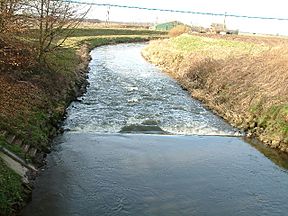
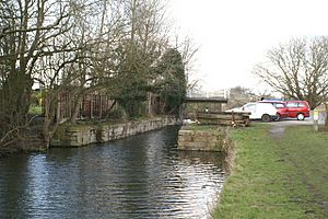
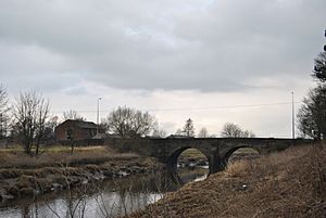
Even though it was abandoned for 200 years, you can still see parts of the navigation between Parbold and Gathurst. These include the remains of several locks. The river has been changed to improve drainage. This has destroyed most signs of the navigation, especially below Rufford. However, the section between Rufford Lock and Sollom is still preserved. This is because it was reused when the river was moved to the east to build the Rufford Branch. Sollom Lock has no gates, but its walls are still standing.
 | Roy Wilkins |
 | John Lewis |
 | Linda Carol Brown |


