
River Ribble facts for kids
Quick facts for kids River Ribble |
|
|---|---|

River Ribble at Ribchester
|
|
| Country | England |
| Physical characteristics | |
| Main source | Confluence of Gayle Beck and Cam Beck, Selside, Ribblehead 807 ft (246 m) |
| River mouth | Irish Sea at Lytham |
| Length | 75 mi (121 km) |
| Basin features | |
| Conservation | Ribble Rivers Trust |
The River Ribble flows through North Yorkshire and Lancashire in Northern England. It starts near the Ribblehead Viaduct in North Yorkshire. It's special because it's one of the few rivers that begin in the Yorkshire Dales and flow west towards the sea. Other rivers like this include the Dee and the Twiss.
Contents
What's in a Name?
The name Ribble might come from an old language called Common Brittonic. It could mean something like "great upland-stream" or "big puddle."
Long ago, the River Ribble might have been called *Bremetonā-. This name is linked to Bremetenacum, which was a Roman fort at Ribchester. The word *breμ– means "roaring," so it could have been the "roaring river."
A Look Back in Time
People have lived along the River Ribble for a very long time! When the Preston Docks were built, they found ancient items from the Stone Age and Saxon times. This shows that people were here thousands of years ago.
The river and coastline looked very different back then. The sea used to reach much further inland. Over time, new land formed as mud and sand settled in the river.
The Romans knew the Ribble as the Belisama. This name might be where Samlesbury gets its name from. The Romans had a fort called Bremetennacum at Ribchester to guard a place where they crossed the river. Another Roman site was found at Walton-le-Dale.
Many valuable treasures have been found near the Ribble. The medieval Mitton Hoard (a collection of silver items) was discovered in 2009. The Cuerdale Hoard, the largest Viking silver treasure ever found outside Russia, was found in 1840 near Preston.
At one point, the Ribble was the northern border of the old kingdom of Mercia. During the time of the Domesday Book (a famous survey from 1086), the river marked the northern edge of an area that was part of the information for Cheshire.
Where the River Flows

The Ribble starts where two smaller streams, Gayle Beck and Batty Wife Beck, meet near the Ribblehead Viaduct at Ribblehead. This is in the shadow of the Yorkshire Three Peaks. It's the only major river in Yorkshire that flows west.
The river flows through towns like Settle, Clitheroe, Ribchester, and Preston. Finally, it empties into the Irish Sea between Lytham St. Annes and Southport. The river is about 75 miles (121 km) long.
Its main smaller rivers that join it are the Hodder and Calder (near Great Mitton). The River Darwen joins at Walton-le-Dale, and the River Douglas joins near Hesketh Bank.
The valley of the river above Hellifield is known as Ribblesdale.
The Ribble Way is a long walking path that follows the river for much of its journey. The river is also connected to the Leeds and Liverpool Canal and the Lancaster Canal through the Ribble Link.
The river's wide mouth, called an estuary, is about 10-mile (16 km) across. It's a very important place for wildlife, especially birds. On average, 340,000 water birds spend the winter there, making it the most important wetland in Britain! The Ribble is also a key breeding spot for the Atlantic salmon, which is an endangered fish.
About 1.25 million people live in the area where the Ribble collects its water.
The river's normal tidal limit (where the tide stops affecting the river) is at Fishwick Bottoms, near Preston. This is about 11 miles (18 km) from the sea.
The River Ribble has the third-largest tides in England. The tides can move at 4 knots (5 mph; 7 km/h), and the water level at the mouth can change by 26 feet (8 m) during spring tides (the biggest tides).
Protecting the Ribble
The Ribble Rivers Trust is a charity that works to make the River Ribble better for both people and wildlife. They protect and improve the river's health.
Preston City Council has suggested plans to build a barrier across the River Ribble. These plans, called 'Riverworks', aim to create a water sports park and build new homes and businesses. However, some local people are against these plans. They say the plans could harm wildlife, increase flood risk for homes, and damage green areas. These residents have started a group called "Save The Ribble." Parts of the river are also a special site for biological heritage.
Crossing the Estuary
People have suggested building a way to cross the Ribble estuary many times. This would make it quicker to travel between the seaside towns of Southport and Blackpool. Ideas have included:
- A tramway in 1899 and again in 1900-1906.
- A railway tunnel in 1907.
- A bridge between 1938 and 1947.
- A road link in 2007, similar to a power station in France.
Towns and Villages Along the Ribble
In North Yorkshire
- Horton in Ribblesdale
- Stainforth
- Stackhouse
- Langcliffe
- Giggleswick
- Settle
- Halton West
- Nappa
In Lancashire
- Paythorne
- Gisburn
- Sawley
- West Bradford
- Horrocksford
- Clitheroe
- Great Mitton
- Brockhall Village
- Little Town
- Ribchester
- Samlesbury
- Walton-le-Dale
- Preston
- Penwortham
- Tarleton
- Hundred End
- Banks
- Lytham
Rivers Joining the Ribble

- River Douglas (also called River Asland)
- Savick Brook
- River Darwen
- Stydd Brook
- Dinckley Brook
- River Calder
- River Hodder
The Ribble's Namesake
The River Ribble gives its name to a few important things:
- The local government areas of Ribble Valley and South Ribble.
- The Ribble Valley parliamentary constituency (an area represented by a Member of Parliament).
- The Ribble Bus Company, which used to operate across North West England.
- The Ribble Steam Railway, a fun place where you can ride old trains.
Images for kids
-
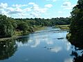
River Ribble at Ribchester
-

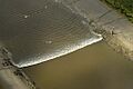
Ribble estuary
-
Tidal bore on the Ribble, between the River Douglas and Preston
See also
 In Spanish: Río Ribble para niños
