
Lancaster Canal facts for kids
Quick facts for kids Lancaster Canal |
|
|---|---|

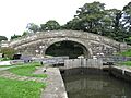
Cathouse Bridge (No. 64) over the navigable section of the canal in Garstang
|
|
| Specifications | |
| Maximum boat length | 70 ft 0 in (21.34 m) |
| Maximum boat beam | 14 ft 0 in (4.27 m) |
| Locks | 14 |
| Status | Navigable |
| Navigation authority | Canal and River Trust |
| History | |
| Original owner | Lancaster Canal Navigation Co |
| Principal engineer | John Rennie |
| Other engineer(s) | William Crossley |
| Date of act | 1792 |
| Date of first use | 1797 |
| Date completed | 1826 |
| Geography | |
| Start point | Preston |
| End point | Kendal |
| Branch(es) | Glasson Dock |
| Connects to | River Lune, Ribble Link |
The Lancaster Canal is a historic canal in North West England. It was originally planned to connect Westhoughton in Lancashire to Kendal in south Cumbria. Canals are man-made waterways used for boats to transport goods or people.
However, the section that was supposed to cross the River Ribble was never finished. Today, much of the canal's southern part is considered part of the Leeds and Liverpool Canal.
The northern part of the canal, from Preston to Tewitfield near Carnforth, is still open for boats. This section is about 42 miles (67.6 km) long. North of Tewitfield, the canal was cut off in three places by the M6 motorway and the A590 road near Kendal.
The southern part, from Johnson's Hillock to Aspull, can still be used by boats. It is now part of the Leeds and Liverpool Canal. The original plan to extend the canal all the way to Westhoughton was never completed.
Contents
The Lancaster Canal's Story

The idea for the Lancaster Canal began with surveys in 1772. More detailed plans were drawn up in 1791 by engineers like John Rennie.
In 1792, a special law called an Act of Parliament was passed. This law allowed the canal to be built. It created a company called the Company of Proprietors of the Lancaster Canal Navigation. This company could raise money to build the canal.
John Rennie was chosen as the main engineer in July 1792. His team started working on the canal almost right away.
Building the Northern Canal

Work began on the flat section from Preston to Tewitfield. In 1794, construction started on the famous Lune Aqueduct. This amazing structure carries the canal 62 feet (19 m) above the River Lune. It was opened in 1797.
By 1797, boats could travel 42.4 miles (68.2 km) from Preston to Tewitfield. Building the canal north from Tewitfield to Kendal started later, in 1813, and was finished in 1819.
A branch canal to Glasson Dock was also built. This 2.5-mile (4 km) section began construction in 1819 and opened in 1826. It has six locks that lower boats down to the sea.

When railways became popular, the canal company decided to lease the canal to a railway company in 1860. This allowed them to keep making money. Eventually, the railway company bought the canal in 1885.
The canal always had problems with water leaking, especially in areas with limestone. In 1939, a small section near Kendal was closed because of this. The canal's owners tried to close the whole canal in 1944, but people protested.
For many years, the main goods carried on the canal were coal from Preston to Kendal Gas Works. This traffic helped keep the canal open. However, in 1944, the coal started being moved by road. The last commercial boats used the canal in 1947.

In 1955, another law allowed the canal to be officially closed. Many people were upset about this. The Inland Waterways Association organized protests, and the Lancaster Canal Boat Club was formed.
After 1955, the canal north of Stainton was drained because of leaks. The last 2 miles (3.2 km) into Kendal were filled in. Even though it was closed, pleasure boats still used the section below Tewitfield.
When the M6 motorway was built, the canal was blocked in three places. This made it impossible for boats to travel north of Tewitfield.
The route of the canal south from Kendal is still visible today. Most of the bridges are still there. This section was not drained because it was used to supply water to a chemical factory. So, small boats can still use this part of the canal.
Fast Passenger Boats
During its busiest times, special "packet boats" offered a fast passenger service. They traveled between Preston and Lancaster, and later to Kendal, at 10 miles per hour (16 km/h). Passengers would get off one boat, walk past the locks at Tewitfield, and get on another boat.
This seven-hour journey was much faster than traveling by stagecoach. People liked the comfort of the canal boats so much that they continued to use them even after trains became available in the 1840s.
Connecting to Other Waterways
The northern part of the canal was separated from the rest of England's canal network for a long time. But in 2002, the Ribble Link was opened. This new waterway finally connected the Lancaster Canal to other canals.
Most of the canal runs through the countryside. The section from Preston to Tewitfield is special because it has no locks. This means it stays at the same height above sea level for its entire length.
The canal used to go right into the center of Preston. Today, the area where the canal basin was is now part of the University of Central Lancashire. You can still find street and pub names that remind people of the canal's past.
The Tramway Bridge
By 1799, the canal was built in two main parts. But there was a gap where it needed to cross the River Ribble. Instead of building a large aqueduct, a temporary tramway was built in 1803.
This tramway had two tracks and used steam-powered inclined planes. It carried goods across the river on a low bridge. This "temporary" solution actually became permanent, and the aqueduct was never built.
The Southern Canal Section
In 1792, the Lancaster Canal Navigation Company planned to link Kendal with Westhoughton. They also wanted to extend the canal to the Bridgewater Canal. However, a local landowner objected, so this extension was stopped.
The Leeds and Liverpool Canal was built nearby. To avoid building a new parallel waterway, the Lancaster Canal built two short branches to connect with the Leeds and Liverpool Canal. These branches included several locks.
In 1851, the Lancaster Canal leased the southern end of its canal to the Leeds and Liverpool Canal. This agreement became permanent in 1864.
The tramway closed in stages between 1864 and 1879. The canal section between Walton Summit and Johnson's Hillock was last used by commercial boats in 1932. This part of the canal was closed in the 1960s. This was partly because building bridges over it for the M61 motorway would have been too expensive.
Today, much of this section is buried under the M61 motorway or has houses built on it. The remaining part of the southern canal, from Johnson's Hillock to Wigan Top Lock, is now part of the Leeds and Liverpool Canal and is still used by boats for fun.
Bringing the Canal Back to Life
There are long-term plans to reopen the section of the canal north of Tewitfield. About 9 miles (14 km) of this section still has water. The last 5 miles (8.0 km) into Kendal are currently dry.
Groups like the Northern Reaches Restoration Group (NRRG) and the Lancaster Canal Restoration Partnership are working to restore the canal from Tewitfield to Kendal. Many organizations are involved in this effort.
Restoring the canal will involve a lot of work. This includes fixing the six places where the canal was blocked, including the three places where the M6 motorway crosses it. They also need to restore the Hincaster Tunnel and the 5 dry miles into Kendal. A new crossing for the A590 road near Kendal is also needed.
This huge project will be very expensive. In 2002, it was estimated to cost £60 million. So, the restoration is planned to happen in different stages.
The first stage planned was to restore 3.7 miles (6.0 km) southwards from Kendal. Money was provided in 2005 for planning and design. However, construction work had not started by late 2016.
The famous Lune Aqueduct received a £2.4 million restoration project. Work began in January 2011 and was completed in March 2012.
In December 2015, a storm called Storm Desmond caused a lot of damage to Bridge 171, also known as Stainton Aqueduct. This led to the canal being temporarily closed there. Funding for the aqueduct's restoration was granted in early 2018, and major work began in August 2018.
Images for kids
-
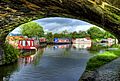
Cathouse Bridge (No. 64) over the navigable section of the canal in Garstang
-
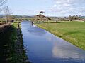
The canal at Farleton, Cumbria, in the unnavigable northern section. The building on the left was used as stables for the packet boat services.
-
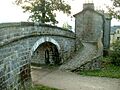
Change Bridge on the route of the canal through Kendal
-
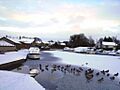
Basin at Carnforth, frozen over in the winter
-
Bridge 1 of the Glasson branch, next to the junction with Lancaster Canal
-
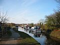
Stretch of the canal in Bilsborrow, Lancashire

