Downs Banks facts for kids
Downs Bank, also known as Barlaston Downs, is a beautiful area of open countryside. It's located about two miles (3 km) north of the town of Stone and four miles (6 km) south of the city of Stoke-on-Trent in Staffordshire. The National Trust owns and takes care of this special place.
Contents
What is Downs Bank Like?
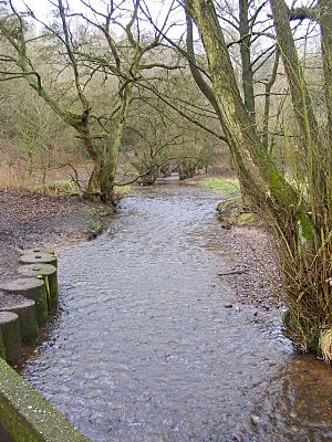
Downs Bank covers about 166 acres (67 hectares). It has a valley that was shaped by ancient glaciers, with a stream flowing through it from north to south. You can also find different types of natural areas here, like woodland and heathland.
Looking After Downs Bank
The National Trust works hard to keep Downs Bank healthy. They have a special project to restore the heathland.
Cattle Helping Nature
In 2005, they brought back cattle to graze on the hillsides during the summer. These cows are like natural gardeners! They help to control plants like bracken and small birch trees. This allows other important plants, such as different types of grasses, heather, bilberry, gorse, and broom, to grow better. It's hoped this will also help animals like viviparous lizards to thrive.
Volunteers and Footpaths
The paths at Downs Bank are very popular, which means they can get worn down. Local people often volunteer to help the National Trust staff. They do important jobs like picking up litter, fixing paths, mending fences, and managing the natural habitats.
The Stream's Recovery
A few years ago, in 2008, the stream at Downs Bank had some pollution from diesel oil. But since then, it has recovered well! Now, it's home to a healthy population of fish, including European bullhead and brown trout.
Visiting Downs Bank
Downs Bank is a great place to visit and explore.
How to Get There
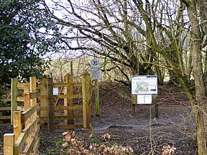
There's a small car park at the southern end of Downs Bank. If you're coming by train, the closest station is Stone railway station. From there, it's about a two-mile walk along lanes and footpaths to reach Downs Bank.
Activities to Enjoy
You can walk freely all over Downs Bank. There are also special paths called bridleways that are marked out. Horse riders and cyclists can use these paths, but they need to be careful.
Many people enjoy walking their dogs here. In 2008, special bins were put up for dog waste, thanks to money raised by local National Trust members.
Downs Bank is also used by the Potteries Orienteering Club for orienteering events. This is a sport where you use a map and compass to find your way around. The club even has a detailed map of the area.
History and Special Features
Downs Bank has an interesting past.
Farming and Gifts
In the 1700s, a farm on Downs Bank grew hops for a local brewery. Hops continued to be grown here until the 1940s, and cattle also grazed until 1959.
In 1950, a man named John Joule gave Downs Bank to the National Trust. He wanted it to be "an offering for victory in the 1939-45 War and a memorial to those who died." He felt it should be open to local people again, as it had once been common land. However, after 1950, without the cattle grazing, the special heathland started to disappear as bracken and birch trees took over. This is why the National Trust now works to restore it.
Millennium Viewpoint
At one of the highest points of Downs Bank, there's a Millennium Viewpoint stone. It used to have a toposcope on top, which is a metal disc with lines pointing to different landmarks you can see from that spot. The original toposcope went missing in 2015, but a new one was put in its place by 2017.
Wassail Tradition
Downs Bank was once part of a special local tradition called the Barlaston Wassail. On New Year's Eve, people would walk in a torchlit procession from the nearby village to Downs Bank and back again.
 | Victor J. Glover |
 | Yvonne Cagle |
 | Jeanette Epps |
 | Bernard A. Harris Jr. |


