Dudleytown, Connecticut facts for kids
Quick facts for kids
Dudleytown, Connecticut
|
|
|---|---|
|
Former populated place
|
|
| Country | United States |
| State | Connecticut |
| County | Litchfield |
| Time zone | UTC-5 (Eastern(EST)) |
| • Summer (DST) | UTC-4 (EDT) |
| GNIS feature ID | 1931925 |
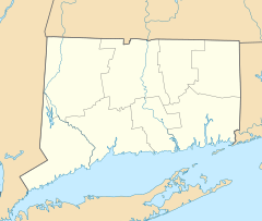
Dudleytown is an abandoned settlement in northwestern Connecticut, United States. It is located in a valley called the Dark Entry Forest. Today, it is often called a ghost town because of many local stories. The land is now private property and is closed to the public. This is because of frequent vandalism and people trespassing.
Since the mid-1920s, people who cared about the land have managed the area. They formed a private land trust. Their goal was to reforest the land after many years of farming. Only small signs of the old village remain, like old cellar holes. Stories about strange happenings started in the 1980s. These stories led to a lot of damage and people entering without permission. Because of this, the owners decided to close the land to everyone.
Contents
What is Dudleytown?
Dudleytown was never an official town with its own government. Instead, it was a part of Cornwall. The name "Dudleytown" was given to this area because several members of the Dudley family lived there.
Early Settlers and Farming Life
The first settlers arrived in the early 1740s. Thomas Griffis was one of the first. Soon after, members of the Dudley family, like Gideon, Barzillai, and Abiel Dudley, moved there by 1753. Martin Dudley joined them a few years later. Other families also made their homes in this area.
Like other parts of Cornwall, the settlers cleared the forests to create farmland. Families worked on these farms for many generations. However, Dudleytown was in a valley, which was not the best place for farming.
Why Did People Leave?
In the mid-1800s, new opportunities appeared. More fertile and spacious land became available in the Midwest of the United States. At the same time, the local iron industry in Cornwall began to slow down. Many people in Cornwall, including those in Dudleytown, started to move away. This caused the population to decline, and eventually, Dudleytown became abandoned.
Protecting the Dark Entry Forest
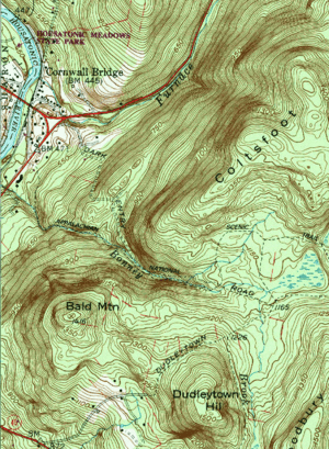
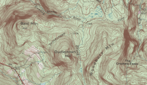
The old village was located a few miles south of the Cornwall Bridge area. It was in a valley known as the Dark Entry Forest. This name came from the deep shadows cast by the surrounding mountains. Because the village was abandoned so long ago, very few original buildings or ruins are left.
In the early 1900s, many old farms in Cornwall were sold. People from New York bought them, hoping for a quieter life in the countryside. Dudleytown was one of these places. Since 1924, a group called Dark Entry Forest, Incorporated, has privately owned the land. Today, the land around the village is still closed to the public.
Goals of the Land Trust
When Dark Entry Forest, Incorporated, was formed in 1924, they had clear goals. They wanted to promote planting new trees (forestation). They also planned to run a wood mill. Most importantly, they aimed to protect birds, animals, and wildflowers. They also hoped the area would be a place for families to enjoy nature.
Soon after buying the land, the new owners planted thousands of trees. This helped to restore the forest.
Fun Activities in the Past
In the 1930s, a group from New York called the Skidreiverein Club used the area. They spent their winter weekends skiing on trails they built. In the summers, they enjoyed canoeing on the nearby Housatonic River. The site also hosted horse riding camps for children, offering a fun outdoor experience.
See also
 In Spanish: Dudleytown, Connecticut para niños
- Portlock
 | William Lucy |
 | Charles Hayes |
 | Cleveland Robinson |


