Dusaux Lake facts for kids
Quick facts for kids Dusaux Lake |
|
|---|---|

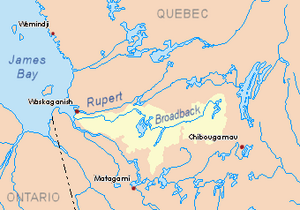
Broadback River basin in yellow
|
|
| Location | Baie-James |
| Coordinates | 50°45′56″N 77°57′26″W / 50.76556°N 77.95722°W |
| Type | Natural |
| Primary inflows | Nottaway River, Davoust River |
| Primary outflows | Nottaway River |
| Basin countries | Canada |
| Max. length | 23.0 kilometres (14.3 mi) |
| Max. width | 1.7 kilometres (1.1 mi) |
| Surface area | 10.58 kilometres (6.57 mi) |
| Surface elevation | 210 metres (690 ft) |
| Islands | 16 |
Dusaux Lake is a freshwater lake located in the Eeyou Istchee Baie-James (municipality) territory in Quebec, Canada. It's part of the Nord-du-Québec region.
You can reach the lake by taking the James Bay road, which runs north and south. The lake's surface is usually frozen from early November until mid-May. It's generally safe to travel on the ice from mid-November to mid-April.
Contents
Exploring Dusaux Lake
Dusaux Lake is about 23.0 kilometres (14.3 mi) long and 1.7 kilometres (1.1 mi) wide at its widest point. It sits at an elevation of 283 metres (928 ft) above sea level.
Islands and Rivers
The lake is home to 16 islands. The biggest one is called Vandry Island, located towards the end of the lake's flow. The Nottaway River flows right through the northwest part of Dusaux Lake.
The lake starts where the Nottaway River enters from the Iroquois Falls in the southeast. Another river, the Davoust River, also flows into the lake from the northeast. In the middle of the lake, the water flows through some rapids around the Desmolier Islands. Dusaux Lake ends downstream of Vandry Island, which is shaped like a half-moon.
Where the Water Goes
The water from Dusaux Lake flows out from its northwest end, past Vandry Island. From there, the Nottaway River continues its journey until it reaches Rupert Bay.
The mouth of Dusaux Lake is located:
- About 79.3 kilometres (49.3 mi) southeast of where the Nottaway River meets Rupert Bay.
- About 123.4 kilometres (76.7 mi) northwest of the town of Matagami.
- About 103.7 kilometres (64.4 mi) east of the border with Ontario.
Nearby Waterways
Other important rivers and lakes near Dusaux Lake include:
- To the north: Chabouillié Lake, Davoust River, and Colomb River.
- To the east: Nottaway River, Dana Lake (Eeyou Istchee Baie-James), and Pauschikushish Ewiwach River.
- To the south: Nottaway River and Kitchigama River.
- To the west: Nottaway River and Kitchigama River.
Naming the Lake
The name "Dusaux" comes from a French family name. You might also see it spelled "Dussault" or "Dussaulx."
The official name "Lac Dusaux" was formally recognized on December 5, 1968, by the Commission de toponymie du Québec, which is Quebec's place-names board.
 | Roy Wilkins |
 | John Lewis |
 | Linda Carol Brown |


