East Island, Hawaii facts for kids

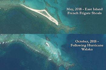
Satellite images of East Island, Hawaii, before (May 2018) and after (October 2018) Hurricane Walaka
|
|
| Geography | |
|---|---|
| Location | Pacific Ocean |
| Coordinates | 23°47′14″N 166°12′35″W / 23.78722°N 166.20972°W |
| Archipelago | French Frigate Shoals |
| Adjacent bodies of water | Pacific Ocean |
| Area | 11 acres (4.5 ha) |
| Length | 0.5 mi (0.8 km) |
| Width | 400 ft (120 m) |
| Country | United States |
| State | Hawaii |
| Demographics | |
| Population | 0 (since 1952) |
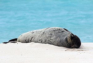
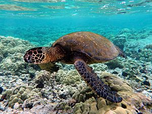
East Island was once a small island in the Pacific Ocean, part of the French Frigate Shoals. It was about half a mile long and 400 feet wide. This island was super important because it was a home for many Hawaiian monk seals and green sea turtles, which are both endangered species.
Sadly, in 2018, a powerful storm called Hurricane Walaka largely washed the island away. Now, only a small sandy strip, about 150 feet long, remains above the water.
East Island was a sandy area that was part of the Papahānaumokuākea Marine National Monument. This monument is a protected area for wildlife. The island was a key place for Hawaiian monk seals and green sea turtles. In fact, 96% of Hawaii's green sea turtles nest in the French Frigate Shoals. More than half of those turtles used to nest on East Island. Experts called it "the most important single islet for [green] sea turtle nesting."
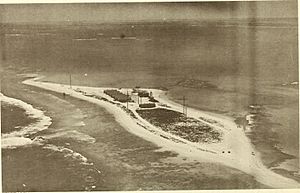
During World War II, the U.S. Coast Guard built a special radio station on East Island. It helped ships and planes find their way. This station operated from 1944 to 1952. In the 1800s, East Island was sometimes called "Turtle Island" because of all the turtles there.

East Island's Past
Scientists first studied East Island in 1923 and 1924 during the Tanager Expedition. Back then, it was about 11 acres in size.
In the 1930s, the U.S. Navy used the area around East Island for training.
- In 1932, a ship called the USS Quail took aerial photos of the shoals from a seaplane.
- In 1935, a "tent city" was set up on East Island to support naval exercises.
- In 1936, the USS Wright (AV-1) used East Island as a base for a month of seaplane operations.
From 1944 to 1952, the United States Coast Guard operated a LORAN radio station on the island. LORAN was a system that helped ships and aircraft figure out their location over long distances.
- In April 1946, a tsunami badly damaged the station.
- In August 1950, the station had to be evacuated because of a typhoon warning.
- The station had 13 buildings, including the LORAN building, barracks, a Mess Hall, and a Machine Shop. There were also water tanks and antennas.
In the 1980s, East Island became known as an important place for monk seals to have their pups. By the late 1900s, it was a famous breeding ground for green sea turtles. In 1997, more than 500 turtle nests were counted on the island.
The Island Disappears
In 2018, most of East Island was washed away by Hurricane Walaka. This powerful storm was a Category 4 hurricane. The storm surge, which is a rise in sea level caused by the storm, covered and eroded the island. This event showed how vulnerable small islands are to strong storms and rising sea levels.
 | William Lucy |
 | Charles Hayes |
 | Cleveland Robinson |


