East Side, Pennsylvania facts for kids
Quick facts for kids
East Side, Pennsylvania
|
|
|---|---|
|
Borough
|
|

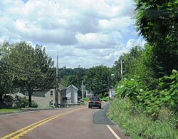
Pennsylvania Route 940 in East Side, July 2023
|
|

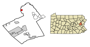
Location of East Side in Carbon County, Pennsylvania.
|
|
| Country | United States |
| State | Pennsylvania |
| County | Carbon |
| Area | |
| • Total | 1.16 sq mi (3.00 km2) |
| • Land | 1.15 sq mi (2.99 km2) |
| • Water | 0.01 sq mi (0.01 km2) |
| Elevation | 1,150 ft (350 m) |
| Population
(2020)
|
|
| • Total | 247 |
| • Density | 214.04/sq mi (82.63/km2) |
| Time zone | UTC-5 (EST) |
| • Summer (DST) | UTC-4 (EDT) |
| ZIP Code |
18661
|
| Area code(s) | 570 |
| FIPS code | 42-21816 |
East Side is a small town, also known as a borough, located in Carbon County, Pennsylvania. It is found in the northeastern part of Pennsylvania. In 2020, about 247 people lived there.
Where is East Side?
East Side is in the northern part of Carbon County. It sits on the east side of the Lehigh River. Right across the river to the west is another town called White Haven. White Haven is in Luzerne County.
The borough covers a total area of about 1.16 square miles (3.00 square kilometers). Most of this area is land, with a very small part being water.
How to Get Around East Side
In 2007, East Side had about 5.18 miles of public roads. Most of these roads, about 4.42 miles, are kept up by the state's Department of Transportation (PennDOT). The borough itself takes care of about 0.76 miles of roads.
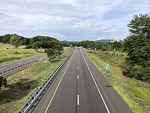
A major highway, Interstate 80, goes through the southern part of East Side. You can get onto I-80 from Exit 274, which is Pennsylvania Route 534, at the eastern edge of the borough. You can also get to I-80 from Exit 273 in White Haven by taking Pennsylvania Route 940.
If you go east on I-80, it's about 3 miles to Interstate 476. Going further east, it's about 33 miles to Stroudsburg. If you head west on I-80, it's about 14 miles to Interstate 81, which is north of Hazleton.
People of East Side
| Historical population | |||
|---|---|---|---|
| Census | Pop. | %± | |
| 1900 | 210 | — | |
| 1910 | 220 | 4.8% | |
| 1920 | 231 | 5.0% | |
| 1930 | 197 | −14.7% | |
| 1940 | 274 | 39.1% | |
| 1950 | 286 | 4.4% | |
| 1960 | 228 | −20.3% | |
| 1970 | 152 | −33.3% | |
| 1980 | 302 | 98.7% | |
| 1990 | 330 | 9.3% | |
| 2000 | 290 | −12.1% | |
| 2010 | 317 | 9.3% | |
| 2020 | 247 | −22.1% | |
| Sources: | |||
Based on the 2000 census, there were 290 people living in East Side. These people lived in 129 homes, and 77 of these were families. Most of the people living in East Side were White (about 97.93%). A small number were Native American (about 2.07%).
In 2000, about 24% of homes had children under 18 living there. Almost half of the homes (48.8%) were married couples. About 13.2% of homes had someone living alone who was 65 or older. The average home had about 2.25 people.
The age of people in East Side was spread out. About 20.7% were under 18 years old. The median age was 43 years. This means half the people were younger than 43 and half were older. For every 100 females, there were about 92 males.
The average income for a home in East Side was $25,833 in 2000. For families, the average income was $35,833. About 15.9% of all people in East Side lived below the poverty line. This included about 23.4% of children under 18.
See also
 In Spanish: East Side (Pensilvania) para niños
 | May Edward Chinn |
 | Rebecca Cole |
 | Alexa Canady |
 | Dorothy Lavinia Brown |


