Edison, Washington facts for kids
Quick facts for kids
Edison, Washington
|
|
|---|---|

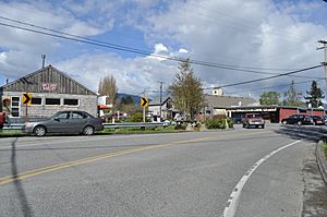
Approaching the center of Edison from the south on Farm to Market Road
|
|

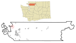
Location of Edison, Washington
|
|
| Country | United States |
| State | Washington |
| County | Skagit |
| Area | |
| • Total | 0.6 sq mi (1.5 km2) |
| • Land | 0.6 sq mi (1.5 km2) |
| • Water | 0.0 sq mi (0.0 km2) |
| Elevation | 7 ft (2 m) |
| Population
(2020)
|
|
| • Total | 240 |
| • Density | 400/sq mi (160/km2) |
| Time zone | UTC-8 (Pacific (PST)) |
| • Summer (DST) | UTC-7 (PDT) |
| ZIP code |
98232
|
| Area code | 360 |
| FIPS code | 53-20680 |
| GNIS feature ID | 1519188 |
Edison is a small community in Skagit County, Washington, in the United States. It is called a census-designated place (CDP). This means it is a place that the government counts for the census, but it is not officially a city or town. In 2020, about 240 people lived there. Edison is part of the larger Mount Vernon and Anacortes area.
Contents
History of Edison
Edison was first settled in 1869 by a person named Ben Samson. The community was later named after the famous inventor Thomas Alva Edison. He was known for his many inventions and laboratories.
In 1897, Edison became the center of a special community project. This project was called Equality Colony. It was supported by a group known as the Brotherhood of the Cooperative Commonwealth. This community was set up on about 280 acres of land just outside Edison.
The people in the Equality Colony worked together. They focused on farming and cutting timber. They also had a school for children. There were shops where people worked as blacksmiths and with copper. The group in Edison also published a newspaper called Industrial Freedom. This newspaper was sent to about 3,000 supporters across the country. The Equality Colony community ended shortly after 1903. By then, only about 100 members were left.
Where is Edison Located?
Edison is located at coordinates 48 degrees, 33 minutes, 45 seconds North and 122 degrees, 26 minutes, 11 seconds West.
The United States Census Bureau says that Edison covers a total area of 0.6 square miles (which is about 1.5 square kilometers). All of this area is land.
People in Edison
As of the 2020 census, 240 people live in Edison.
Famous People From Edison
Some notable people have connections to Edison:
- George Boomer (1862–1915) and Harry Ault (1883–1961) were journalists. They were also members of the Equality Colony.
- Edward R. Murrow (1908–1965) was a very famous news journalist. He graduated from Edison High School.
Schools in Edison
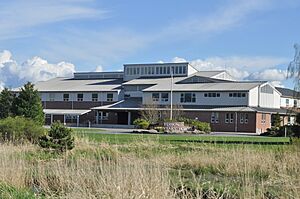
The building that used to be Edison High School later became Edison Elementary School. In 1996, a new, larger building was built for the elementary school. Today, the only school in Edison is the new Edison Elementary School. It is a school for students from kindergarten through 8th grade. It is built on the same site where the old Edison High School used to be.
See also
 In Spanish: Edison (Washington) para niños
 | Stephanie Wilson |
 | Charles Bolden |
 | Ronald McNair |
 | Frederick D. Gregory |


