
Edwards Aquifer facts for kids
Quick facts for kids Edwards Aquifer |
|
|---|---|

Downstream from the headwaters of the San Marcos River
|
|
| Location | Edwards Plateau, Texas Hill Country, Texas, United States |
| Area | 3,237 km2 (1,250 sq mi) |
| Geology | Limestone karst |
| Website | Edwards Aquifer Website |

The Edwards Aquifer is a huge underground water source, one of the best in the world! It's found in Texas, USA, on the eastern side of the Edwards Plateau. This amazing aquifer provides drinking water for over two million people. It's also super important for farms and businesses in the area.
The Edwards Aquifer also feeds famous springs like the Comal and San Marcos springs. These springs create rivers used for fun activities and help keep water flowing downstream. Plus, this aquifer is home to many special and rare animals and plants.
Contents
Where is the Edwards Aquifer?
Geography of the Aquifer
The Edwards Aquifer is located in South Central Texas. It covers about 4,350 square miles and stretches across parts of 11 counties. The aquifer starts in Kinney County and goes eastward through the San Antonio area. It then turns northeast, ending near the Leon River in Bell County.
The aquifer is divided into two main parts: the Austin and San Antonio regions. A natural underground barrier near Kyle, in Hays County, separates these two areas. The aquifer is shaped like a gentle curve, about 160 miles long and 80 miles wide at its widest point.
It has four main areas that run from east to west:
- The drainage area is the northernmost part. Here, water flows on the surface towards the recharge zone.
- The recharge zone is where surface water soaks into the ground and enters the aquifer.
- The artesian zone is where water is under pressure and can flow out of wells naturally.
- The saline zone is the southernmost part, where the water is salty.
The recharge zone follows the Balcones Fault line. This line goes from Brackettville through San Antonio and up to Austin. You might even see signs on highways in Austin and San Antonio telling you when you are entering or leaving this important zone.
How the Aquifer Formed
About 70 million years ago, huge movements of Earth's plates caused the Rocky Mountains to rise again. At the same time, tons of sand and dirt were carried by rivers and floods across Texas. The heavy weight of these sediments caused cracks and breaks in the ground between the Edwards Plateau and the Gulf of Mexico.
The main rock layer, called the Edwards Limestone, is tilted downwards. It's covered by younger limestone layers and thousands of feet of other sediments. The Edwards Aquifer is mostly made of these limestone rocks. Water flows through cracks and holes in the limestone, making the spaces bigger over time.
How Water Moves Underground
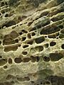
The Edwards Aquifer is a special type of underground water system called a karst aquifer. Unlike aquifers made of sand and gravel, karst aquifers store water in large pockets, caves, and even underground "rivers" and "lakes."
Water moves through these underground pathways at different speeds. Some water might move very slowly, while other water can travel many miles in just one day! The aquifer is about 300 to 700 feet (100 to 200 meters) thick.
In the southern part, the Edwards Aquifer dips under the low plains near the coast. This area is called the Artesian Zone. Here, the water is trapped under pressure by layers of rock that don't let water pass through easily. This pressure means water can flow to the surface on its own through springs and artesian wells.

Climate Around the Aquifer
The Edwards Aquifer is under a part of the Edwards Plateau. So, the weather here helps us understand the climate of the aquifer region. The eastern part of the aquifer has a humid subtropical climate, meaning it's often warm and wet. The western part has a semi-arid climate, which is drier.
The average yearly temperature on the Edwards Plateau is about 66 degrees Fahrenheit (19 degrees Celsius). On average, it rains about 25 inches (64 cm) each year. January is usually the coldest month, and July or August are the hottest. May and September usually get the most rain.
Water Quality
About 1.5 million people get their drinking water from the Edwards Aquifer. The water quality is very good and meets drinking water standards. There haven't been any major pollution problems.
Scientists regularly test the water. They check for things like metals, nutrients, bacteria, and chemicals. These tests show that the levels of these substances are usually well below what is considered harmful. However, small amounts of nitrates (a type of chemical) are found throughout the aquifer. These might come from farm runoff that soaks into the recharge zone.
Because the Edwards Aquifer is a karst aquifer with large cracks and caves, pollutants can travel very quickly through it. This means the aquifer is easily affected by pollution if it enters the recharge zone. Because of this, many groups work hard to protect the recharge zones from pollution.
Animals and Plants of the Aquifer

The Edwards Aquifer is home to many different kinds of living things, including some very rare species found nowhere else. It's one of the most diverse underground water systems in the world! For example, a unique type of blind catfish called the widemouth blindcat lives deep in the aquifer.
Many plants and animals in the Edwards Plateau area depend on the aquifer's water. The land above the aquifer is mostly covered by oak and juniper trees. The Ashe juniper is a very common tree here.
The aquifer also has many tiny creatures without backbones, like snails and small crustaceans. It has the most different kinds of underground animals (called stygobites) found anywhere in the world! Many of these animals are related to sea creatures, which is unusual for an underground water system.
The Comal and San Marcos Springs are especially important. They have a huge variety of organisms because the aquifer water stays at a constant temperature and flow. This stable environment has created unique homes for many species that are found only here.
Several endangered species live in or near the Edwards Aquifer:
- The Barton Springs salamander (Eurycea sosorum) lives only in the Edwards Aquifer.
- The San Marcos salamander (Eurycea nana) is considered threatened.
- Other endangered species include the San Marcos gambusia (a fish), Texas wild rice (a plant), the fountain darter (a fish), the Texas blind salamander, the Comal Springs riffle beetle, the Comal Springs dryopid beetle, and Peck's cave amphipod.
How People Use the Land
The land above the Edwards Aquifer is used in different ways: for ranching, farming, and cities. The northern part is mostly rangeland, with streams that feed the recharge zone. For a long time, much of the land that recharged the aquifer was undeveloped. However, more and more homes and buildings are being built there.
Between 1996 and 1998, residential areas in the recharge zone grew by 9 percent. Even so, 72 percent of the land is still undeveloped. The population in the Edwards Aquifer region continues to grow. In 2012, four counties in the area were among the fastest-growing in the country.
When land is developed, more surfaces like roads and buildings are created that water cannot soak through. These are called "impervious surfaces." They reduce how much water can get into the aquifer and can also affect water quality.
To help protect the aquifer, the city of San Antonio created the Edwards Aquifer Protection Plan in 2000. This plan allows the city to buy "conservation easements" from landowners. This means landowners get paid to agree not to develop their land, helping to keep it natural. Over 130,000 acres are part of this plan.
Who Relies on the Aquifer?

More than 1.7 million people depend on the Edwards Aquifer for their daily water needs. San Antonio, one of America's largest cities, relies heavily on this aquifer. Another major city, Austin, also gets some of its water from the Edwards Aquifer, especially the Barton Springs part.
The population in the region has grown a lot. Between 1990 and 2015, the number of people increased by two-thirds. If this continues, the population could double by 2050. This means even more people will need water from the aquifer.
The economy of South and West Texas also depends on the aquifer. Industries like oil and gas, mining, farming, and manufacturing all need water. As these industries grow, the demand for water from the Edwards Aquifer increases.
Farmers use a lot of water from the aquifer to grow crops like vegetables, hay, peanuts, cotton, corn, and wheat. All these activities put pressure on both the amount of water available and its quality.
Protecting the Aquifer
History of Protection
When Spanish missionaries arrived in Texas in the 1700s, they used the Edwards Aquifer as their main water source. The springs fed by the aquifer were important for choosing where to build missions like the Alamo. As more people settled in Texas, the aquifer continued to provide water for farms, ranches, and homes.
In the 1950s, Texas had a terrible drought. This led to the first laws to protect the Edwards Aquifer. In 1959, the Edwards Underground Water District was created to help manage the water. Later, in the 1970s, the Texas Water Quality Board started making rules about the recharge zones. These rules included checking the geology before building and setting standards for underground storage tanks.
In 1993, a new law created the Edwards Aquifer Authority (EAA). The EAA's main job is to manage the aquifer and limit how much water can be pumped out. This helps protect the spring flows and the endangered species that depend on them.
Conservation Efforts
The Edwards Aquifer is the main water source for a large area of South-Central Texas. It provides water for homes, farms, businesses, and even for fun activities like swimming. It also provides essential water for the homes of endangered species.
Because of a lawsuit in 1991, the Edwards Aquifer Authority (EAA) was formed to lead conservation efforts. The EAA's goal is to manage pumping from the aquifer and make sure that the Comal and San Marcos Springs always have enough water flowing to protect endangered species.
In 2013, the U.S. Fish and Wildlife Service approved the EAA's Habitat Conservation Plan (HCP). This is a 15-year plan to protect the water flow and species in the Edwards Aquifer region. The HCP includes projects to restore natural areas along rivers, which helps animals like the Comal Springs riffle beetle.
Many different groups work together to manage the Edwards Aquifer. Scientists from the National Research Council also study the aquifer and give advice on how to protect it.
Water Balance: How Much Water?
The Edwards Aquifer holds a huge amount of water, but only a part of it can be used. The amount of water in the aquifer changes based on how much water goes in (recharge) and how much water goes out (discharge).
- Inputs (Recharge): Water mainly enters the aquifer in two ways:
* Rainfall soaks directly into the ground. * Water from streams flows into the Recharge Zone. The Recharge Zone is where the ground has many cracks and holes, allowing rain and stream water to easily seep into the aquifer. The Contributing Zone is a larger area where rain and streams collect water and send it towards the Recharge Zone. On average, about 6% of the total rainfall in the contributing and recharge areas actually makes it into the aquifer each year.
- Outputs (Discharge): Water leaves the Edwards Aquifer in two main ways:
* It is pumped out from wells (well discharge). * It flows out as springs (spring discharge). Scientists have been tracking how much water is pumped from wells and how much flows from springs since 1934. During dry years, more water is pumped from wells. During wet years, more water flows from springs.
Scientists use special computer models to understand how water moves in the aquifer. These models help them estimate how much water is in the aquifer, where it's flowing, and how fast. This information is important for managing how much water can be taken out without harming the aquifer or the species that depend on it.
Images for kids
-
Karst formation from Segovia, Spain.

