Elephant Mountain (Piscataquis County, Maine) facts for kids
Quick facts for kids Elephant Mountain |
|
|---|---|
| Highest point | |
| Elevation | 2,650 ft (810 m) |
| Prominence | 980 ft (300 m) |
| Geography | |
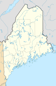
| Location | Piscataquis County, Maine, U.S. |
| Topo map | USGS Four Mountain, Maine |
Elephant Mountain is a mountain located in Piscataquis County, Maine, in the United States. It stands tall in a part of Maine known as Bowdoin College Grant West.
This mountain is about 5 miles (8 km) southeast of a large lake called Moosehead Lake. It's also near other mountains like Baker Mountain and White Cap Mountain.
Water Flowing from Elephant Mountain
Water from Elephant Mountain flows into different streams and rivers. These waters eventually join the Piscataquis River. The Piscataquis River then flows into the Penobscot River. Finally, the Penobscot River empties into Penobscot Bay on the coast of Maine.
So, the rain and snow that fall on Elephant Mountain make a long journey to the ocean!
The B-52 Plane Crash
Elephant Mountain is famous for a historical event. On January 24, 1963, a large United States Air Force B-52 bomber plane crashed on the mountain.
Sadly, seven crew members were on board when the plane went down. Two of them survived the crash. Today, you can still find pieces of the plane wreckage on the mountain. There is even a hiking trail that leads visitors to the crash site. A special memorial is also there to remember the event.
 | John T. Biggers |
 | Thomas Blackshear |
 | Mark Bradford |
 | Beverly Buchanan |


