Elephant Mountain (Oxford County, Maine) facts for kids
Quick facts for kids Elephant Mountain |
|
|---|---|
| Highest point | |
| Elevation | 3,772 ft (1,150 m) |
| Prominence | 2,060 ft (630 m) |
| Listing | New England Fifty Finest #40 New England 100 Highest #98 |
| Geography | |
| Location | Oxford County, Maine, U.S. |
| Topo map | USGS Metallak Mountain, Maine |
| Climbing | |
| Easiest route | trailless bushwhack |
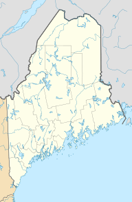
Elephant Mountain is a cool mountain located in Oxford County, Maine. Part of it also reaches into Franklin County. This mountain is surrounded by other peaks. To its northeast is Bemis Mountain, and to its southeast is Old Blue Mountain.
The Famous Appalachian Trail
The Appalachian Trail is a super long hiking path. It stretches about 2,170 miles (3,490 km) from Georgia all the way to Maine. This amazing trail passes right by the bottom of Elephant Mountain. It's about 700 feet (213 m) below the mountain's top.
Where the Water Flows
Elephant Mountain is part of the watershed of the Androscoggin River. A watershed is an area of land where all the water drains into one main river or body of water.
The Androscoggin River eventually flows into Merrymeeting Bay. This bay is where the Kennebec River meets the ocean. From there, the water goes into the Gulf of Maine.
- Water from the northwest side of Elephant Mountain flows into Metallak Brook. This brook then leads to Upper and Lower Richardson lakes. From there, it goes into the Rapid River and Umbagog Lake. Umbagog Lake is actually where the Androscoggin River starts!
- Water from the southwest side of the mountain goes into Birch Brook and Clearwater Brook. These brooks join Black Brook, which flows into the Ellis River. The Ellis River then joins the Androscoggin River.
- On the southeast side, water drains into Mountain Brook. This brook flows into Berdeen Stream, and then into the Swift River. The Swift River is another smaller river that joins the Androscoggin.
 | Shirley Ann Jackson |
 | Garett Morgan |
 | J. Ernest Wilkins Jr. |
 | Elijah McCoy |


