Ellport, Pennsylvania facts for kids
Quick facts for kids
Ellport, Pennsylvania
|
|
|---|---|
|
Borough
|
|

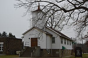
Ellport Presbyterian Church
|
|
| Etymology: Portmanteau of Ellwood City and Portersville | |

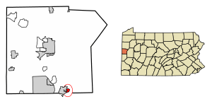
Location in Lawrence County, Pennsylvania
|
|
| Country | United States |
| State | Pennsylvania |
| County | Lawrence |
| Established | 1929-02-15 |
| Area | |
| • Total | 0.46 sq mi (1.20 km2) |
| • Land | 0.43 sq mi (1.11 km2) |
| • Water | 0.03 sq mi (0.09 km2) |
| Highest elevation
(middle of Ellport)
|
900 ft (300 m) |
| Lowest elevation | 790 ft (240 m) |
| Population
(2020)
|
|
| • Total | 1,082 |
| • Density | 2,522.14/sq mi (974.28/km2) |
| Time zone | UTC-4 (EST) |
| • Summer (DST) | UTC-5 (EDT) |
| ZIP code |
16117
|
| Area code(s) | 724 |
Ellport is a small town, called a borough, in southern Lawrence County, Pennsylvania, United States. About 1,081 people lived there in 2020. It's part of the larger Pittsburgh area. The name "Ellport" comes from combining parts of the names of two nearby towns: Ellwood City and Portersville.
Contents
Ellport's Story: How It Began
A long time ago, before 1919, a big part of what is now Ellport was a golf course. It was called the Ellwood City Country Club. The clubhouse was located near what is now 111 Fourth Street.
In 1920, a company from Pittsburgh bought the golf course. They started selling pieces of land, called lots, for about $600 each. This company also bought farms from families like the Deemers and Mahonys. These farms were located to the east of Golf Avenue.
At that time, this area was still part of Wayne Township. But in 1929, the people living there wanted their own town. So, 183 residents signed a paper asking the courts to make Ellport its own borough. Some people who couldn't write signed with an "X".
Ellport officially became a borough on February 15, 1929. This was made possible by an order signed by Judge Daniel M. Foley of Lawrence County.
Where is Ellport Located?
Ellport is located in Pennsylvania. Its exact spot is 40°51′37″N 80°15′43″W / 40.86028°N 80.26194°W.
The United States Census Bureau says Ellport covers about 0.5 square miles (1.2 square kilometers). Most of this area is land, about 0.4 square miles (1.1 square kilometers). A small part, about 0.04 square miles (0.09 square kilometers), is water.
Who Lives in Ellport?
| Historical population | |||
|---|---|---|---|
| Census | Pop. | %± | |
| 1930 | 1,009 | — | |
| 1940 | 967 | −4.2% | |
| 1950 | 1,122 | 16.0% | |
| 1960 | 1,458 | 29.9% | |
| 1970 | 1,350 | −7.4% | |
| 1980 | 1,290 | −4.4% | |
| 1990 | 1,243 | −3.6% | |
| 2000 | 1,148 | −7.6% | |
| 2010 | 1,180 | 2.8% | |
| 2020 | 1,081 | −8.4% | |
| 2021 (est.) | 1,085 | −8.1% | |
| Sources: | |||
In 2000, a census (a count of people) showed that 1,148 people lived in Ellport. There were 482 households, which are groups of people living together.
The population has changed over the years. For example, in 1960, there were 1,458 people. By 2020, the population was 1,081.
Learning in Ellport
Students in Ellport go to schools that are part of the Ellwood City Area School District.
Getting Around Ellport
Major Roads and Highways
 PA 488
See also
 In Spanish: Ellport para niños
 | John T. Biggers |
 | Thomas Blackshear |
 | Mark Bradford |
 | Beverly Buchanan |

