Elwood, Utah facts for kids
Quick facts for kids
Elwood, Utah
|
|
|---|---|

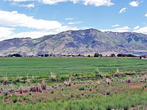
Town of Elwood, with Mendon Peak in background
|
|

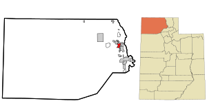
Location in Box Elder County and the state of Utah
|
|

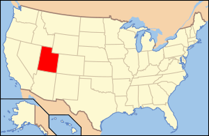
Location of Utah in the United States
|
|
| Country | United States |
| State | Utah |
| County | Box Elder |
| Settled | 1868 |
| Incorporated | 1933 |
| Area | |
| • Total | 8.07 sq mi (20.91 km2) |
| • Land | 8.06 sq mi (20.88 km2) |
| • Water | 0.01 sq mi (0.04 km2) |
| Elevation | 4,285 ft (1,306 m) |
| Population
(2020)
|
|
| • Total | 1,173 |
| • Density | 145.35/sq mi (56.10/km2) |
| Time zone | UTC-7 (Mountain (MST)) |
| • Summer (DST) | UTC-6 (MDT) |
| ZIP code |
84337
|
| Area code(s) | 435 |
| FIPS code | 49-22760 |
| GNIS feature ID | 2412482 |
Elwood is a small town located in Box Elder County, Utah, in the United States. It's a quiet place where people enjoy a peaceful life. In 2020, about 1,173 people lived here. This number grew from 1,034 people in 2010, showing that more families are choosing to call Elwood home.
Elwood was first settled in 1868. It officially became an incorporated town in 1933. This means it got its own local government to help manage the town.
Contents
Where is Elwood Located?
Elwood is found in the eastern part of Box Elder County. It sits in a wide, flat area called the Bear River Valley. Two important rivers flow near the town. The Bear River forms part of its eastern edge. The Malad River is part of its western border.
Nearby Towns and Cities
Elwood is close to several other communities. To the east, you can find the town of Deweyville and the city of Honeyville. If you travel northwest, you will reach the city of Tremonton.
How to Get to Elwood
Major highways run right through Elwood. These include Interstate 15 and Interstate 84. You can easily get into town using Exit 376, which connects to Utah State Route 13. This route is the main road that goes through Elwood.
Size of the Town
The United States Census Bureau says that Elwood covers an area of about 20.3 square kilometers (about 8 square miles). Only a very small part of this area is water, like rivers or ponds.
Who Lives in Elwood?
The population of Elwood has changed over many years. Here is a look at how many people have lived in the town during different census years:
| Historical population | |||
|---|---|---|---|
| Census | Pop. | %± | |
| 1910 | 525 | — | |
| 1920 | 648 | 23.4% | |
| 1930 | 520 | −19.8% | |
| 1940 | 469 | −9.8% | |
| 1950 | 393 | −16.2% | |
| 1960 | 345 | −12.2% | |
| 1970 | 294 | −14.8% | |
| 1980 | 481 | 63.6% | |
| 1990 | 575 | 19.5% | |
| 2000 | 678 | 17.9% | |
| 2010 | 1,034 | 52.5% | |
| 2020 | 1,173 | 13.4% | |
| U.S. Decennial Census | |||
Families and Households
In 2000, there were 678 people living in Elwood. These people lived in 194 different homes, which are called households. Most of these households, about 76%, were married couples living together. Many homes, nearly half, had children under 18 living there. The average household had about 3 to 4 people.
Age of Residents
The people in Elwood are of different ages. In 2000, about 38% of the population was under 18 years old. This means there are many kids and teenagers in the town. The average age of people in Elwood was 29 years old. This shows it's a town with a relatively young population.
Income in Elwood
In 2000, the average income for a household in Elwood was about $46,406 per year. For families, the average income was a bit higher, around $52,292 per year. This money helps families live and buy what they need.
See also
 In Spanish: Elwood (Utah) para niños

