Empire, Nevada facts for kids
Quick facts for kids
Empire, Nevada
|
|
|---|---|
| Country | United States |
| State | Nevada |
| Area | |
| • Total | 5.13 sq mi (13.30 km2) |
| • Land | 5.13 sq mi (13.30 km2) |
| • Water | 0.00 sq mi (0.00 km2) |
| Elevation | 4,036 ft (1,230 m) |
| Population
(2020)
|
|
| • Total | 47 |
| • Density | 9.16/sq mi (3.54/km2) |
| Time zone | UTC-8 (Pacific (PST)) |
| • Summer (DST) | UTC-7 (PDT) |
| ZIP codes |
89405
|
| Area code(s) | 775 |
| FIPS code | 32-23700 |
| GNIS feature ID | 2583921 |
Empire is a small community in Washoe County, Nevada. It is called an unincorporated community, which means it doesn't have its own local government like a city. It's also a census-designated place (CDP), which is an area the government defines for counting people. In 2021, about 65 people lived there.
For 63 years, from 1948 to 2011, Empire was a "company town." This means almost everyone who lived there worked for one company, the USG Corporation. This company made building materials like sheetrock from gypsum. At its busiest, over 750 people lived in Empire.
In 2011, the US Gypsum mine and town closed down. But in 2016, a new company, Empire Mining Company (EMC), bought them. EMC also makes gypsum products. Since then, the town and mine have slowly reopened. Empire is once again a company town, though it's much smaller now.
Contents
History of Empire, Nevada
The story of Empire began in 1907. That's when Alex Ranson found gypsum in the area. Gypsum is a soft mineral used to make plaster and drywall.
In 1909, Alex Ranson and some friends claimed the land for mining. They sold the mine in 1911 for a lot of money.
In 1922, the Pacific Portland Cement company started building a factory in Empire. By 1924, they had moved their entire factory there. They named the new plant "Empire."
U.S. Gypsum bought the town in 1948. Empire grew, and by the early 1960s, it had its largest population of 750 people.
The Town Closes and Reopens
The gypsum plant closed on January 31, 2011. This happened because there wasn't much construction work going on. About 95 jobs were lost. Families with children could stay in their company homes until the school year ended in June 2011. After that, Empire looked like a ghost town with empty homes and a closed factory. Even its ZIP Code, 89405, was stopped.
During the years the town was closed (2011–2016), U.S. Gypsum put up a big fence around the area. They also kept two employees to look after the property. They even brought in two llamas to help keep the grass short!
In mid-2016, U.S. Gypsum sold Empire to the Empire Mining Company (EMC). Workers began to move back to the town. Since 2016, EMC has partly reopened both the mine and the town. The population in 2021 was 65 people.
Geography of Empire
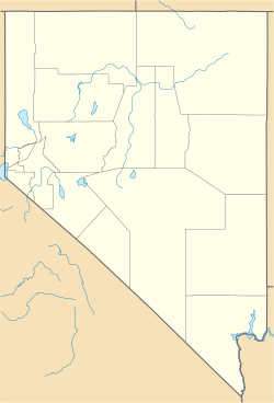
Empire is located in Nevada. The area of Empire is about 13.3 square kilometers (5.13 square miles). All of this area is land. Empire is about 4,040 feet (1,231 meters) above sea level.
Climate in Empire
Empire has a desert climate. This means it can get very hot in the summer and quite cold in the winter. It doesn't get much rain or snow.
| Climate data for Empire, Nevada (Elevation 3,980ft) | |||||||||||||
|---|---|---|---|---|---|---|---|---|---|---|---|---|---|
| Month | Jan | Feb | Mar | Apr | May | Jun | Jul | Aug | Sep | Oct | Nov | Dec | Year |
| Record high °F (°C) | 64 (18) |
68 (20) |
75 (24) |
82 (28) |
97 (36) |
103 (39) |
102 (39) |
102 (39) |
104 (40) |
89 (32) |
74 (23) |
64 (18) |
104 (40) |
| Mean daily maximum °F (°C) | 43.1 (6.2) |
48.2 (9.0) |
54.6 (12.6) |
64.3 (17.9) |
74.4 (23.6) |
83.7 (28.7) |
92.7 (33.7) |
90.4 (32.4) |
85.5 (29.7) |
70.2 (21.2) |
54.1 (12.3) |
44.1 (6.7) |
67.1 (19.5) |
| Mean daily minimum °F (°C) | 21.5 (−5.8) |
24.8 (−4.0) |
29.2 (−1.6) |
35.7 (2.1) |
43.3 (6.3) |
50.2 (10.1) |
57.6 (14.2) |
54.0 (12.2) |
48.0 (8.9) |
37.4 (3.0) |
26.7 (−2.9) |
22.1 (−5.5) |
37.5 (3.1) |
| Record low °F (°C) | −3 (−19) |
−1 (−18) |
12 (−11) |
20 (−7) |
23 (−5) |
30 (−1) |
37 (3) |
41 (5) |
32 (0) |
16 (−9) |
7 (−14) |
−6 (−21) |
−6 (−21) |
| Average precipitation inches (mm) | 0.96 (24) |
0.52 (13) |
0.64 (16) |
0.61 (15) |
0.74 (19) |
0.54 (14) |
0.14 (3.6) |
0.12 (3.0) |
0.20 (5.1) |
0.62 (16) |
0.35 (8.9) |
1.12 (28) |
6.56 (167) |
| Average snowfall inches (cm) | 2.4 (6.1) |
1.8 (4.6) |
1.1 (2.8) |
0.1 (0.25) |
0.1 (0.25) |
0 (0) |
0 (0) |
0 (0) |
0 (0) |
0 (0) |
0 (0) |
1.6 (4.1) |
7.0 (18) |
| Source: The Western Regional Climate Center | |||||||||||||
Population Changes
| Historical population | |||
|---|---|---|---|
| Census | Pop. | %± | |
| 2010 | 217 | — | |
| 2020 | 47 | −78.3% | |
| U.S. Decennial Census | |||
The number of people living in Empire has changed a lot over the years. In 2010, 217 people lived there. By 2020, the population had dropped to 47. This shows the impact of the mine closing and then partly reopening.
Economy and Life in Empire
The main business in Empire is gypsum mining. Since the town reopened, it has gone back to being a company town. This means most people living there work for the mining company. The Empire gypsum mine was open for 88 years, from 1923 to 2011. It was one of the longest-running mines in the U.S. Even during World War II, the mine stayed open because gypsum was considered a very important resource.
Past and Present Services
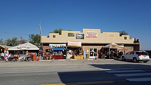
When U.S. Gypsum owned the town, Empire had many facilities. It had a church, a public swimming pool, and even a nine-hole golf course. There was also an airport and a post office. For employees, there was a day-care center. The town also had a convenience store and a gas station. This was the only store for over 50 miles!
Since EMC reopened the town in 2016, the store and gas station have also reopened. The Catholic Church in Empire still holds services once a month.
Tourism and Local Activities
Empire's economy also gets a boost from tourists. Many people visit the nearby Black Rock Desert. This desert is famous for the Burning Man festival. This week-long event attracts tens of thousands of people every year. Burning Man accounts for about 20% of sales at the few businesses in the area. Empire's store and gas station are the closest places to get supplies for the festival. The Black Rock Desert is also used for many other fun activities throughout the year.
Getting Around Empire
The main road that leads to Empire is Nevada State Route 447. This highway helps people get to and from the town.
Empire also has a small airport called Empire Airport. It's a dirt airstrip, mostly used by small planes.
Education in Empire
Children in Empire go to school in the Washoe County School District. The local school is Gerlach K-12 School. This school is in Gerlach, a nearby community. It also has a branch of the Washoe County Library System.
There used to be an elementary school in Empire called Ernest M. Johnson Elementary School. It opened in 1958. In 2001, the school moved to an addition at the Gerlach High School site. In 2011, Gerlach High School was changed to become the Johnson Elementary School for all grades, from kindergarten to 12th grade.
 | Madam C. J. Walker |
 | Janet Emerson Bashen |
 | Annie Turnbo Malone |
 | Maggie L. Walker |


