Ensenada Municipality facts for kids
Quick facts for kids
Ensenada Municipality
Municipio de Ensenada
|
|||
|---|---|---|---|
|
Municipality
|
|||
| Municipality of Ensenada | |||

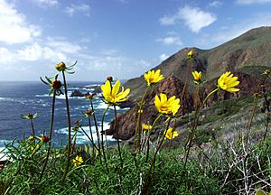
The Pacific coast of Ensenada Municipality
|
|||
|
|||

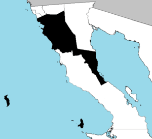
Location of Ensenada in Baja California since 2022
|
|||
| Country | Mexico | ||
| State | |||
| Municipal seat | Ensenada | ||
| Largest city | Ensenada | ||
| Municipality established | 29 December 1953 | ||
| Area | |||
| • Total | 19,526.8 km2 (7,539.3 sq mi) | ||
| Population
(2020)
|
|||
| • Total | 443,807 | ||
| • Density | 22.72810/km2 (58.86550/sq mi) | ||
| Time zone | UTC−8 (Northwest (US Pacific)) | ||
| • Summer (DST) | UTC−7 (Northwest) | ||
| INEGI code | 001 | ||
| Website | Ayuntamiento de Ensenada | ||
| Source: National Institute for Federalism and Municipal Development (Inafed) Former website inaccessible. It was substituted. National Institute for Federalism and Municipal Development (Inafed) | |||
Ensenada is a large municipality located in the Mexican state of Baja California. It is one of the biggest municipalities in Mexico. In 2020, its land area was about 19,526.8 square kilometers. This makes it a bit smaller than the state of Hidalgo.
Ensenada is special because it includes Cedros Island and Guadalupe Island. These islands are located far offshore. This makes Ensenada the westernmost municipality in all of Mexico and Latin America.
The area became a "partido" (like a region) on May 15, 1882. Later, on December 29, 1953, it officially became a municipality of the state of Baja California.
The Ensenada municipality shares its borders with all other municipalities in Baja California. To the north, it borders Tijuana, Playas de Rosarito, and Tecate. To the east and southeast, it borders Mexicali and San Felipe. To the south, it borders San Quintín. The main city and government center, called the municipal seat, is Ensenada. This port city is located in the northwest part of the municipality.
As of 2020, the leader of the municipality is Armando Ayala Robles. This person is called the municipal president (or presidente municipal in Spanish). There are plans to build a major port in Punta Colonet. This area is about 80 kilometers south of the city of Ensenada.
In recent years, the size of Ensenada Municipality has changed. In February 2020, San Quintín became its own separate municipality. Before this, Ensenada was the largest municipality in the country. Then, in January 2022, Puertecitos also separated from Ensenada. It became part of the new San Felipe municipality. These changes made Ensenada Municipality smaller than it used to be.
How Ensenada is Divided
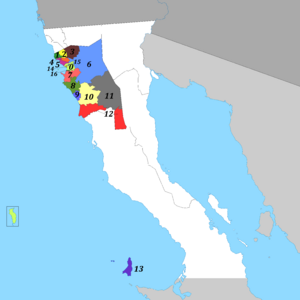
The Ensenada municipality is divided into 17 smaller areas. These areas are called boroughs. Each borough helps manage the local government.
Here are the 17 boroughs of Ensenada:
- Ensenada
- La Misión
- El Porvenir
- Francisco Zarco (Guadalupe)
- San Antonio de las Minas
- El Sauzal
- Real del Castillo
- Maneadero
- Santo Tomás
- Eréndira
- San Vicente
- Valle de la Trinidad
- Colonet
- Isla de Cedros
- Sector Centro
- Sector Noroeste
- Chapultepec
Population of Ensenada
| Historical population | ||
|---|---|---|
| Year | Pop. | ±% |
| 1990 | 259,979 | — |
| 2000 | 370,730 | +42.6% |
| 2010 | 466,814 | +25.9% |
| 2020 | 443,807 | −4.9% |
| From INEGI's Decennial Census. | ||
In 2020, the total population of the Ensenada municipality was 443,807 people. These people live in many different communities. There are 1,698 places where people live within the municipality.
The city of Ensenada is the largest community. It has 330,652 residents.
Here are some of the other largest communities in the municipality:
- Rodolfo Sánchez Taboada (Maneadero) (27,969 people)
- El Sauzal de Rodríguez (11,371 people)
- El Zorrillo (8,522 people)
- San Vicente (5,062 people)
- Valle de Guadalupe (4,334 people)
- Valle de la Trinidad (3,381 people)
- Punta Colonet (3,095 people)
- Ojos Negros (2,707 people)
- Poblado Héroes de Chapultepec (2,360 people)
See also
 In Spanish: Municipio de Ensenada para niños
 | Mary Eliza Mahoney |
 | Susie King Taylor |
 | Ida Gray |
 | Eliza Ann Grier |


