Estrella River facts for kids
Quick facts for kids Estrella River |
|
|---|---|
|
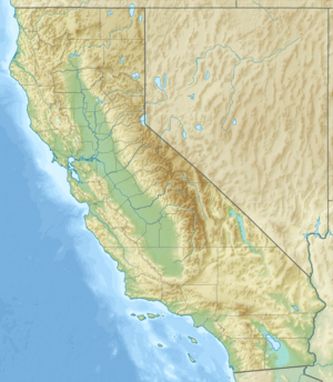
Location of the mouth of the Estrella River in California
|
|
| Country | United States |
| State | California |
| Region | San Luis Obispo County |
| Physical characteristics | |
| Main source | Confluence of Cholame Creek and San Juan Creek Shandon 35°39′21″N 120°22′13″W / 35.65583°N 120.37028°W |
| River mouth | Salinas River San Miguel 35°44′30″N 120°41′33″W / 35.74167°N 120.69250°W |
| Length | 28.5 mi (45.9 km) |
The Estrella River is a river in California, United States. It flows for about 28.5 miles (45.9 km) through San Luis Obispo County. This river is a "tributary," which means it's a smaller river that flows into a larger one. The Estrella River eventually joins the Salinas River.
Contents
About the Estrella River
The Estrella River is an important waterway in eastern San Luis Obispo County. It helps drain water from a large area of land. The river's name, "Estrella," means "star" in Spanish.
Where the River Begins
The Estrella River starts when two other creeks meet. These are Cholame Creek and San Juan Creek. This meeting point is close to the town of Shandon.
Cholame Creek starts high up on the southwest side of Middle Mountain. Another small stream, Little Cholame Creek, also feeds into it. Cholame Creek drains a wide area known as the Cholame Valley. This valley is surrounded by mountains. The Diablo Range is on its east side, and the Cholame Hills are on the west. These hills are part of the Temblor Range. The area usually gets about 11 to 17 inches (28 to 43 cm) of rain each year. More rain falls in the northern parts.
Where the River Flows
From where it begins, the Estrella River flows mostly towards the west and northwest. It travels until it reaches its "mouth," which is where it flows into another river. The Estrella River's mouth is where it joins the Salinas River. This spot is about 8 miles (12.8 km) north of Paso Robles.
The Land Around the River
The land that drains water into a river is called its "watershed" or "drainage basin." For the Estrella River, part of the Temblor Range sends water into San Juan Creek. Interestingly, the nearby Carrizo Plain does not drain into this river. This is because of how the Earth's land has moved over a long time, a process called tectonic action.
The La Panza Range also contributes water to the southwest part of the Estrella River's watershed. Most of the land in this watershed is used as "rangeland." This means it's open land where animals like cattle can graze. There are also some areas used for growing crops, some pastures, and a few developed areas like towns.
 | Isaac Myers |
 | D. Hamilton Jackson |
 | A. Philip Randolph |


