Cholame Hills facts for kids
Quick facts for kids Cholame Hills |
|
|---|---|

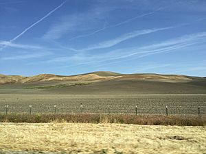
View of the Cholame Hills from CA 46.
|
|
| Highest point | |
| Elevation | 675 m (2,215 ft) |
| Geography | |
| Country | United States |
| State | California |
| District | Monterey County |
| Range coordinates | 35°49′13.877″N 120°25′35.558″W / 35.82052139°N 120.42654389°W |
| Parent range | Temblor Range, California Coast Ranges |
| Topo map | USGS Cholame Hills |
The Cholame Hills are a small mountain range located in a special part of California. They are found in the very southeastern corner of Monterey County. Imagine them as a natural border, helping to shape the landscape of this area.
These hills are actually a northern part of a bigger mountain chain called the Temblor Range. Both the Cholame Hills and the Temblor Range belong to an even larger system known as the California Coast Ranges. This means they are all connected, forming a long line of mountains and hills along California's coast.
If you travel south from the Cholame Hills, you would find California State Route 46, a major road. Nearby is also the small town of Cholame, California.
Contents
What are the Cholame Hills?
The Cholame Hills are a low mountain range. This means they are not super tall, but they still rise above the land around them. They are an important part of the natural scenery in this area of California.
Where are the Cholame Hills located?
These hills are located in the southeastern part of Monterey County. This county is in the central part of California, known for its beautiful coastlines and diverse landscapes. The Cholame Hills are quite far inland from the famous Monterey Bay.
How tall are the Cholame Hills?
The highest point in the Cholame Hills reaches about 675 meters (or about 2,215 feet) above sea level. While this isn't as high as some of California's giant mountains, it's still a significant elevation for a range of hills.
Part of a Bigger Mountain System
The Cholame Hills are not alone. They are connected to much larger mountain systems in California. Understanding these connections helps us see how all the natural features of a region fit together.
The Temblor Range Connection
Think of the Cholame Hills as the northern "fingers" of the Temblor Range. The Temblor Range is a longer mountain chain that stretches for many miles. It's known for being very close to the San Andreas Fault, a famous geological feature.
Part of the California Coast Ranges
Both the Cholame Hills and the Temblor Range are part of an even bigger system called the California Coast Ranges. This is a series of mountain ranges that run parallel to the Pacific Ocean. They stretch for hundreds of miles along California's coast. These ranges play a big role in California's weather and ecosystems.
Nearby Landmarks
The Cholame Hills are near some important roads and towns. These landmarks help people find their way around and understand the geography of the area.
California State Route 46
To the south of the Cholame Hills, you'll find California State Route 46. This is a state highway that connects the Central Valley with the Central Coast. It's a busy road for travelers and local residents.
The Town of Cholame
Also to the south of the hills is the small town of Cholame, California. This town is quite small but has a place in California's history. It's often remembered because it's near the site where actor James Dean had his fatal car accident in 1955.
 | Selma Burke |
 | Pauline Powell Burns |
 | Frederick J. Brown |
 | Robert Blackburn |


