Ethridge, Tennessee facts for kids
Quick facts for kids
Ethridge, Tennessee
|
|
|---|---|

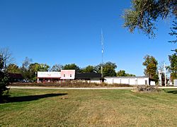
Buildings along Depot Street
|
|

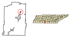
Location of Ethridge stretches from Lawrence and Giles County, Tennessee.
|
|
| Country | United States |
| State | Tennessee |
| County | Lawrence |
| Area | |
| • Total | 1.15 sq mi (2.99 km2) |
| • Land | 1.15 sq mi (2.99 km2) |
| • Water | 0.00 sq mi (0.00 km2) |
| Elevation | 981 ft (299 m) |
| Population
(2020)
|
|
| • Total | 537 |
| • Density | 465.74/sq mi (179.84/km2) |
| Time zone | UTC-6 (Central (CST)) |
| • Summer (DST) | UTC-5 (CDT) |
| ZIP code |
38456
|
| Area code(s) | 931 |
| FIPS code | 47-24460 |
| GNIS feature ID | 1283870 |
Ethridge is a small town in Lawrence County, Tennessee, United States. In 2020, about 537 people lived there. It is known for being home to a group of Swartzentruber Amish people.
Contents
History of Ethridge
Ethridge started as a railroad stop called Hudson Springs in the 1880s. This stop was a few miles south of where the town is today. A local store owner and supporter of the town asked the railroad to name the stop after Emerson Etheridge. He was a well-known politician in the mid-1800s.
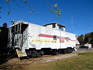
The current location of Ethridge was once where two "drovers' roads" crossed. These were paths used in the mid-1800s to move cattle. In the late 1890s, the railroad built a new station at this crossing. They named it Wayne Station.
People often got confused, with passengers meant for Wayne Station ending up at Ethridge. To fix this, a real estate agent convinced the railroad to close the old Ethridge stop. They then renamed Wayne Station to "Ethridge."
Growth and Decline
By 1914, Ethridge had grown to about 400 people. The town was busy as a place where lumber was moved from one type of transport to another (called transloading). There were at least four lumber mills and one finishing mill in Ethridge. Lumber from these mills and others nearby was brought to Ethridge and loaded onto trains.
During this time, Ethridge had many businesses. It had five grocery stores, a meat market, two barber shops, a post office, a hotel, and a tire pump factory. However, the town faced hard times after the Wall Street Crash of 1929. Also, more people started using cars instead of trains, which caused the town to decline. Ethridge officially became a town in 1973.
Geography of Ethridge
Ethridge is located at 35°19′16″N 87°18′8″W / 35.32111°N 87.30222°W. The town is found where U.S. Route 43 meets a local road called Red Hill Road. This road is known as Main Street within Ethridge.
Lawrenceburg is a few miles south along US 43. Mount Pleasant is several miles to the north. The beginning of Little Shoal Creek is just east of Ethridge. This creek is one of the streams that feed into Shoal Creek. The Buffalo River also starts just west of Ethridge.
The United States Census Bureau says the town covers about 1.2 square miles (3.1 square kilometers). All of this area is land.
Population and People
| Historical population | |||
|---|---|---|---|
| Census | Pop. | %± | |
| 1980 | 548 | — | |
| 1990 | 565 | 3.1% | |
| 2000 | 536 | −5.1% | |
| 2010 | 465 | −13.2% | |
| 2020 | 537 | 15.5% | |
| Sources: | |||
In the year 2000, there were 536 people living in Ethridge. There were 210 households and 153 families. The town had about 458 people per square mile (177 people per square kilometer). There were 245 homes, with about 209 homes per square mile (81 homes per square kilometer).
Most of the people in Ethridge were White (99.63%). A small number were Pacific Islander (0.37%). About 0.75% of the population was Hispanic or Latino.
Households and Families
Out of 210 households, 33.3% had children under 18 living with them. About 52.4% were married couples living together. Some households (16.7%) had a female head of household with no husband present. About 27.1% were not families.
Almost a quarter of all households (22.4%) were made up of single individuals. About 11.9% of households had someone living alone who was 65 years old or older. On average, there were 2.55 people in each household and 2.98 people in each family.
Age Distribution
The population in Ethridge was spread out by age. About 25.6% of the people were under 18 years old. Around 11.0% were between 18 and 24. The largest group, 28.7%, was between 25 and 44. About 22.8% were between 45 and 64. Finally, 11.9% were 65 years old or older. The average age in the town was 34 years.
For every 100 females, there were about 97.8 males. If you looked at females 18 and over, there were about 90 males for every 100 females.
See also
 In Spanish: Ethridge para niños
 | May Edward Chinn |
 | Rebecca Cole |
 | Alexa Canady |
 | Dorothy Lavinia Brown |


