
Buffalo River (Tennessee) facts for kids
Quick facts for kids Buffalo River |
|
|---|---|

Duck River watershed showing the Duck and Buffalo rivers
|
|
| Physical characteristics | |
| Main source | Confluence of North and South Forks in northern Lawrence County, Tennessee 869 ft (265 m) 35°23′21″N 87°17′28″W / 35.3891°N 87.2912°W |
| River mouth | confluence with the Duck River in Humphreys County 361 ft (110 m) 35°59′44″N 87°50′21″W / 35.9956173°N 87.8391937°W |
| Length | 125 mi (201 km) |
| Basin features | |
| Progression | Lawrence County Lewis County Wayne County Perry County Humphreys County |
| River system | Tennessee River Basin |
| Basin size | 763 sq mi (1,980 km2) Buffalo River |
| Tributaries |
|
| GNIS | 1305509 |
The Buffalo River is a long and beautiful river in Middle Tennessee, USA. It flows for about 125 miles (201 km) through the southern and western parts of the region. It's the biggest river that flows into the Duck River. People love to go canoeing on the Buffalo River, especially in the middle part. The river got its name from the Buffalo fish, which were very common here when the first European settlers arrived.
Contents
River's Journey
The Buffalo River starts where its North and South Forks meet in Lawrence County, Tennessee. From there, it flows mostly northwest for several miles.
Through Lewis County
The river then enters Lewis County, Tennessee. Here, it flows under the famous Natchez Trace Parkway. The Little Buffalo River also joins it in Lewis County. The river runs alongside and then crosses State Route 99.
Into Wayne and Perry Counties
Next, the Buffalo River goes into northern Wayne County. More streams join it here, including the Green River. A few miles past the Green River, near Flatwoods, State Route 13 crosses the Buffalo. The river then turns north and flows into Perry County. State Route 13 generally follows the river through most of Perry County.
Reaching Humphreys County
Finally, the river enters Humphreys County. It goes under Interstate 40 and Bakerville Road. About 8 miles (13 km) north of there, the Buffalo River joins the Duck River.
River's Surroundings
The upper part of the Buffalo River, in Lawrence County, is special. It's named a "State Scenic River" because of its natural beauty.
Towns and Communities
Only two towns are located along the Buffalo River: Linden and Lobelville. Both are in Perry County. There are also two smaller communities nearby: Flatwoods and Beardstown.
How Water Flows Here
The Buffalo River's watershed is all the land where rain and snow melt flow into the river. This area is like a giant funnel for the river. It's divided into three smaller parts: two sections of the Buffalo River itself and the Cane Creek area.
The Buffalo River watershed has about 1,200 miles (1,900 km) of smaller streams that feed into it. It also has 349 acres (141 ha) of water in ponds and lakes behind 10 dams. Most of this water is in Laurel Hill Lake, which is about 329 acres (133 ha).
Land Use Around the River
Most of the land in the watershed is covered by forests (about 69%). The rest is mainly used for farming. This includes pasture and hay fields (10%) and row crops (8%). Only a very small part of the land is used for homes or businesses.
The soil in this area is mostly loam, which is good for plants. The ground also has karst features, which means there are caves and sinkholes formed by water dissolving limestone.
Amazing River Life
The Buffalo River is full of different kinds of aquatic animals. Many people enjoy fishing here, often using traditional methods like limb and trot lines. You can find many catfish and other fish like drum. The largest aquatic animal you might see is the alligator snapping turtle, which can weigh 50 pounds (23 kg) or more!
The TDEC has found 48 rare plant and animal species in the Buffalo River watershed. These species are rare because they have small populations or live in very specific places.
Rare Fish Species
There are 20 rare aquatic species in the river and its smaller streams. These include 12 types of fish. Many of the rare fish are Darters, which are small, colorful fish. Some of these darters are listed as Threatened or Endangered by the state or federal government.
- Ammocrypta vivax, the Scaly Sand Darter
- Cyprinella monacha, the Spotfin Chub – This one is federally threatened.
- Etheostoma aquali, the Coppercheek Darter – This one is threatened at the state level.
- Etheostoma boschungi, the Slackwater Darter – This one is federally threatened.
- Etheostoma cinereum, the Ashy Darter – This one is threatened at the state level.
- Etheostoma denoncourti, the Golden Darter
- Etheostoma pseudovulatum, the Egg-Mimic Darter – This one is endangered at the state level.
- Percina burtoni, the Blotchside Darter
- Percina macrocephala, the Longhead Darter – This one is threatened at the state level.
Rare Crayfish
The Alabama crayfish is a rare type of crayfish found near the Buffalo River.
Rare Mussels
Three types of mussels are also rare here. The Cracking Pearly Mussel and the Pale Lilliput are both listed as endangered by both state and federal groups.
- Hemistena lata, the Cracking Pearly Mussel
- Quadrilla cylindrical cylindrical, the Rabbitsfoot
- Toxolasma cylindrellus, the Pale Lilliput
Rare Snails
Four rare types of snails live near the Buffalo River.
- Leptoxis praerosa, the Onyx Rocksnail
- Lithasia duttoniana, the Helmet Rocksnail
- Lithasia geniculata fuliginosa, the Geniculate Rocksnail
- Lithasia geniculata fulginosa, the Geniculate Riversnail
River's Landscape
Most of the Buffalo River watershed is part of the Western Highland Rim. This area has rolling hills and long ridges with steep sides. The river itself flows through a wide flood plain of flat "bottom land." The land usually ranges from 400 to 1,000 feet (120 to 300 m) high.
The main type of rock in this area is Paleozoic limestone. This limestone, along with chert and shale, is covered by thin, somewhat acidic soils. The way the land looks today, with its ridges and hollows, is because different types of limestone wear away at different rates.
The smaller streams that flow into the Buffalo River usually come out of narrow hollows. Only the biggest streams have their own true valleys. The streams are generally clear and flow at a moderate speed.
River's Importance
Canoeing and floating trips are a big part of the local economy. This area is a bit remote, so tourism helps a lot. The Middle Tennessee Council of the Boy Scouts of America has a canoe base called Grimes Canoe Base along the Buffalo River. Many businesses offer canoe rentals and trips for visitors. The river is mostly a Class I stream, which means it has many calm, flat sections, perfect for easy floating or tubing.
Trails Near the River
There are three trails connected to the Buffalo River:
- Buffalo River – This is a scenic water trail in Perry County, about 37.87 miles (60.95 km) long.
- Ladies Bluff Trail – Also in Perry County, this is a 2-mile (3.2 km) hiking trail. Part of it is accessible for people with disabilities.
- Linden City Park Walking Trail – This health and fitness trail in Perry County is 0.2 miles (0.32 km) long and is also accessible for people with disabilities.
How to Get to the River
- In Lobelville, TN, near Old TN-13, there's a place to put your canoe in the water. You can then float about 4 miles (6.4 km) to Cuba Landing Road. There's a small fee to take your boat out there.
Images for kids
-
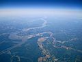
High altitude view of Tennessee River at Humphreys County, Tennessee
-
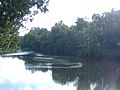
Buffalo River - panoramio


