Excalibur (Arizona) facts for kids
Quick facts for kids Excalibur |
|
|---|---|
| Highest point | |
| Elevation | 7,052 ft (2,149 m) NGVD 29 |
| Geography | |
| Location | Coconino County, Arizona, U.S. |
| Topo map | USGS King Arthur Castle |
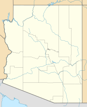
Excalibur is a cool rock formation located on the northern edge of the Grand Canyon in Coconino County, Arizona. It stands tall as a unique part of this famous natural wonder.
What is Excalibur?
Excalibur is not a mountain you can climb easily. Instead, it is a striking rock formation. It is found on the less-visited North Rim of the Grand Canyon. This area is known for its amazing views and unique geological shapes.
How Excalibur Got Its Name
This special formation was named in 1908 by a mapmaker and scientist named François E. Matthes. He chose the name "Excalibur" after the famous sword of the legendary King Arthur. According to the old stories, the magical sword Excalibur was given to King Arthur by the mysterious Lady of the Lake.
The name "Excalibur" was likely chosen because a tall, pointy rock near the top of the formation looks a bit like the handle of a sword. It's a fun way to connect a real-world landmark to a classic legend!
Neighbors in the Canyon
Excalibur is not the only place in this part of the Grand Canyon named after the Arthurian legend. Many other features nearby also have names from the King Arthur stories. These include the Holy Grail Temple, King Arthur Castle, Guinevere Castle, Elaine Castle, and Galahad Point. It's like a whole kingdom of legendary names carved into the canyon!
 | Kyle Baker |
 | Joseph Yoakum |
 | Laura Wheeler Waring |
 | Henry Ossawa Tanner |


