Explorer Seamount facts for kids
Quick facts for kids Explorer Seamount |
|
|---|---|
| Summit depth | 830 m (2,723 ft) |
| Location | |
| Location | North Pacific Ocean |
| Coordinates | 49°05′N 130°48′W / 49.083°N 130.800°W |
| Country | Canada |
| Geology | |
| Type | Submarine volcano |
| Age of rock | Holocene |
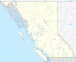
The Explorer Seamount is like a giant underwater mountain found in the deep Pacific Ocean, not far from the coast of British Columbia, Canada. It's a special kind of seamount because it sits right on the Explorer Ridge. This ridge is a place where huge pieces of the Earth's crust, called tectonic plates, are slowly pulling apart.
Contents
Discovering the Explorer Seamount
The Explorer Seamount is an underwater mountain, also known as a seamount. It is located in the vast Pacific Ocean, specifically off the western coast of Canada, near the province of British Columbia. This seamount is a significant feature of the ocean floor in that region.
Where is it Located?
The Explorer Seamount is found on something called the Explorer Ridge. Imagine the Earth's surface as a giant puzzle made of huge pieces called tectonic plates. The Explorer Ridge is a special place where two of these plates, the Pacific Plate and the Explorer Plate, are slowly moving away from each other. This movement creates a "spreading center" on the ocean floor.
How it Formed
Because the plates are pulling apart at the Explorer Ridge, hot molten rock, called magma, can rise up from deep inside the Earth. When this magma erupts underwater, it forms volcanoes. The Explorer Seamount is a submarine volcano, meaning it's an underwater volcano that grew big enough to form a mountain on the seafloor. This type of volcanic activity, where plates pull apart, is called "rift-related volcanism." The seamount is named after the Explorer Ridge because it's a key part of this active area.
Why the Name "Explorer"?
The Explorer Seamount gets its name from a ship! It was named after the Explorer, a ship used by the Coast and Geodetic Survey. This ship explored the northern Pacific Ocean and the Gulf of Alaska between 1940 and 1943. It's common for underwater features to be named after the ships that helped discover or map them.
 | James Van Der Zee |
 | Alma Thomas |
 | Ellis Wilson |
 | Margaret Taylor-Burroughs |


