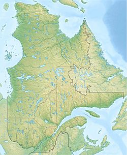
F.-X.-Lemieux Lake facts for kids
Quick facts for kids F.X.-Lemieux Lake |
|
|---|---|
| Location | Lac-Croche, MRC La Jacques-Cartier, Capitale-Nationale, Québec, Canada |
| Coordinates | 47°32′27″N 71°39′51″W / 47.54083°N 71.664171°W |
| Lake type | Natural |
| Primary inflows | (clockwise from the mouth) Décharge des lacs Raoul, Melchior et Laquerre, décharge du lac Bizette. |
| Primary outflows | Métabetchouane River |
| Basin countries | Canada |
| Max. length | 4.7 km (2.9 mi) |
| Max. width | 0.9 km (0.56 mi) |
| Surface elevation | 674 m (2,211 ft) |
Lac F.X.-Lemieux is a beautiful lake found in the province of Quebec, Canada. It's located in a wild area called Lac-Croche, which is part of the La Jacques-Cartier Regional County Municipality. This region is known as Capitale-Nationale.
The lake is nestled within the western-central part of the Laurentides Wildlife Reserve. This is a large protected area where nature thrives. Only a few small roads lead to this area. These roads are mainly used for logging and outdoor fun like fishing and hiking. Logging is the main activity here, followed by tourism.
The surface of Lac F.X.-Lemieux usually freezes over in early December. It stays frozen until the end of March. However, it's generally safe to walk or play on the ice from mid-December to mid-March.
About the Lake's Shape and Size
Lac F.X.-Lemieux is about 4.7 kilometres (2.9 mi) long. It is also about 0.9 kilometres (0.56 mi) wide. The lake's surface is high up, at an altitude of 674 metres (2,211 ft) above sea level. This lake is surrounded by mountains and has a very unique shape. It looks a bit like a beaver with a long tail!
This unusually shaped lake has a bay that stretches east for about 2.5 kilometres (1.6 mi). It also has about a dozen islands. A diamond-shaped piece of land sticks out from the north shore. It reaches south into the middle of the lake.
Water Flow and Nearby Lakes
Lac F.X.-Lemieux gets its water from a few different places:
- From the northeast, it receives water from a group of lakes, including Laquerre, Raoul, and Fa.
- From the north, water flows in from Lake Bizette.
The water then flows out from the south shore of Lac F.X.-Lemieux. This outflow travels south, passing through several smaller lakes. These include Cluse, Verneuil, Oblong, and Minime lakes. After that, the current turns west. It zigzags until it reaches Lac aux Rognons. The Métabetchouane River flows through Lac aux Rognons.
From Lac aux Rognons, the water generally flows north along the Métabetchouane River for about 151.9 kilometres (94.4 mi). The Métabetchouane River then empties into the south shore of Lac Saint-Jean. The water then crosses Lac Saint-Jean for about 22.8 kilometres (14.2 mi) towards the northeast. Finally, it follows the Saguenay River via La Petite Décharge for about 172.3 kilometres (107.1 mi). The water eventually reaches Tadoussac, where it joins the large Saint Lawrence Estuary.
Why the Lake is Called F.X.-Lemieux
The lake is named after François-Xavier Lemieux. He was an important person in Quebec's government. He served as the Deputy Minister of Lands and Forests from 1924 to 1936. During his time in office, a major road was built. This road connected Quebec City to Lac Saint-Jean.
François-Xavier Lemieux was born in Quebec in 1877. He studied at a college in Montreal. When he was 23, he started working for the government in Quebec. He worked as a secretary for several ministers who were in charge of Lands and Forests. These ministers included Adélard Turgeon, Jules Allard, and Honoré Mercier (the son).
The name "Lac F.X.-Lemieux" was officially recognized on December 5, 1968. This was done by the Commission de toponymie du Québec. This commission is responsible for naming places in Quebec.
 | Precious Adams |
 | Lauren Anderson |
 | Janet Collins |


