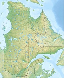
Lac aux Rognons (Lac-Croche) facts for kids
Quick facts for kids Lac aux Rognons |
|
|---|---|
| Location | Lac-Croche, MRC La Jacques-Cartier, Capitale-Nationale, Québec, Canada |
| Coordinates | 47°30′51″N 71°44′01″W / 47.51417°N 71.73361°W |
| Lake type | Natural |
| Primary inflows | (clockwise from the mouth) Décharge des lacs Narval, Serré et Coquille, décharge des lacs Ombrelle et Chalifoux, Métabetchouane River, décharge d'un lac non identifié, décharge des lacs Fauve, Lebrun, Magnan, Mutrecy, Baribeau et Petit lac Baribeau. |
| Primary outflows | Métabetchouane River |
| Basin countries | Canada |
| Max. length | 5.0 km (3.1 mi) |
| Max. width | 0.9 km (0.56 mi) |
| Surface elevation | 589 m (1,932 ft) |
Lac aux Rognons is a lake in the beautiful Quebec province of Canada. It's located in a wild area called Lac-Croche. The Métabetchouane River flows right through the northwest part of the lake.
This lake is found in the middle-west section of the Laurentides Wildlife Reserve. This reserve is a huge protected area. The area around the lake is mainly used for cutting down trees (forestry). Tourism and outdoor activities are also very popular here.
If you visit in winter, you'll find the lake is usually frozen solid. It starts freezing in early December. It's generally safe to walk or play on the ice from mid-December until mid-March.
Contents
About Lac aux Rognons
Lac aux Rognons is quite a long lake. It stretches for about 5.0 kilometres (3.1 mi) (about 3 miles). It's not very wide, only about 0.9 kilometres (0.56 mi) (half a mile). The lake sits high up, at an altitude of 589 metres (1,932 ft) (about 1,932 feet) above sea level.
The lake has a unique shape, like a big "U". This is because a piece of land, called a peninsula, sticks out from the west shore. It reaches far into the lake towards the southeast. The Métabetchouane River flows through the northern part of this lake for about 3.7 kilometres (2.3 mi).
The main water source for Lac aux Rognons is the Métabetchouane River. This river flows into the lake from the south.
Where the Water Goes
From Lac aux Rognons, the water travels a long way!
- First, it flows north for about 146.9 kilometres (91.3 mi) along the Métabetchouane River.
- Then, it reaches the big Lac Saint-Jean and crosses it for 22.8 kilometres (14.2 mi) towards the northeast.
- After that, the water joins the Saguenay River. It travels east for 172.3 kilometres (107.1 mi) until it reaches Tadoussac.
- Finally, at Tadoussac, the water from Lac aux Rognons mixes with the huge Saint Lawrence estuary.
Nearby Rivers
Many other rivers and lakes are close to Lac aux Rognons.
- To the north, you'll find the rivière de la Place and F.-X.-Lemieux Lake.
- The Métabetchouane River is to the east and south.
- To the west, there's more of the Métabetchouane River and the Rivière à Moïse.
The Story Behind the Name
The name "Lac aux Rognons" means "Kidney Lake" in French. It got this name because its "U" shape looks a bit like a kidney! This lake is located at the top part of the Métabetchouane River.
A surveyor named E. Casgrain first wrote about this lake in 1887.
An Important Travel Route
Long ago, this lake was a very important spot for Indigenous peoples. It was a key part of their travel routes between the St. Lawrence Valley and Lac Saint-Jean. In the 1600s, Jesuit missionaries also used this route. They followed what was known as the Innu winter road, passing by Lac aux Rognons to reach Lac Saint-Jean and even Hudson Bay.
The Huron Wendats, another Indigenous group, moved to the Quebec (city) area in the mid-1600s. They sometimes used hunting and fishing lands that belonged to other groups. The Algonquins agreed to stay west of the Batiscan River. The Innu also started to use the lands north of Quebec (city) less often. This was because there wasn't as much game (animals to hunt) due to French settlers moving in.
Since Lac aux Rognons was on the edge of both Innu and Wendat lands, both groups visited it. Even in the 1800s, the Gros-Louis Wendate family had a camp by the lake. However, they slowly had to leave the area after the Parc des Laurentides (which became the Laurentides Wildlife Reserve) was created in 1895.
There are other places in Quebec named "Rognon." For example, there's a lake and a river that feed into the Batiscan River.
The name "lac aux Rognons" was officially recognized on December 5, 1968, by the Commission de toponymie du Québec.
 | Chris Smalls |
 | Fred Hampton |
 | Ralph Abernathy |


