Fair Bluff, North Carolina facts for kids
Quick facts for kids
Fair Bluff, North Carolina
|
|
|---|---|

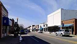
Downtown Fair Bluff
|
|
| Country | United States |
| State | North Carolina |
| County | Columbus |
| Area | |
| • Total | 2.36 sq mi (6.11 km2) |
| • Land | 2.36 sq mi (6.11 km2) |
| • Water | 0.00 sq mi (0.00 km2) |
| Elevation | 62 ft (19 m) |
| Population
(2020)
|
|
| • Total | 709 |
| • Density | 300.55/sq mi (116.04/km2) |
| Time zone | UTC-5 (Eastern (EST)) |
| • Summer (DST) | UTC-4 (EDT) |
| ZIP code |
28439
|
| Area codes | 910, 472 |
| FIPS code | 37-22240 |
| GNIS feature ID | 2406477 |
| Website | Official Fair Bluff, NC website: http://www.fairbluff.com/ |
Fair Bluff is a small town located in Columbus County, North Carolina, United States. It sits along the Lumber River. The town has faced major challenges due to severe coastal flooding.
In 2016, Hurricane Matthew caused widespread flooding, and then Hurricane Florence brought more high water in 2018. These events greatly impacted the town. Before the hurricanes, the population was 951 in 2010. After the floods, the number of people living there dropped significantly.
Contents
History of Fair Bluff
Fair Bluff got its name from a high bank, or "bluff," that overlooks the Lumber River. In 1807, there were plans to build a town on land owned by John Wooton. This new town was going to be called Wootonton.
The town was indeed built, but the name Wootonton was never officially used. Instead, the community kept the name Fair Bluff. It was officially recognized as a town again in 1873.
Historic Buildings
The Powell House is an important historical building in Fair Bluff. It was added to the National Register of Historic Places in 1978. This means it is recognized for its historical importance.
Economy and Changes Over Time
For a long time, farming was the main way people made a living in Fair Bluff. Tobacco was a very important crop grown in the area. However, by the 1980s, tobacco farming became less common. This change affected the town and its people.
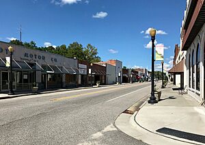
The downtown area used to be very busy. But in the late 1980s, a car dealership moved away. This caused some businesses to struggle. The town also faced challenges with how it was planned. People started leaving Fair Bluff to find better jobs and opportunities elsewhere. This decline was similar to what happened in nearby towns like Tabor City and Chadbourn.
Major Flooding Events
Fair Bluff has experienced several serious floods. In 1999, the town had a very damaging flood.
The town was hit very hard by flooding from the Lumber River in 2016. This was caused by Hurricane Matthew. Hundreds of people had to leave their homes. The floodwaters reached many important buildings, including the town hall, police station, fire department, a grocery store, and a school.
By 2018, the town was still working to rebuild. However, many residents who left because of the flood never came back. Several businesses also remained closed.
In September 2018, Fair Bluff was flooded again by Hurricane Florence. This hurricane also forced people to evacuate. The downtown area was once more underwater. About 72 homes were destroyed. After Hurricane Florence, many buildings in the downtown area were left empty. There were no plans to fix or use them again. The town's only factory also closed a few months later. Many more residents moved away.
The federal government bought some properties from residents. This helped people move, but it also meant the town collected less money in taxes. The town government has made plans to clear the old business district and turn it into a park. They also plan to build a new business area further away from the river, in a safer spot.
Geography
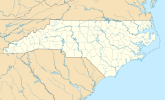
Fair Bluff is located at 34°18′40″N 79°1′57″W / 34.31111°N 79.03250°W. The town is part of the Carolina Border Belt. This area is known for its tobacco markets and warehouses. It stretches along both sides of the North Carolina-South Carolina border.
According to the United States Census Bureau, Fair Bluff covers a total area of about 2.2 square miles (6.11 square kilometers). All of this area is land.
Population Information
| Historical population | |||
|---|---|---|---|
| Census | Pop. | %± | |
| 1880 | 218 | — | |
| 1890 | 243 | 11.5% | |
| 1900 | 328 | 35.0% | |
| 1910 | 441 | 34.5% | |
| 1920 | 397 | −10.0% | |
| 1930 | 806 | 103.0% | |
| 1940 | 970 | 20.3% | |
| 1950 | 1,056 | 8.9% | |
| 1960 | 1,030 | −2.5% | |
| 1970 | 1,039 | 0.9% | |
| 1980 | 1,095 | 5.4% | |
| 1990 | 1,068 | −2.5% | |
| 2000 | 1,181 | 10.6% | |
| 2010 | 951 | −19.5% | |
| 2020 | 709 | −25.4% | |
| 2022 (est.) | 716 | −24.7% | |
| U.S. Decennial Census | |||
The population of Fair Bluff has changed over the years. In 2000, there were 1,181 people living in the town. By the 2020 census, the population had decreased to 709 people. This shows a significant drop in residents, especially after the major floods.
In 2000, about 25% of the population was under 18 years old. The average household had about 2.32 people. The town had a mix of different age groups, with a good number of residents who were 65 years or older.
See also
 In Spanish: Fair Bluff (Carolina del Norte) para niños
 | Isaac Myers |
 | D. Hamilton Jackson |
 | A. Philip Randolph |


