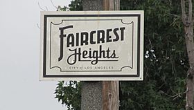
Faircrest Heights, Los Angeles facts for kids
Quick facts for kids
Faircrest Heights
|
|
|---|---|

Faircrest Heights Signage located at the intersection of Fairfax Avenue and Airdrome.
|
|
| Country | |
| State | |
| County | |
| Time zone | Pacific |
| Zip Code |
90035, 90016, 90019
|
| Area code(s) | 323 |
Faircrest Heights is a cool neighborhood located in the Mid-City area of Los Angeles, California. It's a great place with a rich history and interesting facts!
Contents
History of Faircrest Heights
Homes in Faircrest Heights were built a long time ago. Most of them were constructed in the 1920s and 1930s.
A "Hidden Gem" Neighborhood
In December 2004, Los Angeles magazine called Faircrest Heights one of the "10 Best Districts You've Never Heard Of." This means it was a bit of a secret gem!
Community Programs and Leaders
In 2018, Eric Garcetti, who was the mayor of Los Angeles at the time, visited Faircrest Heights. He announced a big program there. This program offered $100 million in rebates from the Department of Water and Power. A rebate is like getting some money back after you buy something, often to encourage people to save water or energy.
Geography of Faircrest Heights
Faircrest Heights is located in a busy part of Los Angeles. It has clear boundaries that help people know where the neighborhood begins and ends.
Faircrest Heights Boundaries
The neighborhood is surrounded by several main streets. On the west side, you'll find La Cienega Boulevard. To the east, it's bordered by Fairfax Avenue. Pico Boulevard is to the north, and Guthrie Avenue is to the south.
Some maps, like Google Maps, show slightly different boundaries. They might say Alvira Street is on the west and Sawyer Street is on the south.
Neighboring Communities
Faircrest Heights is close to many other interesting neighborhoods. To the west, you'll find Crestview and La Cienega Heights. Reynier Village is located to the southwest.
If you head north, you'll reach Little Ethiopia and South Carthay. To the east of Faircrest Heights is Picfair Village.
People in Faircrest Heights
The people who live in Faircrest Heights come from many different backgrounds. This makes the neighborhood a diverse and interesting place.
Demographics of the Area
Based on information from the 2010 Census, Faircrest Heights has a mix of different groups. About 38% of the people are white, 37% are African American, and 8% are Asian. The remaining 18% belong to other groups. This mix of cultures and backgrounds helps make the community unique.
Education in Faircrest Heights
Faircrest Heights is home to an important school that helps students learn and grow.
Local Schools and Learning
One notable school in the area is the Los Angeles Center for Enriched Studies. It is located at 5931 W. 18th Street. This school offers special programs to help students get a rich and deep education.
Notable People from Faircrest Heights
Some famous people have lived in Faircrest Heights!
- Rita Hayworth was a very famous actress and dancer. She was a big star in Hollywood during the 1940s and 1950s.
 | Aurelia Browder |
 | Nannie Helen Burroughs |
 | Michelle Alexander |


