Fairwood, Spokane County, Washington facts for kids
Quick facts for kids
Fairwood, Washington
|
|
|---|---|

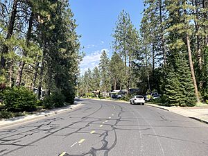
Typical residential scene along Regina Avenue in Fairwood
|
|

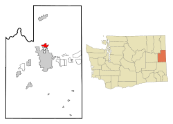
Location of Fairwood, Washington
|
|
| Country | United States |
| State | Washington |
| County | Spokane |
| Area | |
| • Total | 3.99 sq mi (10.3 km2) |
| • Land | 3.99 sq mi (10.3 km2) |
| • Water | 0.0 sq mi (0 km2) |
| Elevation | 1,814 ft (553 m) |
| Population
(2020)
|
|
| • Total | 10,541 |
| • Density | 2,639.2/sq mi (1,019.0/km2) |
| Time zone | UTC-8 (Pacific (PST)) |
| • Summer (DST) | UTC-7 (PDT) |
| FIPS code | 53-23165 |
| GNIS feature ID | 1867610 |
Fairwood is a special kind of community in Spokane County, Washington, United States. It's called a census-designated place (CDP). This means it's an area that the government counts for the census, but it's not officially a city or town.
In 2020, about 10,541 people lived in Fairwood. It is known as one of the wealthier areas in Washington state.
Contents
Geography of Fairwood
Fairwood is located at coordinates 47.764591° N, 117.413924° W. It covers an area of about 3.6 square miles (9.3 square kilometers). Almost all of this area is land.
The community sits in a low area near the Little Spokane River. The land gently slopes down towards the river. To the southwest, you can see Five Mile Prairie rising up. This area has steep cliffs made of basalt rock.
North of Fairwood, you can see the foothills of the Selkirk Range. These are part of the larger Columbia Mountains. To the south, the city of Spokane stretches out, with Fairwood blending into its northern edge.
Fairwood's Population
In 2020, there were 10,541 people living in Fairwood. These people lived in 3,872 homes.
Most of the people in Fairwood are White, making up about 90.9% of the population. Other groups include Asian (3.8%), Native American (1.5%), and African American (0.1%). About 3.2% of the people are from two or more races. Around 3.7% of the population is of Hispanic or Latino background.
Education in Fairwood
Fairwood is part of the Mead School District. This district serves many students in the area.
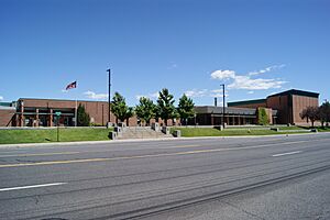
Fairwood is home to Brentwood Elementary School. It also has Mead High School, which is located right in the middle of Fairwood. Students from Fairwood often attend Northwood Middle School, which is in a nearby area of Spokane County.
Even though Mead High School is named after the community of Mead, it mainly serves the Fairwood area. Brentwood Elementary serves the western part of Fairwood. Farwell Elementary serves the eastern part. Whitworth University is a college located just south of Fairwood.
Getting Around Fairwood
Fairwood has public transportation provided by the Spokane Transit Authority. This agency runs bus lines through the community.
There are two main bus routes that serve Fairwood. These routes help people travel to and from Downtown Spokane.
| Route | Where it Goes | How it Runs | Streets Used | ||
|---|---|---|---|---|---|
|
25
Division |
Downtown Spokane STA Plaza |
↔ | Fairwood Hastings Park and Ride |
This bus runs often. | Newport Highway, Hawthorne, Division |
|
124
North Express |
Downtown Spokane STA Plaza |
↔ | Fairwood Hastings Park and Ride |
This is a faster bus during busy weekday hours. | Waikiki, Wall, Monroe |
See also
 In Spanish: Fairwood (condado de Spokane) para niños
 | Calvin Brent |
 | Walter T. Bailey |
 | Martha Cassell Thompson |
 | Alberta Jeannette Cassell |


