Farmington, La Crosse County, Wisconsin facts for kids
Quick facts for kids
Farmington, Wisconsin
|
|
|---|---|
|
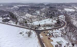
Farmington Town Hall in Mindoro
|
|

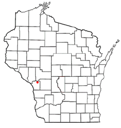
Location of Farmington, Wisconsin
|
|
| Country | United States |
| State | Wisconsin |
| County | La Crosse |
| Area | |
| • Total | 75.5 sq mi (195.5 km2) |
| • Land | 75.3 sq mi (195.1 km2) |
| • Water | 0.2 sq mi (0.4 km2) |
| Elevation | 787 ft (240 m) |
| Population
(2010)
|
|
| • Total | 2,061 |
| • Density | 27/sq mi (10.6/km2) |
| Time zone | UTC-6 (Central (CST)) |
| • Summer (DST) | UTC-5 (CDT) |
| ZIP Codes | |
| Area code(s) | 608 |
| FIPS code | 55-063-25325 |
| GNIS feature ID | 1583191 |
Farmington is a town located in La Crosse County, Wisconsin, in the United States. In 2010, about 2,061 people lived there. This was an increase from 1,733 people in 2000. Farmington is part of the larger La Crosse area. You can also find smaller communities like Burr Oak, Mindoro, and Stevenstown within the town of Farmington.
Contents
Exploring Farmington's Location
Farmington is on the northern edge of La Crosse County. It shares borders with Trempealeau, Jackson, and Monroe counties to the north. Mindoro is the largest community in Farmington. It sits in the middle of the town, in a valley called Fleming Creek, also known as Lewis Valley.
Wisconsin Highway 108 runs through the eastern part of Farmington. This highway goes north about 9 miles (14 km) to Melrose. It also goes south the same distance to West Salem.
Land and Water in Farmington
Farmington covers a total area of about 195.5 square kilometers (75.5 square miles). Most of this area, about 195.1 square kilometers (75.3 square miles), is land. Only a small part, about 0.4 square kilometers (0.2 square miles), is water.
The Black River forms the northwest border of the town. This river eventually flows into the famous Mississippi River. Fleming Creek, which flows west, drains most of the water from Farmington's land into the Black River.

Unique Natural Features
Farmington is home to some interesting natural and historical spots. The Agger Rockshelter is located here. This is a rock shelter that might have been used by early people.
Another cool spot is the Mindoro Cut. This is a unique road cut through a hill, found near Mindoro on County Trunk Highway C. It's a notable example of early road building.
Who Lives in Farmington?
Let's look at how the population of Farmington has changed over time:
| Historical population | ||
|---|---|---|
| Year | Pop. | ±% |
| 1980 | 1,507 | — |
| 1990 | 1,599 | +6.1% |
| 2000 | 1,733 | +8.4% |
| 2010 | 2,061 | +18.9% |
In 2000, there were 1,733 people living in Farmington. There were 664 households, which are groups of people living together in one home. Most of the people living in Farmington were White (about 97.46%).
Households and Families
Out of the 664 households in 2000:
- About 33.3% had children under 18 years old living with them.
- Most households (66.1%) were married couples living together.
- About 18.7% of all households were made up of single individuals.
- About 7.7% of households had someone aged 65 or older living alone.
The average number of people in a household was 2.61. For families, the average size was 2.96 people.
Age Groups in Farmington
The population in Farmington in 2000 was spread out across different age groups:
- About 25.4% of the people were under 18 years old.
- About 6.8% were between 18 and 24 years old.
- About 29.8% were between 25 and 44 years old.
- About 26.6% were between 45 and 64 years old.
- About 11.4% were 65 years old or older.
The average age of people in Farmington was 38 years.
See also
 In Spanish: Farmington (condado de La Crosse, Wisconsin) para niños
 | James Van Der Zee |
 | Alma Thomas |
 | Ellis Wilson |
 | Margaret Taylor-Burroughs |

